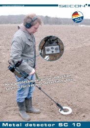
unterwasser-metalldetektoren uwex® erobern den tauchsport - Secon
unterwasser-metalldetektoren uwex® erobern den tauchsport - Secon
unterwasser-metalldetektoren uwex® erobern den tauchsport - Secon

Erfolgreiche ePaper selbst erstellen
Machen Sie aus Ihren PDF Publikationen ein blätterbares Flipbook mit unserer einzigartigen Google optimierten e-Paper Software.
erkannt wird, wenn das Problem der sogenannten „unmagnetischen“, besser: nicht<br />
messbar magnetischen Bombe eine ernste Gefahr darstellt. Solche Fälle können<br />
auftreten, wenn durch magnetisches Gestein und eine stärkere remanente Magnetisierung,<br />
unterstützt durch eine ungünstige Lage des Blindgängers sich dieser<br />
einer rein magnetischen Detektion entzieht und eine aktive elektromagnetische<br />
Sondierung eine sinnvoll einzusetzende Alternative darstellt.<br />
Am Beispiel der Deponievermessung wer<strong>den</strong> diese Zusammenhänge ebenfalls erhellt.<br />
Abb. 5 links zeigt das Resultat der Vermessung mit dem Zweispulengerät der Frequenzelektromagnetik<br />
von Abb. 2 über einem zentralen Bereich der Deponie, und<br />
– gegenübergestellt – das Feld der Magnetik vom selben Flächenausschnitt. Unschwer<br />
erkennt man, dass zahllose FEM-Anomalien mit magnetischen Anomalien<br />
korrespondieren und damit eisenmetallische Störkörper anzeigen dürften. Aber es<br />
gibt auch signifikante Unterschiede und eine insgesamt deutlichere elektromagnetische<br />
als magnetische Signatur, die aus <strong>den</strong> ganz unterschiedlichen Messparametern<br />
(Magnetisierung und elektrische Leitfähigkeit) resultiert und im Sinne einer<br />
Materialdifferenzierung zu interpretieren wäre.<br />
Die vielleicht eindrucksvollsten Bilder von der geophysikalischen Deponievermessung<br />
liefert die Aufnahme mit der transienten Impulselektromagnetik (TEM, Abb. 6).<br />
Allerdings ist sie auch die instrumentell aufwändigste. Zum Verständnis wird stark<br />
vereinfachend gesagt, dass das mit <strong>den</strong> Impulsen ausgesandte elektromagnetische<br />
Signal mit der Zeit in die Tiefe (und auch in die Breite) wandert und dabei laufend<br />
TIME-BOMBS OF A DIFFERENT TYPE<br />
detection of landfill historic wastes with explosive ordnance detection measuring systems | Prof. Dr. Dr. habil. Kord Ernstson<br />
One would not think it looking at the juicy green meadow.<br />
But beneath this a time-bomb is ticking away.<br />
80 years ago a limestone quarry was shut down here.<br />
Then, 50 years ago, the old quarry suffered the fate<br />
that befell many other such places at that time, namely<br />
that it was filled up over many years with refuse,<br />
namely domestic refuse, bulky refuse, industrial<br />
wastes, construction rubble and somewhere along<br />
the line highly poisonous industrial sludges.<br />
The time-bomb: The geological frame, namely the limestone,<br />
is fissured and karstified and not very far<br />
away there are drinking water extraction works. The<br />
authorities know about the danger and started investigations<br />
a long time ago at the end of which the steps<br />
for remediation will be planned. Bore holes have been<br />
sunk but on this large area these are no more than just<br />
pinpricks. Where e xactly are the edges of the landfill,<br />
down to what depth is there waste, does particular<br />
material lie in particular parts of the landfill body, has<br />
contaminated water already started to infiltrate into<br />
the limestone?<br />
The environmental offices are well aware of plenty of<br />
such cases. For two or three decades it has become<br />
common practice to deal with historic waste problems<br />
with the aid of geophysical measurements. Above all<br />
modern digital measurement techniques and miniaturization<br />
of the equipment have opened up completely<br />
new areas of application in the field of geophysics, a<br />
development that has been largely ignored in the field<br />
of the locating of bombs, mines and other unexploded<br />
military ordnance. However EBINGER, a firm which<br />
readers of this magazine will know much rather as a<br />
producer of „sophisticated equipment“ for locating explosive<br />
ordnance, has not closed its mind to this development.<br />
This is appropriate particularly since there<br />
are many areas of overlapping in these two areas of re-<br />
10 | ebingernews<br />
eine „Antwort“ in Form des Messsignals nach oben<br />
an die Empfangsspule gibt. In gewisser Weise wird<br />
der Untergrund zeitlich abgebildet, was in Mikro- und<br />
Millisekun<strong>den</strong> abläuft. Die Messung in zwei Abstän<strong>den</strong><br />
von der Erdoberfläche kann Oberflächeneinflüsse<br />
und tiefere Bereiche ansprechen, und eine Differenzbildung<br />
aus <strong>den</strong> Messsignalen der unteren und<br />
oberen Schleife (ähnlich der Differenzbildung bei <strong>den</strong><br />
Fluxgate-Gradiometern) kommt dem sogenannten<br />
Vertikalgradienten nahe, der sich durch ein höheres<br />
Auflösungsvermögen auszeichnet. Die hier gezeigte<br />
Auswahl für nur drei Kanäle (Abb. 6) vermittelt bereits<br />
eindringlich, wie sich die Feldstruktur in sukzessiven<br />
Zeitfenstern verändert.<br />
Zeitbomben: Die immer drängender wer<strong>den</strong>de Altlastenproblematik<br />
hat die Geophysik vor 20, 30 Jahren<br />
gezwungen, ihre Messsysteme, die zuvor vor allem in<br />
weit größere Tiefen geschaut hatten, <strong>den</strong> neuen Gegebenheiten<br />
anzupassen. Die Kampfmittelräumung ist<br />
dem nur sehr zögerlich oder gar nicht gefolgt. Dass<br />
es auch anders geht – darüber sollte hier ein kleiner<br />
Einblick gegeben wer<strong>den</strong>.<br />
connaissance/investigation with very often the same geophysical measuring systems<br />
being used. Here we permit the reader to cast a look at these very interesting links as<br />
we show – using as example the afore-mentioned historic landfill – how information<br />
can be obtained today with the aid of the most modern measuring equipment on the<br />
substrate in the area of historic wastes.<br />
Indispensable in most cases with historic waste investigations are passive measurements<br />
of the magnetic field (Fig. 1) as well as active induction methods with the aid<br />
of frequency electromagnetism (FEM Fig. 2) and transient (pulsed) electromagnetism<br />
techniques (TEM, Fig. 3). A special feature with the measurements with magnetism<br />
and pulsed electromagnetism is the fact that both data fields are i<strong>den</strong>tically structured<br />
when the measurements are appropriately recorded and can be evaluated<br />
synoptically directly with one another on the computer. In this way and due to the<br />
fact that the two methods react to different parameters differentiation can be carried<br />
out more easily between the responses from different materials and different objects<br />
(ferrous metals, non-ferrous metals, magnetic rock, ceramics, industrial sludges etc.).<br />
Measurements of the magnetic field react in a clarifying manner to the ferrous metal<br />
components which almost always are to be found in domestic refuse, bulky refuse<br />
and construction rubble and hence in landfills. This means that the extent and lateral<br />
limits of a landfill can generally be traced in the image from a magnetic field survey.<br />
(Fig. 4). It can be seen that the landfill under consideration here is no exception and<br />
that it – following special processing of the data – stands out clearly from the normal<br />
geological framework. Low-pass filtering is used here as a type of smoothing process<br />
for the anomalies field, which is magnetically very disturbed. On the other hand the<br />
field of the horizontal gradients as calculated describes the maximum horizontal<br />
measured value change at each grid point whereby this can be regarded as a form<br />
of high-pass filter. Above all in the fields that have been processed one can recognize<br />
the not-unexpected inhomogeneous structure of the landfill.<br />
The active electromagnetic methods also react to ferrous metal objects in the body<br />
of the landfill. Here the electrical conductivity of the material is the parameter which<br />
makes possible the formation of an eddy current. For this reason electromagnetic<br />
methods – in contrast to magnetic field measurement methods – are also able to<br />
„see“ non-ferrous metal objects. This is an advantage that is also becoming recognized<br />
to an increasing extent in the field of explosive ordnance disposal when the<br />
problem representing serious danger is that of the so-called „non-magnetic“ bombs<br />
(or better: bombs the magnetism of which cannot be measured). Such situations can