Jahrbuch PDF (63MB) - ETH Zurich - ETH Zürich
Jahrbuch PDF (63MB) - ETH Zurich - ETH Zürich
Jahrbuch PDF (63MB) - ETH Zurich - ETH Zürich

Sie wollen auch ein ePaper? Erhöhen Sie die Reichweite Ihrer Titel.
YUMPU macht aus Druck-PDFs automatisch weboptimierte ePaper, die Google liebt.
Website<br />
www.lampugnani.gta.<br />
arch.ethz.ch<br />
Prof. Dr. Vittorio Magnago<br />
Lampugnani<br />
Matthias Albrecht<br />
Ammann<br />
Gabriela Barman-Krämer<br />
Mit Unterstützung der<br />
Professur Geographic<br />
Information Systems and<br />
Theory of Errors,<br />
Prof. Dr. Alessandro<br />
Carosio<br />
Claudia Dolci<br />
links:<br />
Ausschnitt aus dem Blatt<br />
No. 23 des Atlas de Jacoubet,<br />
1827–1839, überzeichnet<br />
mit den Transformationsprojekten<br />
für das 1 er<br />
Arrondissement von Paris,<br />
1853, aus: Pierre Pinon,<br />
Les Plans de Paris.<br />
Histoire d’une capitale,<br />
Paris 2004<br />
Stanislav Poljak<br />
Forschung Research<br />
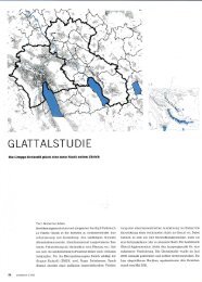
Vergleichende Darstellung und Analyse historischer<br />
Stadtentwicklungsprozesse<br />
Im Projekt werden ausgewählte Entwurfsstrategien von<br />
Planern (Architekten, Städtebauern) und ihre Auswirkung<br />
auf die Architektur der Stadt untersucht. Das Ziel<br />
ist, durch die morphologische Studie städtischer Transformationen,<br />
städtebauliche Strategien zu definieren, die<br />
einerseits historisch verankert sind und andererseits<br />
allgemeine Gültigkeit besitzen, so dass sie auch für zeitgenössische<br />
Fragestellungen zum Städtebau interpretiert<br />
werden können.<br />
Das methodische Instrumentarium ist eine dreistufige<br />
morphologische Analyse, wodurch die strukturellen<br />
Transformationen europäischer Städte nachvollziehbar dargelegt<br />
werden: Die Analyse der Situation vor Beginn<br />
der Transformation («Ausgangssituation»), die Analyse der<br />
Entwurfsstrategie und die Analyse der Situation nach<br />
der Transformation («Endsituation»). Indem die Ausgangsund<br />
Endsituation des Transformationsprozesses einander<br />
gegenübergestellt werden, sollen sowohl die stadtstrukturellen<br />
Bedingungen der Transformation als auch<br />
ihr Ergebnis, das in seiner bekannten Form die Fallstudie<br />
als Beispiel der gelungenen Umsetzung einer Strategie<br />
qualifiziert, klar benannt und als begrenzende Parameter<br />
der Transformation anerkannt werden. Die diese<br />
beiden Situationen verbindende städtebauliche Strategie –<br />
die durch die politischen, ökonomischen und soziokulturellen<br />
Rahmenbedingungen unter Umständen ebenso<br />
geprägt worden ist wie durch die planerischen und<br />
gestalterischen Konzepte – bildet das zentrale Sujet der<br />
Analyse.<br />
Wichtigste Primärquellen für die morphologische Analyse<br />
sind die historischen Pläne. Damit ein Vergleich<br />
dieser Pläne untereinander möglich wird, werden sie in<br />
digitalisierter Form georeferenziert (Georeferenzierung =<br />
die Einordnung von Karten, Luft- oder Satellitenbildern<br />
in ein [geo]räumliches Koordinatensystem) und<br />
entzerrt. Durch die Überlagerung der im Massstab<br />
und Ausrichtung abgestimmten Endprodukte dieses Werkprozesses<br />
können städtebauliche Transformationen<br />
in ihrer Auswirkung auf das Stadtgefüge strukturiert betrachtet<br />
und die schrittweise Umsetzung der Handlungsstrategien<br />
visuell nachvollziehbar gemacht werden.<br />
Da sowohl planerische Rahmenbedingungen als auch<br />
konkrete städtebauliche Projekte zumeist mit zeichnerischen<br />
Mitteln kommuniziert werden, liegt es nahe, die<br />
Verwendung solcher Quellen methodisch zu reflektieren<br />
und historiographische Analyseinstrumente darauf zu<br />
beziehen.<br />
Der Londoner Square als strategisches Instrumentarium in der<br />
Stadtentwicklung<br />
London war schon vor dem «Great Fire» (1666) die grösste<br />
Stadt Englands und entwickelte sich in den folgenden<br />
zwei Jahrhunderten auch infolge seines starken, durch ökonomische,<br />
politische und soziale Ereignisse gesteuerten<br />
Wachstums zur Weltstadt. Für die Bebauung der Gebiete<br />
ausserhalb des mittelalterlichen Zentrums waren vorwiegend<br />
die Besitzer der Ländereien (Estates) selbst verantwortlich.<br />
Dabei konnten sie dank einer liberalen<br />
Bauordnung ihre persönlichen Wünsche und Vorlieben<br />
einbringen. Aufgrund dieser Umstände wurde die<br />
Morphologie der Stadt London massgeblich durch den<br />
227<br />
Comparative Presentation and Analysis of Urban Development<br />
Processes in History<br />
This research project investigates selected design strategies<br />
adopted by planners (architects, urban planners) and<br />
the effects of these strategies on the architecture of the<br />
city. The aim is to use a morphological study of urban<br />
transformations to define urban planning strategies<br />
which on the one hand, have historical roots and on the<br />
other, have general validity so that they can also be<br />
interpreted for the purposes of contemporary issues in<br />
urban planning.<br />
The methodological instruments used comprise a<br />
three-stage morphological analysis, which will provide a<br />
comprehensible presentation of structural transformations<br />
in European cities: an analysis of the situation before<br />
the start of the transformation (the ‘starting situation’);<br />
analysis of the design strategy; and analysis of the situation<br />
after the transformation (the ‘end situation’). The starting<br />
situation and the end situation in the transformation<br />
process will be compared with each other in order to<br />
identify clearly, and to recognize as limiting parameters<br />
for the transformation, both the urban-structural conditions<br />
for the transformation and also its outcome. The<br />
known form of the latter makes the case study the<br />
ideal method of exemplifying the successful implementation<br />
of a strategy. The urban planning strategy linking<br />
these two situations, which may in some circumstances<br />
be shaped just as much by the political, economic,<br />
and sociocultural structural conditions as by the planning<br />
and design concepts involved, will form the central<br />
subject of the analysis.<br />
The most important primary sources for the morphological<br />
analysis are historical plans. To make it possible<br />
to compare these plans with one another, they will be georeferenced<br />
in digitized form (geo-referencing is the<br />
arranging maps, aerial photographs and satellite photographs<br />
within a [geo-]spatial system of coordinates)<br />
and rectified. Superimposing the end products of this<br />
procedure, matched for scale and orientation, will<br />
make it possible to view urban planning transformations<br />
in a structured way with regard to their effects on<br />
the fabric of the city and to make the stages in which the<br />
strategies for action were implemented visually evident.<br />
As both the structural conditions for planning and<br />
also specific urban planning projects are for the most part<br />
communicated using graphic methods, it is obvious<br />
that the use of such sources requires methodological consideration<br />
and that they need to have historiographic<br />
analytical tools applied to them.<br />
The London Square as a Strategic Tool in Urban Development<br />
Even before the Great Fire (1666), London was the<br />
largest city in England, and it developed to become a<br />
world metropolis during the following two centuries<br />
due to large-scale growth driven by economic, political<br />
and social events. The owners of landed property<br />
NSL/Institut ISB Departement Architektur<br />
Vittorio Magnago Lampugnani