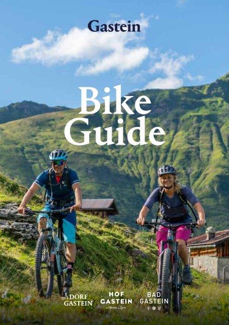
Bike Guide Gastein

Erfolgreiche ePaper selbst erstellen
Machen Sie aus Ihren PDF Publikationen ein blätterbares Flipbook mit unserer einzigartigen Google optimierten e-Paper Software.
<strong>Bike</strong><br />
<strong>Guide</strong>
2<br />
B I K E G U I D E<br />
Inhalt / content<br />
Vorwort 3<br />
Preface<br />
Zeichenerklärung und Klassifizierung 4 - 5<br />
Mark explanation and classification<br />
Talübersicht 6 - 7<br />
Valley overview<br />
<strong>Bike</strong>touren 8 - 47<br />
<strong>Bike</strong> Tours<br />
Dorfgastein 10 - 19<br />
Bad Hofgastein 20 - 31<br />
Bad <strong>Gastein</strong> 32 - 45<br />
Geführte Touren 48 - 55<br />
<strong>Guide</strong>d tours<br />
<strong>Bike</strong>transport / <strong>Bike</strong> transport 56<br />
<strong>Bike</strong>transfer / <strong>Bike</strong> transfer 57<br />
<strong>Bike</strong> & Rad Unterkünfte 58<br />
<strong>Bike</strong> & cycle accomodations<br />
<strong>Bike</strong>schule / <strong>Bike</strong> school 59<br />
<strong>Bike</strong>-Verleih und <strong>Bike</strong>-Shops 60 - 63<br />
<strong>Bike</strong> & cycle accomondations<br />
Fahrtechnik Tipps 64<br />
Mountain biking technique tips 65<br />
Verhaltensregeln für <strong>Bike</strong>r 66<br />
Rules of conduct for bikers 67<br />
Alphabetisches Register 68 - 71<br />
Alphabetical index<br />
IMPRESSUM<br />
Herausgeber/Publisher: <strong>Gastein</strong>ertal Tourismus GmbH<br />
Fotos: <strong>Gastein</strong>ertal Tourismus GmbH und Partner, Christoph Oberschneider, Krug, WOM Medien Andreas Meyer<br />
Layout: datenknoten.at<br />
Für Irrtümer, Druckfehler und Preisänderungen wird keine Haftung übernommen.<br />
Änderungen vorbehalten / Subject to change
V O R W O R T 3<br />
<strong>Bike</strong>n in <strong>Gastein</strong><br />
Von kurzen Genussstrecken bis zu langen schweren Touren -<br />
Abwechslung pur erwartet <strong>Bike</strong>r in <strong>Gastein</strong>.<br />
In <strong>Gastein</strong> schmiegen sich herausfordernde, als auch erlebnisreiche<br />
Mountainbike Touren an die Flanken der Hohen Tauern.<br />
Tolle Aussichten sind garantiert. Ehrgeizige Mountainbiker finden sich<br />
auf den sportlich-herausfordernden <strong>Bike</strong>touren der Region wieder.<br />
Talradwege versprechen Ausgleich und genussvolles <strong>Bike</strong>n.<br />
In <strong>Gastein</strong> können Sie ohne Hektik und Drängeln die Strecken<br />
meistern, dazu gibt es auch noch geführte <strong>Bike</strong>touren für noch mehr<br />
Vergnügen und tolle Tipps. Die MTB Routen fügen sich sanft in die<br />
alpine Landschaft und laden dazu ein, auch mal stehen zu bleiben und<br />
den sagenhaften Ausblick zu genießen. Entlang der Touren finden<br />
Sie zahlreiche Rast- und Einkehrmöglichkeiten die mit regionalen<br />
Schmankerln locken.<br />
Biking in <strong>Gastein</strong><br />
From short pleasure routes to long difficult tours -<br />
pure variety awaits bikers in <strong>Gastein</strong>.<br />
In <strong>Gastein</strong>, challenging as well as adventurous mountain bike tours nestle<br />
on the flanks of the Hohe Tauern. Great views are guaranteed. Ambitious<br />
mountain bikers will find themselves on the region‘s sporty and challenging<br />
bike tours. Valley bike trails promise balance and enjoyable biking.<br />
In <strong>Gastein</strong> you can master the routes without hustle and bustle, and there<br />
are also guided bike tours for even more enjoyment and great tips. The MTB<br />
routes blend gently into the alpine landscape and invite you to stop and enjoy<br />
the fabulous view. Along the tours you will find numerous rest and refreshment<br />
stops with regional delicacies.
4<br />
B I K E G U I D E<br />
Zeichenerklärung<br />
Explanation of symbols<br />
LEGENDE LEGENDE / / KEY KEY<br />
21<br />
Wanderweg/hiking / trail trail<br />
E<br />
<strong>Bike</strong>weg/bike / trial trail<br />
A<br />
Alpe Adria Radweg<br />
<strong>Gastein</strong> Trail<br />
Kabinenbahn/cabin lift<br />
12 Berghütte/mountain hut<br />
Tourist Information<br />
Bahnhof/train station<br />
Parkplatz Parplatz gebührenfrei/<br />
free parking<br />
H<br />
Bushaltestelle/bus / bus stop stop<br />
Gipfel/peak / peak<br />
ZEICHENERKLÄRUNG/<br />
EXPLANATION OF SYMBOLS<br />
Schwierigkeitsgrad/<br />
difficulty<br />
Streckenlänge/<br />
route length<br />
Dauer/<br />
duration<br />
Kumulierte Höhenmeter/<br />
cumulative altitude<br />
Seehöhe Start/<br />
sea level start<br />
Seehöhe höchster Punkt/<br />
altitude highest point
Klassifizierung<br />
nach Kondition und Fahrtechnik<br />
Bei Erfüllung eines der beiden Kriterien<br />
(Länge oder kumulierter Anstieg), wird die Strecke der jeweiligen<br />
Klassifizierung blau, rot oder schwarz zugeordnet.<br />
K L A S S I F I Z I E R U N G 5<br />
Blaue Touren<br />
Länge: < 30 Kilometer<br />
Kumulierter Anstieg: < 600 Höhenmeter<br />
Rote Touren<br />
Länge: 30 - 60 Kilometer<br />
Kumulierter Anstieg: 600 - 1400 Höhenmeter<br />
Schwarze Touren<br />
Länge: > 60 Kilometer<br />
Kumulierter Anstieg: > 1400 Höhenmeter<br />
Classification according to condition<br />
and riding technique<br />
If one of the two criteria (length or cumulative ascent) is met,<br />
the route is assigned to the respective classification blue, red or black.<br />
Blue tours<br />
Length: < 30 kilometers<br />
Cumulated ascent: < 600 vertical meters<br />
Red tours<br />
Length: 30 - 60 kilometers<br />
Cumulated ascent: 600 - 1400 vertical meters<br />
Black tours<br />
Length: > 60 kilometers<br />
Cumulated ascent: > 1400 vertical meters
6 B I K E G U I D E<br />
T A L Ü B E R S I C H T 7<br />
Talübersicht<br />
Valley overview<br />
<strong>Gastein</strong>ertal Runde<br />
N
8<br />
B I K E G U I D E<br />
Tour aufs<br />
Smartphone<br />
https://qr.tourinfra.com/TzkMT<br />
Beste Jahreszeit<br />
MAI JUN<br />
JUL AUG<br />
SEP OKT<br />
bis 15. NOV<br />
geeignet<br />
witterungsbedingt<br />
(1108 m)<br />
hm<br />
1200 1200<br />
1100 1100<br />
1000 1000<br />
900 900<br />
800 800<br />
0 5 10 15 20 25 30 35 40 km<br />
(802 m)<br />
Asphalt: 90%<br />
Schotter/Fahrweg:<br />
Weg: 9%<br />
Pfad/Steig: 1%<br />
Asphalt: 90 %<br />
Länge: 44.8 km, Höchster Punkt: 1108 m, Tiefster Punkt: Schotter/Fahrweg: 802 m 1 %<br />
Weg: 9 %<br />
Pfad/Steig: 1 %
G A S T E I N E R T A L R U N D E 9<br />
<strong>Gastein</strong>ertal<br />
Runde<br />
Hauptstartort: Dorfgastein / Klammstein<br />
Ideale Rundtour, um das <strong>Gastein</strong>ertal und seine Orte<br />
kennenzulernen. Besonders für Familien und<br />
Genussbiker geeignet!<br />
Tourbeschreibung<br />
G<br />
G2<br />
Der <strong>Gastein</strong>er Radweg ist ein Rundkurs, der durch das<br />
gesamte <strong>Gastein</strong>ertal führt und zu den beliebtesten<br />
Einkehrmöglichkeiten und Sehenswürdigkeiten<br />
<strong>Gastein</strong>s leitet. Ein Einstieg ist in allen Orten möglich.<br />
Darüber hinaus ist der Radweg Hauptzubringer zu<br />
allen Mountainbikerouten im <strong>Gastein</strong>ertal.<br />
Interessantes und Wissenswertes<br />
Der <strong>Gastein</strong>er Radweg ist Teil des Ciclovia Alpe Adria<br />
Radweges, der von Salzburg bis an die nördliche Adria<br />
nach Grado führt. Dieser gilt als einer der beliebtesten<br />
Radwege Europas und wurde bereits mehrfach ausgezeichnet.<br />
Kurzinfo<br />
mittel<br />
44,93 km<br />
03:00:00 h<br />
Kondition/condition:<br />
Technik/technique:<br />
Panorama/panorama:<br />
Kultur/culture:<br />
584 m<br />
802 m<br />
1108 m<br />
Tour description<br />
The <strong>Gastein</strong>er Radweg is a circular route that leads through the entire <strong>Gastein</strong> Valley and<br />
guides you to <strong>Gastein</strong>‘s most popular restaurants and sights. It is possible to start in any of the villages.<br />
In addition, the cycle path is the main access route to all mountain bike routes in the <strong>Gastein</strong> Valley.<br />
Interesting facts and things to know<br />
The <strong>Gastein</strong>er Radweg is part of the Ciclovia Alpe Adria Radweg that leads from Salzburg to Grado at the<br />
northern Adriatic Sea. This is considered one of the most popular cycle paths in Europe and has already<br />
received several awards.
Tour aufs<br />
Smartphone<br />
https://qr.tourinfra.com/eutUG<br />
Beste Jahreszeit<br />
MAI JUN<br />
JUL AUG<br />
SEP OKT<br />
bis 15. NOV<br />
geeignet<br />
witterungsbedingt<br />
(816 m)<br />
(1099 m)<br />
hm<br />
1200 1200<br />
1000 1000<br />
800 800<br />
0 2 4 6 8 km<br />
Asphalt: 39%<br />
Schotter/Fahrweg<br />
Asphalt: 39 %<br />
Schotter/Fahrweg: 61 %<br />
Länge: 8 km, Höchster Punkt: 1099 m, Tiefster Punkt: 816 m
S T R O H L E N A L M - D O R F E R B E R G 11<br />
Strohlehenalm-<br />
Dorferberg Runde<br />
Hauptstartort: Dorfgastein / Gemeindepark<br />
Die perfekte Runde für die kleine Tour zum Einstieg<br />
Tourbeschreibung<br />
Q<br />
Ausgangspunkt der Tour ist der Gemeindepark in<br />
Dorfgastein. Von dort führt die Asphaltstraße Richtung<br />
Unterberg. Noch bevor man direkt in diesen Ortsteil<br />
kommt, zweigt links der Güterweg Richtung Strohlehenalm<br />
ab. Die Forststraße schlängelt sich nun durch den<br />
Wald bergauf und spendet an heißen Sommertagen<br />
wohltuenden Schatten. Besonders beeindruckend ist der<br />
einzigartige Blick auf das Dorf. Bei der Abzweigung zur<br />
Strohlehenalm (nicht bewirtschaftet) nimmt man den<br />
Forstweg links bergab Richtung Dorfgastein. Über den<br />
Dorferberg gelangt man zurück zum Ausgangspunkt.<br />
Kurzinfo<br />
leicht<br />
8,11 km<br />
01:30:00 h<br />
Kondition/condition:<br />
Technik/technique:<br />
Panorama/panorama:<br />
Kultur/culture:<br />
326 m<br />
816 m<br />
1099 m<br />
Interessantes und Wissenswertes<br />
Die Abfahrt vom Dorferberg bietet einen phantastischen Ausblick auf Dorfgastein und seine<br />
östliche Talseite mit dem Dorfer Hausberg, dem Schuhflicker, und dem Erlebnisberg Fulseck.<br />
Am Ende der Tour empfiehlt sich eine gemütliche Einkehr in eines der zahlreichen<br />
Restaurants entlang der Dorfstraße im Ortszentrum.<br />
Tour description<br />
The starting point of the tour is the community park in Dorfgastein. From there, the asphalt road leads<br />
towards Unterberg. Before you reach this part of the village, the road branches off to the left in the direction<br />
of Strohlehenalm. The forest road now winds uphill through the forest and provides pleasant shade on hot<br />
summer days. The unique view of the village is particularly impressive. At the turnoff to the Strohlehenalm<br />
(not managed), take the road to the left downhill towards Dorfgastein. Via the Dorferberg you return to<br />
the starting point.<br />
Interesting facts and things to know<br />
The descent from the Dorferberg offers a fantastic view of Dorfgastein and its eastern side of the valley with<br />
the local mountain, the Schuhflicker, and the Erlebnisberg Fulseck. At the end of the tour, we recommend a<br />
leisurely stop in one of the numerous restaurants along the Dorfstraße in the centre of the village.
Tour aufs<br />
Smartphone<br />
https://qr.tourinfra.com/5RGzq<br />
Beste Jahreszeit<br />
MAI JUN<br />
JUL AUG<br />
SEP OKT<br />
bis 15. NOV<br />
geeignet<br />
witterungsbedingt<br />
(1447 m)<br />
hm<br />
1600 1600<br />
1400 1400<br />
1200 1200<br />
1000 1000<br />
800 800<br />
0 1 2 3 4 5 6 7 8 9 10 11 12 13 14 15 16 17 18 19 km<br />
(817 m)<br />
Asphalt: 34%<br />
Schotter/Fahrweg:<br />
Asphalt: 34 %<br />
Länge: 19.4 km, Höchster Punkt: 1447 m, Tiefster Punkt: 817<br />
Schotter/Fahrweg:<br />
m<br />
66 %<br />
1<br />
Kögerlalm
K Ö G E R L A L M 13<br />
Kögerlalm<br />
Hauptstartort: Dorfgastein / Gemeindepark<br />
Eine Tour mit einem grandiosen Weitblick über weite<br />
Teile des Salzachtales und dem Hochkönigmassiv.<br />
Tourbeschreibung<br />
T<br />
Ausgehend vom Gemeindepark Dorfgastein radelt man<br />
in nördlicher Richtung nach Unterberg. Dort folgt man<br />
der Beschilderung und radelt etwa 500 Höhenmeter entlang<br />
der Forststraße bergauf. Unterwegs passiert man die<br />
Abzweigung zur Amoseralm. Hier hält man sich rechts.<br />
Vorbei an der Huabalm ist es nur noch eine Kehre bis zum<br />
höchsten Punkt der Tour. Hier steht die „Drei Waller<br />
Kapelle“. Es empfiehlt sich unbedingt eine Rast einzulegen<br />
und die besondere Atmosphäre an diesem Kraftplatz<br />
zu genießen. Von hier aus führt die Forststraße noch ein<br />
kurzes Stück bergab zur Kögerlalm.<br />
Kurzinfo<br />
mittel<br />
19,57 km<br />
02:00:00 h<br />
Kondition/condition:<br />
Technik/technique:<br />
Panorama/panorama:<br />
Kultur/culture:<br />
757 m<br />
817 m<br />
1447 m<br />
Interessantes und Wissenswertes<br />
Das <strong>Gastein</strong>ertal war in der Frühzeit schwer zugänglich. Der Sattel auf dem die „Drei Waller<br />
Kapelle“ steht war in früheren Zeiten ein relativ einfacher Weg um das <strong>Gastein</strong>ertal zu erreichen.<br />
Kurz nach dem Übergang befindet sich die Kögerlalm, die durch ihre besondere Lage einzigartige<br />
Ausblicke in das Salzachtal und auf das Hochkönigsmassiv zu bieten hat. Die Alm hat während der<br />
Sommermonate täglich geöffnet und bietet kulinarische Köstlichkeiten aus eigener Erzeugung.<br />
Tour description<br />
Starting from the Dorfgastein community park, cycle in a northerly direction to Unterberg. There you<br />
follow the signs and cycle uphill for about 500 metres along the forest road. On the way you pass the<br />
turn-off to the Amoseralm. Keep to the right here. After the Huabalm, it is only one more bend to the<br />
highest point of the tour. Here you will find the „Drei Waller Kapelle“. It is highly recommended to take a<br />
break and enjoy the special atmosphere at this place of power. From here, the forest road leads downhill for<br />
a short distance to the Kögerlalm.<br />
Interesting facts and things to know<br />
The <strong>Gastein</strong> Valley was difficult to access in early times. The saddle on which the „Drei Waller Kapelle“<br />
stands was a relatively easy way to reach the <strong>Gastein</strong> Valley in earlier times. Shortly after the crossing, you<br />
will find the Kögerlalm, which offers unique views of the Salzach valley and the Hochkönig massif due to its<br />
special location. The alp is open daily during the summer months and offers culinary delicacies from its own<br />
production.
Tour aufs<br />
Smartphone<br />
https://qr.tourinfra.com/Uoc4Z<br />
Beste Jahreszeit<br />
MAI JUN<br />
JUL AUG<br />
SEP OKT<br />
bis 15. NOV<br />
geeignet<br />
witterungsbedingt<br />
(1587 m)<br />
(816 m)<br />
hm<br />
1600 1600<br />
1400 1400<br />
1200 1200<br />
1000 1000<br />
800 800<br />
0 1 2 3 4 5 6 7 8 9 10 11 12 13 14 15 16 17 18 19 km<br />
Asphalt: 34%<br />
Schotter/Fa<br />
Asphalt: 34 %<br />
Länge: 19.8 km, Höchster Punkt: 1587 m, Tiefster Punkt: 816<br />
Schotter/Fahrweg:<br />
m<br />
66 %<br />
2<br />
Amoseralm
A M O S E R H O C H A L M 15<br />
Amoser Hochalm<br />
Hauptstartort: Dorfgastein / Gemeindepark<br />
Eine anspruchsvolle Mountainbiketour, die vor allem<br />
mit der schönen Aussicht ins <strong>Gastein</strong>ertal beeindruckt.<br />
Tourbeschreibung<br />
S<br />
Die Tour auf die Amoser Hochalm führt in ein sehr<br />
schönes Almengebiet oberhalb von Unterberg, einem<br />
nördlichen Ortsteil von Dorfgastein. Die Tour beginnt im<br />
Gemeindepark Dorfgastein. Man folgt der Beschilderung<br />
nach Unterberg. Beim Amosergut beginnt die Steigung,<br />
kurz darauf endet der Asphalt. Schon bald ergeben sich<br />
schöne Ausblicke über das <strong>Gastein</strong>ertal. Bei der Amoseralm<br />
(bewirtschaftet) auf etwa 1200 m findet sich ein<br />
Rastplatz. Geübte <strong>Bike</strong>r fahren die Forststraße weiter, die<br />
nach und nach an Schwierigkeit zunimmt. Am Ziel angekommen<br />
wird man belohnt für die Mühen des Aufstiegs.<br />
Die Amoser Hochalm (nicht bewirtschaftet) liegt am<br />
Fuße des Bernkogels, der mit seinen steilen Felsflanken<br />
als besonders markanter Punkt in der Landschaft gilt.<br />
Kurzinfo<br />
mittel<br />
19,91 km<br />
02:30:00 h<br />
Kondition/condition:<br />
Technik/technique:<br />
Panorama/panorama:<br />
Kultur/culture:<br />
807 m<br />
816 m<br />
1587 m<br />
Interessantes und Wissenswertes<br />
Die Strecke ist sehr sonnenexponiert und man sollte nicht unbedingt die Mittagszeit für diese<br />
Tour wählen. Zur Stärkung entlang der Strecke lädt die Amoseralm herzlich ein. Die beliebte<br />
Alm bietet Brot, Speck, Käse und erfrischende Getränke aus eigener Erzeugung. Auch so<br />
manches Schmankerl, wie beispielsweise der Schweinsbraten aus dem Holzkohleofen, wartet<br />
auf den hungrigen Radler.<br />
Tour description<br />
The tour to the Amoser Hochalm leads into a very beautiful alpine pasture area above Unterberg, a<br />
northern district of Dorfgastein. The tour begins in the Dorfgastein community park. Follow the signs to<br />
Unterberg. The ascent begins at the Amosergut, but the asphalt ends shortly afterwards. Soon there are<br />
beautiful views over the <strong>Gastein</strong> Valley. At the Amoseralm (managed) at about 1200 m you will find a rest<br />
area. Experienced bikers continue along the forest road, which gradually becomes more difficult. Once<br />
you reach your destination, you will be rewarded for the effort of the ascent. The Amoser Hochalm (not<br />
managed) is located at the foot of the Bernkogel, which with its steep rocky flanks is a particularly striking<br />
point in the landscape.<br />
Interesting facts and things to know<br />
The route is very sun-exposed and you should not necessarily choose lunchtime for this tour.<br />
The Amoseralm invites you to stop for refreshments along the way. The popular alp offers bread, bacon,<br />
cheese and refreshing drinks from its own production. Many a delicacy, such as roast pork from the<br />
charcoal oven, awaits the hungry cyclist.
Tour aufs<br />
Smartphone<br />
https://qr.tourinfra.com/QkOHZ<br />
(816 m)<br />
(1811 m)<br />
Beste Jahreszeit<br />
MAI JUN<br />
JUL AUG<br />
SEP OKT<br />
bis 15. NOV<br />
geeignet<br />
witterungsbedingt<br />
hm<br />
1950 1950<br />
1800 1800<br />
1650 1650<br />
1500 1500<br />
1350 1350<br />
1200 1200<br />
1050 1050<br />
900 900<br />
750 750<br />
0 1 2 3 4 5 6 7 8 9 10 11 12 13 14 15 16 17 18 19 20 km<br />
Asphalt: 15%<br />
Schotter/Fahrw<br />
Asphalt: 15 %<br />
Länge: 20.4 km, Höchster Punkt: 1811 m, Tiefster Punkt: Schotter/Fahrweg: 816 m<br />
85 %<br />
2<br />
Präauer Hochalm
P R Ä A U A L M - R U N D E 17<br />
Präaualm-Runde<br />
Hauptstartort: Dorfgastein / Gemeindepark<br />
Konditionell herausfordernde Mountainbiketour<br />
mit 1130 Höhenmetern zur höchstgelegenen Alm in<br />
Dorfgastein.<br />
Tourbeschreibung<br />
Q<br />
Man fährt von Dorfgastein aus erst Richtung Unterberg<br />
und biegt dann beim Holzlagerplatz, links bergwärts<br />
Richtung Strohlehenalm bzw. Präau Alm ab.<br />
Nach wenigen Serpentinen erreicht man die Abzweigung<br />
Präau Alm/Strohlehenalm. Will man nun auf die Präau<br />
Alm, so fährt man geradeaus weiter durch den Dorfer<br />
Wald. Bei steter Steigung windet sich diese Straße nun<br />
um den Tagkogel und man gelangt zum Jägerhäusl. Hier<br />
teilt sich die Straße und man nimmt den steileren Weg<br />
rechts hinauf. Die letzten 200 Höhenmeter sind noch<br />
einmal eine echte Herausforderung auch für konditionell<br />
gute <strong>Bike</strong>r. Die herrlich gelegene Präau Alm lässt aber<br />
schnell wieder alle Strapazen vergessen.<br />
Kurzinfo<br />
mittel<br />
20,54 km<br />
03:00:00 h<br />
Kondition/condition:<br />
Technik/technique:<br />
Panorama/panorama:<br />
Kultur/culture:<br />
1013 m<br />
816 m<br />
1811 m<br />
Interessantes und Wissenswertes<br />
Die Präau Alm ist die höchstgelegene Alm in Dorfgastein auf 1.808 m Seehöhe. Mit Freude<br />
und Begeisterung zur Natur und zu den Tieren bewirtschaften die Gastgeber die Hochalm<br />
den ganzen Sommer über. Die Erzeugung von biologischen Milchprodukten, wie Almkäse<br />
und Butter, sowie die Verarbeitung von natürlichen Kräutern und Früchten zu Säften,<br />
Marmeladen, Salben u.v.m. ist eine Herzensangelegenheit von Monika und Sepp Rieser.<br />
Tour description<br />
From Dorfgastein, first drive in the direction of Unterberg and then turn left uphill at the wood storage<br />
area in the direction of Strohlehenalm or Präau Alm. After a few serpentines you reach the junction<br />
Präau Alm/Stohlehenalm. If you want to reach the Präau Alm, continue straight ahead through the Dorfer<br />
Wald. The road winds steadily uphill around the Tagkogel and leads to the Jägerhäusl. Here the road splits<br />
and you take the steeper path up to the right. The last 200 metres in altitude are a real challenge, even for<br />
bikers with good physical condition. But the beautifully situated Präau Alm soon makes you forget all your<br />
exertions.<br />
Interesting facts and things to know<br />
The Präau Alm is the highest alpine pasture in Dorfgastein at 1.808 m above sea level. With joy and<br />
enthusiasm for nature and the animals, the hosts manage the high alp all summer long. The production of<br />
organic dairy products, such as alpine cheese and butter, as well as the processing of natural herbs and fruits<br />
into juices, jams, ointments and much more is a matter close to the hearts of Monika and Sepp Rieser.
Tour aufs<br />
Smartphone<br />
https://qr.tourinfra.com/n8THG<br />
Beste Jahreszeit<br />
MAI JUN<br />
JUL AUG<br />
SEP OKT<br />
bis 15. NOV<br />
geeignet<br />
witterungsbedingt<br />
(2005 m)<br />
hm<br />
2250 2250<br />
2000 2000<br />
1750 1750<br />
1500 1500<br />
1250 1250<br />
1000 1000<br />
750 750<br />
0 5 10 15 20 25 30 km<br />
(827 m)<br />
Länge: 32.7 km, Höchster Punkt: 2005 m, Tiefster Punkt: 827 m<br />
Asphalt: 19 %<br />
Schotter/Fahrweg: 61 %<br />
Singeltrail: 13 %<br />
Bergbahn/Lift/Transport: 6 %<br />
Interesting facts and things to know<br />
On the Fulseck you are rewarded with magnificent views. The <strong>Gastein</strong> Valley opens up to the south and the<br />
panoramic view sweeps over the mountain peaks of the Hohe Tauern, with Austria‘s highest mountain, the<br />
Großglockner, to the Hochkönig in the north and further east to the Dachstein. Dorfgastein‘s local mountain<br />
offers various leisure activities under the motto „Adventure - Water and Wind“. A refreshing oasis of<br />
peace and relaxation on the Fulseck is the Spiegelsee.
F U L S E C K T A L Ü B E R G A N G 19<br />
Fulseck Talübergang<br />
Dorfgastein/Großarl<br />
Hauptstartort: Dorfgastein / Gemeindepark<br />
Eine anspruchsvolle talüberschreitende Tour für<br />
geübte Mountainbiker und Trailbiker.<br />
Tourbeschreibung<br />
O<br />
Ausgehend vom Gemeindepark Dorfgastein führt<br />
der Weg vorbei am Tourismus-Informationsbüro in<br />
Richtung Alpengasthof Hauserbauer. Vorbei an der<br />
Mühlwinkelhütte geht es über den Gruberwaldweg in<br />
Richtung Mittelstation und weiter zur Bergstation der<br />
Dorfgasteiner Bergbahnen. Durch die <strong>Bike</strong>verbindung<br />
Dorfgastein-Großarltal haben Mountainbiker die Möglichkeit,<br />
auch den Singletrail Großarltal zu nutzen. Man<br />
fährt von Dorfgastein mit dem <strong>Bike</strong> oder mit der Gipfelbahn-Fulseck<br />
bergwärts und dann über die beschilderte<br />
Mountainbikestrecke zum Start des Singletrails an der<br />
Panoramabahn Bergstation im Großarltal. Von dort führt<br />
dieser auf 2 Varianten 10 km und 960 hm ins Tal. Der<br />
Singletrail weist den Schwierigkeitsgrad S1 auf. Wieder<br />
rauf auf den Berg gelangt man nur mit der Panoramabahn<br />
Großarltal (kostenpflichtig). An der Bergstation<br />
angekommen führt die beschilderte Mountainbikestrecke<br />
wieder zurück nach Dorfgastein.<br />
Kurzinfo<br />
sehr schwer<br />
33,11 km<br />
04:00:00 h<br />
Kondition/condition:<br />
Technik/technique:<br />
Panorama/panorama:<br />
Kultur/culture:<br />
1855 m<br />
827 m<br />
2005 m<br />
Interessantes und Wissenswertes<br />
Am Fulseck wird man mit grandiosen Ausblicken belohnt. Richtung Süden öffnet sich das<br />
<strong>Gastein</strong>ertal und der Rundumblick schweift über die Berggipfel der Hohen Tauern mit dem<br />
höchsten Berg Österreichs, dem Großglockner, bis hin zum Hochkönig im Norden und weiter<br />
Richtung Osten zum Dachstein. Der Hausberg von Dorfgastein bietet verschiedene Freizeitangebote<br />
unter dem Motto “Abenteuer - Wasser und Wind”. Eine erfrischende Oase der Ruhe<br />
und Erholung am Fulseck ist der Spiegelsee.<br />
Tour description<br />
Starting from the Dorfgastein community park, the trail leads past the tourist information office in the<br />
direction of Alpengasthof Hauserbauer. Pass the Mühlwinkelhütte and take the Gruberwaldweg towards<br />
the middle station and on to the top station of the Dorfgastein cable cars. Thanks to the Dorfgastein-<br />
Großarltal bike connection, mountain bikers also have the opportunity to use the Großarltal single trail.<br />
From Dorfgastein you ride your bike or take the Gipfelbahn-Fulseck uphill and then follow the signposted<br />
mountain bike route to the start of the single trail at the Panoramabahn mountain station in the Großarl<br />
Valley. From there, the trail leads down to the valley in 2 variants of 10 km and 960 hm. The single trail<br />
has a difficulty level of S1. You can only get back up to the mountain with the Großarl Valley panorama lift<br />
(subject to a charge). Once you have reached the mountain station, the signposted mountain bike trail leads<br />
back to Dorfgastein.
Tour aufs<br />
Smartphone<br />
https://qr.tourinfra.com/51axS<br />
Beste Jahreszeit<br />
(1205 m)<br />
(838 m)<br />
hm<br />
1300 1300<br />
MAI<br />
JUN<br />
1200 1200<br />
JUL<br />
AUG<br />
1100 1100<br />
A<br />
S<br />
SEP OKT<br />
bis 15. NOV<br />
geeignet<br />
witterungsbedingt<br />
1000 1000<br />
900 900<br />
800 800<br />
0 2 4 6 8 10 12 14 km<br />
Länge: 15.1 km, Höchster Punkt: 1205 m, Tiefster Punkt: 838 m<br />
Asphalt: 73 %<br />
Schotter/Fahrweg: 27 %<br />
30<br />
Waldgasthof<br />
Angertal
A N G E R T A L - R U N D E 21<br />
Angertal-Runde<br />
Hauptstartort: Bad Hofgastein / Ortszentrum<br />
Ideale Kurztour mit geringem Schwierigkeitsgrad,<br />
die für alle Mountainbiker geeignet ist.<br />
Tourbeschreibung<br />
J<br />
Die Radtour beginnt im Ortszentrum von Bad Hofgastein<br />
und führt in südwestlicher Richtung zum Ortsteil Lafen.<br />
Hier beginnt die Steigung und führt über die Bahnhaltestelle<br />
Angertal bis zum Hartlgut. Von hier beginnt die<br />
Schotterstraße ins Angertal. Es empfiehlt sich eine Rast<br />
am idyllisch gelegenen Waldgasthof. De--r Rückweg führt<br />
wieder vorbei am Skizentrum Angertal und bergab über<br />
die Angertalstraße zurück nach Bad Hofgastein.<br />
Interessantes und Wissenswertes<br />
Kehren Sie ein beim Waldgasthof im Angertal für<br />
eine kurze Pause und gönnen Sie sich ein leckeres<br />
Erfrischungsgetränk. Wer Lust und Laune hat und<br />
ein bisschen Zeit mitbringt, beweist sich beim Bogenschießen<br />
im Jagdbogenparcours oder versucht sein Glück<br />
beim Angeln am idyllische Wildwasserteich.<br />
Kurzinfo<br />
mittel<br />
15,13 km<br />
01:30:00 h<br />
Kondition/condition:<br />
Technik/technique:<br />
Panorama/panorama:<br />
Kultur/culture:<br />
426 m<br />
838 m<br />
1205 m<br />
Tour description<br />
The bike tour starts in the centre of Bad Hofgastein and leads in a south-westerly direction to the Lafen<br />
district. Here the climb begins and leads via the Angertal railway station to Hartlgut. From here the gravel<br />
road into the Angertal begins. Here we recommend a rest at the idyllically situated Waldgasthof. The way<br />
back leads past the Angertal ski centre and downhill along the Angertal road back to Bad Hofgastein.<br />
Interesting facts and things to know<br />
Stop at the Waldgasthof in the Angertal for a short break and treat yourself to a delicious refreshing drink.<br />
If you are in the mood, take advantage of the break and try your hand at archery in the hunting archery<br />
course, or try your luck at fishing in the idyllic wild water pond.
Tour aufs<br />
Smartphone<br />
https://qr.tourinfra.com/bsMPq<br />
(1741 m)<br />
(845 m)<br />
Beste Jahreszeit<br />
MAI JUN<br />
JUL AUG<br />
SEP OKT<br />
bis 15. NOV<br />
geeignet<br />
witterungsbedingt<br />
hm<br />
1800 1800<br />
1600 1600<br />
1400 1400<br />
1200 1200<br />
1000 1000<br />
800 800<br />
0 2 4 6 8 10 12 14 16 km<br />
Asphalt: 28%<br />
Schotter/Fahr<br />
Asphalt: 28 %<br />
Länge: 16.9 km, Höchster Punkt: 1741 m, Tiefster Punkt: Schotter/Fahrweg: 845 m 72 %<br />
36 Grubhütte<br />
37 Grußberghütte 38 Planitzenhütte
R A S T Ö T Z E N 23<br />
Rastötzen<br />
Hauptstartort: Bad Hofgastein / Ortszentrum<br />
<strong>Bike</strong>tour mit Almflair und gemütlicher Geselligkeit im<br />
weiten Almkessel der Rastötzen.<br />
Tourbeschreibung<br />
M<br />
Die Rastötzenalm ist eine für Mountainbiker herausfordernde<br />
Strecke, die Serpentinen ziehen sich doch<br />
recht steil nach oben und wirklich erholsame Teilstücke<br />
kommen eher selten vor. Bereits im Ortsgebiet geht‘s<br />
steil die Wasserfallgasse hinauf bis zur Brücke. Hier wird<br />
der Kirchbach überquert und schon kommt oberhalb des<br />
Friedhofes das nächste Steilstück hinauf bis zum Café<br />
Sonnberg. Hier zweigt man links Richtung Annencafé ab.<br />
Über eine durch dichten Nadelwald führende Forststraße<br />
schlängelt man sich in Serpentinen zu den drei bewirtschafteten<br />
Almen hoch.<br />
Kurzinfo<br />
mittel<br />
17,15 km<br />
02:30:00 h<br />
Kondition/condition:<br />
Technik/technique:<br />
Panorama/panorama:<br />
Kultur/culture:<br />
905 m<br />
845 m<br />
1741 m<br />
Interessantes und Wissenswertes<br />
Die Rastötzen liegt in einem Kessel eingebettet zwischen mehreren Gipfeln. Einer davon ist<br />
der Gamskarkogel, der höchste Grasberg Europas mit 2467 m. Diese Tour kann man ideal mit<br />
einer Wanderung zum Gamskarkogel verbinden. Gehzeit: ca. 1,5 Stunden. Nach einer gemütlichen<br />
Rast mit Jause bei selbstgemachten Erzeugnissen auf einer der Almen geht‘s auf der<br />
gleichen Strecke wieder zurück nach Bad Hofgastein.<br />
Tour description<br />
The Rastötzenalm is a challenging route for mountain bikers, the serpentines are quite steep and really<br />
relaxing sections are rare. Already in the village area, the route climbs steeply up Wasserfallgasse to the<br />
bridge. Here the Kirchbach is crossed and the next steep section comes up above the cemetery to Café<br />
Sonnberg. Here you turn left in the direction of the Annencafé. Follow a forest road through a dense<br />
coniferous forest up to three alpine pastures.<br />
Interesting facts and things to know<br />
The Rastötzen is nestled in a basin between several peaks. One of them is the Gamskarkogel, the highest<br />
grassy mountain in Europe at 2467 m. This tour can be ideally combined with a hike to the Gamskarkogel.<br />
Walking time: approx. 1.5 hours. After a cosy break with a snack of homemade products at one of the alpine<br />
pastures, you return to Bad Hofgastein along the same route.
Tour aufs<br />
Smartphone<br />
https://qr.tourinfra.com/MCBnh<br />
Beste Jahreszeit<br />
MAI JUN<br />
JUL AUG<br />
SEP OKT<br />
bis 15. NOV<br />
geeignet<br />
witterungsbedingt<br />
(1731 m)<br />
(832 m)<br />
hm<br />
1800 1800<br />
1600 1600<br />
1400 1400<br />
1200 1200<br />
1000 1000<br />
800 800<br />
0 2 4 6 8 10 12 14 16 18 20 22 24 26 km<br />
Länge: 26 km, Höchster Punkt: 1731 m, Tiefster Punkt: Asphalt: 832 m51 %<br />
Schotter/Fahrweg: 49 %<br />
Asphalt: 51%<br />
Schotter/Fah<br />
12 Biberalm<br />
13 Wiedneralm
Biberalm -<br />
Wiedneralm<br />
Hauptstartort: Bad Hofgastein / Ortszentrum<br />
B I B E R A L M - W I E D N E R A L M 25<br />
Eine Tour mit Aussicht auf der westlichen Talseite<br />
von Bad Hofgastein und ein lohnendes Ziel für<br />
Mountainbiker.<br />
Kurzinfo<br />
Tourbeschreibung<br />
L<br />
Die Tour beginnt im Ortszentrum von Bad Hofgastein<br />
und führt Richtung Norden über ein Teilstück des<br />
<strong>Gastein</strong>er Radweges bis zum Bahnhof Bad Hofgastein.<br />
Vor dem Bahnhof zweigt die Straße nach links ab, man<br />
passiert eine Unterführung und beginnt den Anstieg<br />
durch den Ortsteil Breitenberg. Immer wieder schweift<br />
der Blick Richtung Süden und gibt herrliche Ausblicke<br />
auf das <strong>Gastein</strong>ertal frei. Am Brandebengut auf 1151 m<br />
geht die Strecke auf einer Forststraße weiter. Der Weg<br />
führt jetzt durch bewaldetes Gebiet, Schotter und<br />
Asphaltabschnitte wechseln sich ab. Kurz bevor man die<br />
Waldgrenze erreicht kommt man zur Weggabelung Biberalm<br />
- Wiedneralm. Je nachdem für welche Alm man sich<br />
entscheidet ist es nur noch ein kurzes Stück bis zum Ziel.<br />
mittel<br />
26,16 km<br />
03:00:00 h<br />
Kondition/condition:<br />
Technik/technique:<br />
Panorama/panorama:<br />
Kultur/culture:<br />
1013 m<br />
832 m<br />
1731 m<br />
Interessantes und Wissenswertes<br />
Am Weg zu den Almen oberhalb des Bad Hofgasteiner Ortsteils Breitenberg ergeben sich<br />
immer wieder schöne Blicke in Richtung des südlichen <strong>Gastein</strong>ertals. Beide Almen verwöhnen<br />
mit allerlei Selbstgemachten, vom hauseigenen Bio-Bier bis hin zum frisch gemachten<br />
Krapfen.<br />
Tour description<br />
The tour starts in the centre of Bad Hofgastein and leads north along a section of the <strong>Gastein</strong> cycle path<br />
to Bad Hofgastein railway station. Before the station, the road branches off to the left, you pass a subway<br />
and begin the ascent through the Breitenberg district. Again and again, the view sweeps south and reveals<br />
magnificent views of the <strong>Gastein</strong> Valley. At Brandebengut at 1151 m, the trail continues on a forest road.<br />
The trail now leads through wooded areas, alternating gravel and asphalt sections. Shortly before you reach<br />
the forest line, you come to the Biberalm - Wiedneralm fork. Depending on which alp you choose, it is only a<br />
short distance to your destination. 12<br />
Interesting facts and things to know<br />
On the way to the alpine pastures above the Bad Hofgastein district of Breitenberg, there are always<br />
beautiful views in the direction of the southern <strong>Gastein</strong> Valley. Both alpine pastures spoil you with all kinds<br />
of homemade treats, from their own organic beer to freshly made doughnuts.
Tour aufs<br />
Smartphone<br />
https://qr.tourinfra.com/TPupk<br />
Beste Jahreszeit<br />
MAI JUN<br />
JUL AUG<br />
SEP OKT<br />
bis 15. NOV<br />
geeignet<br />
witterungsbedingt<br />
(1834 m)<br />
hm<br />
2000 2000<br />
1800 1800<br />
1600 1600<br />
1400 1400<br />
1200 1200<br />
1000 1000<br />
800 800<br />
0 3 6 9 12 15 18 21 24 27 km<br />
Asphalt: 43 %<br />
Länge: 29.4 km, Höchster Punkt: 1834 m, Tiefster Punkt:<br />
Schotter/Fahrweg:<br />
838 m<br />
57 %<br />
(838 m)<br />
Asphalt: 43%<br />
Schotter/Fahr<br />
27 Präerhütte<br />
28 Feldinghütte
G A D A U N E R E R H O C H A L M E N 27<br />
Gadaunerer<br />
Hochalmen<br />
Hauptstartort: Bad Hofgastein / Ortszentrum<br />
Sportliche <strong>Bike</strong>tour ins schöne Almengebiet der<br />
Gadaunerer Hochalmen. Das Almplateau liegt eingebettet<br />
in einer atemberaubenden alpinen Almlandschaft.<br />
Tourbeschreibung<br />
K<br />
Ausgangspunkt ist das Ortszentrum von Bad Hofgastein.<br />
Man folgt der Beschilderung hinauf ins Angertal. Von<br />
dort an beginnt die Schotterstraße vorbei am Skizentrum<br />
Angertal. Man passiert den Schranken beim Waldgasthof<br />
und fährt erst relativ flach hinein ins hintere Angertal, bis<br />
man den Angertalbach überquert hat. Nach der Brücke<br />
nimmt man den Weg rechts bergauf. Der Weg führt jetzt<br />
großteils durch bewaldetes Gebiet. Nach dem steilsten<br />
Stück lädt ein Trinkwasserbrunnen mit herrlich frischem<br />
Bergquellwasser zu einer kurzen Pause ein. Von da an<br />
sind es nur noch wenige Serpentinen bis man oberhalb<br />
der Baumgrenze die Gadaunerer Hochalmen erreicht,<br />
die durch die zahlreichen Almen wie ein kleines Almdorf<br />
wirken.<br />
Kurzinfo<br />
mittel<br />
29,53 km<br />
03:00:00 h<br />
Kondition/condition:<br />
Technik/technique:<br />
Panorama/panorama:<br />
Kultur/culture:<br />
1058 m<br />
838 m<br />
1834 m<br />
Interessantes und Wissenswertes<br />
Auf dem sonnigen Bergplateau der Gadaunerer Hochalmen befinden sich mehrere bewirtschaftete<br />
Almhütten. Bei einer herrlichen Aussicht und dem gemütlichen Ambiente ist es ein<br />
Hochgenuss, die selbst erzeugten Produkte zu verkosten.<br />
Tour description<br />
The starting point is the centre of Bad Hofgastein. Follow the signs up to the Angertal valley. From there<br />
the gravel road begins past the Angertal ski centre. Pass the barrier at the Waldgasthof and ride relatively<br />
flat into the back of the Angertal until you have crossed the Angertalbach river. After the bridge, take the<br />
path to the right uphill. The trail now leads largely through wooded areas. After the steepest part, a drinking<br />
fountain with wonderfully fresh mountain spring water invites you to take a short break. From then<br />
on, there are only a few more serpentines until you reach the Gadaunerer Hochalmen above the tree line,<br />
which look like a small alpine village due to the numerous alpine pastures.<br />
Interesting facts and things to know<br />
On the sunny mountain plateau of the Gadaunerer Hochalmen there are several managed alpine huts.<br />
With a magnificent view and the cosy ambience, it is a great pleasure to taste the home-grown products.
Tour aufs<br />
Smartphone<br />
https://qr.tourinfra.com/gLvDT<br />
(1685 m)<br />
(839 m)<br />
Beste Jahreszeit<br />
MAI JUN<br />
JUL AUG<br />
SEP OKT<br />
bis 15. NOV<br />
geeignet<br />
witterungsbedingt<br />
hm<br />
1800 1800<br />
1600 1600<br />
1400 1400<br />
1200 1200<br />
1000 1000<br />
800 800<br />
0 5 10 15 20 25 km<br />
Länge: 28.1 km, Höchster Punkt: 1685 m, Tiefster Punkt: 839 m<br />
Asphalt: 45 %<br />
Schotter/Fahrweg: 55 %<br />
Asphalt: 45%<br />
Schotter/Fahrweg<br />
32<br />
Schattbachalm
S C H A T T B A C H A L M 29<br />
Schattbachalm<br />
Hauptstartort: Bad Hofgastein / Ortszentrum<br />
<strong>Bike</strong>-Tour in das Angertal, eines der Seitentäler des<br />
<strong>Gastein</strong>ertales, mit lohnenswertem Abschluss und<br />
Hüttenromantik.<br />
Tourbeschreibung<br />
K<br />
Ausgangspunkt ist das Ortszentrum von<br />
Bad Hofgastein. Man folgt der Beschilderung hinauf ins<br />
Angertal. Von dort an beginnt die Schotterstraße auf<br />
der Ostseite des Stubnerkogels. Anfangs folgt man dem<br />
Güterweg Richtung Stubnerkogel Bergstation bis zur<br />
Abzweigung Jungeralm/Schattbachalm. In einer weiten<br />
Serpentine quert man die Lifttrassen der Angertalbahn<br />
und der Senderbahn. Hier schlängelt sich der Weg mäßig<br />
steigend bis zur Schattbachalm.<br />
Kurzinfo<br />
mittel<br />
28,2 km<br />
03:00:00 h<br />
Kondition/condition:<br />
Technik/technique:<br />
Panorama/panorama:<br />
Kultur/culture:<br />
956 m<br />
839 m<br />
1685 m<br />
Interessantes und Wissenswertes<br />
Das Angertal ist reich bestückt mit schönen Almen,<br />
eine herrliche, neu in traditioneller Holzbauweise errichtete Hütte ist die Schattbachalm<br />
der Familie Schnell. Hier gibt es neben typischen, selbsthergestellten Produkten auch die<br />
Möglichkeit zum Übernachten.<br />
Tour description<br />
The starting point is the center of Bad Hofgastein. Follow the signs up to the Angertal. From there, the<br />
gravel road begins on the east side of the Stubnerkogel. Initially you follow the goods road in the direction<br />
of the Stubnerkogel mountain station until you reach the Jungeralm/Schattbachalm junction. In a wide<br />
serpentine you cross the lift lines of the Angertalbahn and the Senderbahn. Here the path winds moderately<br />
uphill to the Schattbachalm.<br />
Interesting facts and things to know<br />
The Angertal is richly endowed with beautiful alpine pastures, a wonderful, newly built in traditional<br />
wooden construction is the Schattbachalm of the Schnell family. Here, in addition to typical, homemade<br />
products, there is also the possibility to stay overnight.
Tour aufs<br />
Smartphone<br />
https://qr.tourinfra.com/KiDrA<br />
Beste Jahreszeit<br />
MAI JUN<br />
JUL AUG<br />
SEP OKT<br />
bis 15. NOV<br />
geeignet<br />
witterungsbedingt<br />
(838 m)<br />
(2231 m)<br />
hm<br />
2250 2250<br />
2000 2000<br />
1750 1750<br />
1500 1500<br />
1250 1250<br />
1000 1000<br />
750 750<br />
0 5 10 15 20 25 30 35 km<br />
Asphalt: 33%<br />
Schotter/Fahr<br />
Asphalt: 33 %<br />
Länge: 36.4 km, Höchster Punkt: 2231 m, Tiefster Punkt: 838 m<br />
Schotter/Fahrweg: 67 %
S T U B N E R K O G E L G I P F E L 31<br />
Stubnerkogel<br />
Gipfel<br />
Hauptstartort: Bad Hofgastein / Ortszentrum<br />
Gipfelstürmer Tour über 1400 Höhenmeter zum<br />
Aussichtsberg Stubnerkogel. Diese Tour ist konditionell<br />
gut trainierten <strong>Bike</strong>rn zu empfehlen.<br />
Tourbeschreibung<br />
Ausgangspunkt ist das Ortszentrum von Bad Hofgastein.<br />
Man folgt der Beschilderung hinauf ins Angertal.<br />
Beim Skizentrum Angertal beginnt die Steigung<br />
entlang der Skiabfahrten über die Schotterstraße<br />
vorbei an der Stubnerkogel Mittelstation bis zum<br />
Gipfel des Stubnerkogels.<br />
Interessantes und Wissenswertes<br />
J<br />
J2<br />
Schau‘n und Trau‘n ist das Motto am Gipfel des<br />
Stubnerkogels. Er ist nicht nur ein legendärer Ski- und<br />
<strong>Bike</strong>berg, sondern auch ein traumhafter Aussichtsberg:<br />
Die 140 m lange Hängebrücke und der Felsenweg sorgen<br />
für Nervenkitzel und die Aussichtsplattformen Glocknerblick<br />
und Talblick bieten fantastische Ausblicke auf die<br />
Bergwelt der Hohen Tauern und <strong>Gastein</strong>s.<br />
Kurzinfo<br />
schwer<br />
36,59 km<br />
03:00:00 h<br />
Kondition/condition:<br />
Technik/technique:<br />
Panorama/panorama:<br />
Kultur/culture:<br />
1446 m<br />
838 m<br />
2231 m<br />
Tour description<br />
The starting point is the centre of Bad Hofgastein. Follow the signs up to Angertal valley.<br />
At the Angertal ski centre, the climb begins next to the ski slopes along the gravel road past the<br />
Stubnerkogel middle station to the summit of the Stubnerkogel.<br />
Interesting facts and things to know<br />
Look and trust is the motto at the summit of the Stubnerkogel. It is not only a legendary skiing and biking<br />
mountain, but also a fantastic viewing mountain: the 140 m long suspension bridge and the rock path<br />
provide thrills and the viewing platforms Glocknerblick and Talblick offer fantastic views of the mountain<br />
world of the Hohe Tauern and <strong>Gastein</strong>.
Tour aufs<br />
Smartphone<br />
https://qr.tourinfra.com/f9qVz<br />
Beste Jahreszeit<br />
MAI JUN<br />
JUL AUG<br />
SEP OKT<br />
bis 15. NOV<br />
geeignet<br />
witterungsbedingt<br />
(1221 m)<br />
hm<br />
1250 1250<br />
1200 1200<br />
1150 1150<br />
1100 1100<br />
1050 1050<br />
1000 1000<br />
0 1 2 3 4 5 6 7 8 9 10 11 12 13 km<br />
Asphalt: 63 %<br />
Länge: 13.8 km, Höchster Punkt: 1221 m, Tiefster Schotter/Fahrweg: Punkt: 1026 m 15 %<br />
Weg: 22 %<br />
(1026 m)<br />
Asphalt: 6<br />
Schotter/F<br />
Weg: 22%<br />
48 Untere Astenalm 49 Obere Astenalm
A S T E N A L M E N 33<br />
Astenalmen<br />
Hauptstartort: Bad <strong>Gastein</strong> / Kur- und Tourismusverband<br />
Eine leichte familientaugliche Mountainbiketour entlang<br />
der sonnigen Kaiserin Elisabeth-Promenade nach Böckstein<br />
und weiter zu den Astenalmen.<br />
Tourbeschreibung<br />
E<br />
Beim Kur- und Tourismusverband in Bad <strong>Gastein</strong> beginnt<br />
die Tour über die Karl Heinrich Waggerl Straße in südlicher<br />
Richtung. Nach einer kurzen Steigung beginnt<br />
nach der Überquerung der Bundesstraße die Kaiserin<br />
Elisabeth-Promenade, die weiter nach Böckstein führt.<br />
Vorbei an der Wallfahrtskirche Maria zum guten Rat<br />
und am historischen Ortszentrum mit dem Montanmuseum<br />
führt der Weg weiter zur Evianquelle. Über den<br />
alten Nassfelderweg erreicht man nach kurzer Fahrt die<br />
Astenalmen.<br />
Kurzinfo<br />
leicht<br />
13,81 km<br />
01:30:00 h<br />
Kondition/condition:<br />
Technik/technique:<br />
Panorama/panorama:<br />
Kultur/culture:<br />
230 m<br />
1029 m<br />
1203 m<br />
Interessantes und Wissenswertes<br />
Die Obere Astenalm ist eine 300 Jahre alte Hütte, die außen im Originalzustand erhalten ist.<br />
Eine Attraktion ist die Schau-Krapfenküche, in der frische Krapfen in verschiedensten Variationen<br />
zubereitet werden. Auch die Untere Astenalm ist teils noch im Originalzustand und<br />
Elektrizität sucht man hier vergebens. Beide Hütten locken mit hausgemachten Spezialitäten<br />
aus der Region.<br />
Tour description<br />
The tour starts at the spa and tourism association in Bad <strong>Gastein</strong> via Karl Heinrich Waggerl Straße in a<br />
southerly direction. After a short climb and crossing the main road, the Kaiserin Elisabeth-Promenade<br />
begins, which continues to Böckstein. Past the pilgrimage church Maria zum guten Rat and the historic<br />
town centre with the Montanmuseum, the trail continues to the Evianquelle. After a short ride along the<br />
old Nassfelderweg, you reach the Astenalmen.<br />
Interesting facts and things to know<br />
The Obere Astenalm is a 300-year-old hut that has been preserved in its original condition on the outside.<br />
One attraction is the show kitchen, where fresh doughnuts are prepared in many different variations. The<br />
Untere Astenalm is also partly still in its original condition and you won‘t find electricity there. Both huts<br />
offer homemade specialities from the region.
Tour aufs<br />
Smartphone<br />
https://qr.tourinfra.com/dD6gE<br />
Beste Jahreszeit<br />
MAI JUN<br />
JUL AUG<br />
SEP OKT<br />
bis 15. NOV<br />
geeignet<br />
witterungsbedingt<br />
(1275 m)<br />
hm<br />
1300 1300<br />
1250 1250<br />
1200 1200<br />
1150 1150<br />
1100 1100<br />
1050 1050<br />
0 2 4 6 8 10 12 14 16 18 km<br />
Asphalt: 47 %<br />
Länge: 18 km, Höchster Punkt: 1275 m, Tiefster Punkt:<br />
Schotter/Fahrweg:<br />
1056 m<br />
53 %<br />
(1056 m)<br />
Asphalt: 47<br />
Schotter/Fa<br />
62 Himmelwandhütte 63 Prossau
P R O S S A U 35<br />
Prossau<br />
Hauptstartort: Bad <strong>Gastein</strong> / Kur- und Tourismusverband<br />
Einfache Mountainbiketour zum Alpenhaus Prossau<br />
im Nationalpark Hohe Tauern<br />
Tourbeschreibung<br />
A<br />
Die Prossau liegt am Ende des Kötschachtales in<br />
Bad <strong>Gastein</strong>. Man startet die Tour beim Kur- und Tourismusverband<br />
Bad <strong>Gastein</strong> in südlicher Richtung über die<br />
Karl Heinrich Waggerl Straße. An der ersten Kreuzung<br />
biegt man links Richtung Kötschachtal ab und folgt der<br />
Kötschachtaler Straße. Im Tal angekommen passiert man<br />
den Grünen Baum und den Malerwinkel und radelt<br />
entlang der Kötschach taleinwärts weiter. Man erreicht<br />
zuerst die Himmelwandhütte, die zu einer Pause lädt.<br />
Danach passiert man die sagenumwogene Himmelwand,<br />
bevor der Weg langsam beginnt mehr anzusteigen und<br />
man am Ziel angekommen das Alpenhaus Prossau erreicht.<br />
Kurzinfo<br />
leicht<br />
18,14 km<br />
01:30:00 h<br />
Kondition/condition:<br />
Technik/technique:<br />
Panorama/panorama:<br />
Kultur/culture:<br />
394 m<br />
1056 m<br />
1275 m<br />
Interessantes und Wissenswertes<br />
Die beliebte Tour führt in die Kernzone des Nationalparks Hohe Tauern. Am Fuße des<br />
Ankogels schlängelt sich die Forststraße malerisch durch das Seitental. Entlang der Strecke<br />
empfiehlt es sich in der Himmelwandhütte oder im Alpenhaus Prossau eine Rast einzulegen.<br />
Die selbstgemachten Strudel sind in der Himmelwandhütte besonders zu empfehlen. Das<br />
Alpenhaus Prossau bietet traditionelle Österreichische Gerichte, die man im Gastgarten, mit<br />
einem wunderschönen Blick auf den Wasserfall am hinteren Talschluss des Kötschachtals,<br />
genießen kann.<br />
Tour description<br />
The Prossau is located at the end of the Kötschachtal valley in Bad <strong>Gastein</strong>. You start the tour at the<br />
Bad <strong>Gastein</strong> spa and tourism association in a southerly direction via Karl Heinrich Waggerl Straße. At the<br />
first junction, turn right towards Kötschachtal and follow Kötschachtaler Straße. Once in the valley, you<br />
pass the Grüner Baum and the Malerwinkel and continue cycling along the Kötschach into the valley. You<br />
first reach the Himmelwandhütte, which invites you to take a break. Then you pass the legendary Himmelwand<br />
before the path slowly begins to climb and you reach your destination, the Alpenhaus Prossau.<br />
Interesting facts and things to know<br />
This popular tour leads into the core zone of the Hohe Tauern National Park. At the foot of the Ankogel,<br />
the forest road winds picturesquely through the side valley. Along the way, it is recommended to take a break<br />
at the Himmelwandhütte or the Alpenhaus Prossau. The homemade strudels at the Himmelwandhütte are<br />
particularly recommended. The Alpenhaus Prossau offers traditional Austrian dishes, which you can enjoy<br />
in the guest garden with a beautiful view of the waterfall at the back of the Kötschachtal valley.
Tour aufs<br />
Smartphone<br />
https://qr.tourinfra.com/KYaWD<br />
(1112 m)<br />
(843 m)<br />
Beste Jahreszeit<br />
MAI JUN<br />
JUL AUG<br />
SEP OKT<br />
bis 15. NOV<br />
geeignet<br />
witterungsbedingt<br />
hm<br />
1200 1200<br />
1100 1100<br />
1000 1000<br />
900 900<br />
800 800<br />
0 1 2 3 4 5 6 7 8 9 10 11 12 km<br />
Asphalt: 84%<br />
Weg: 16%<br />
Asphalt: 85 %<br />
Weg: 16 %<br />
Länge: 12.3 km, Höchster Punkt: 1112 m, Tiefster Punkt: 843 m
E R Z H E R Z O G J O H A N N R U N D E 37<br />
Erzherzog Johann<br />
Runde<br />
Hauptstartort: Bad <strong>Gastein</strong> / Kur- und Tourismusverband<br />
Abwechslungsreiche Einsteigerrunde mit zahlreichen<br />
Einkehrmöglichkeiten für den Genussradler.<br />
Tourbeschreibung<br />
Vom Kur- und Tourismusverband Bad <strong>Gastein</strong> fährt man<br />
in nördlicher Richtung in die Promenade ein. Umsäumt<br />
von Blatt- und Nadelbäumen fährt man entlang der<br />
Promenade bis zum Bahnübergang. Hier beginnt die<br />
Steigung zum Hinterschneeberggut. Weiters nimmt man<br />
die asphaltierte Straße bergab und passiert nach einer<br />
Weile die Abzweigung zum Bertahoftrail. Man folgt der<br />
Straße und biegt bei der nächsten Straßenkreuzung Richtung<br />
Tal ab. Bei der Schaubrennerei Durzbauer biegt man<br />
rechts Richtung Bertahof ab und folgt dem Weg bis zum<br />
<strong>Gastein</strong>er Badesee. Hier orientiert man sich an der Beschilderung<br />
des <strong>Gastein</strong>ertal Radweges und fährt in südlicher<br />
Richtung durch das Ortszentrum von Bad <strong>Gastein</strong>,<br />
vorbei am Wasserfall, zurück zum Ausgangspunkt.<br />
Tour description<br />
I<br />
Interessantes und Wissenswertes<br />
Kurzinfo<br />
leicht<br />
12,32 km<br />
02:00:00 h<br />
Kondition/condition:<br />
Technik/technique:<br />
Panorama/panorama:<br />
Kultur/culture:<br />
Den Anfang des Weges ziert eine Büste des Erzherzog Johann, dem Namensgeber der Runde,<br />
die an den treuen Gast von Bad <strong>Gastein</strong> erinnert. Entlang der Tour warten zahlreiche Einkehrmöglichkeiten<br />
und Sehenswürdigkeiten. Die Bergdestillerie und Jausenstation Hauseben, die<br />
Schaubrennerei Durzbauer, der Bertahof, oder das Gasthaus Bäckerwirtsgut sind nur einige<br />
lohnende Adressen für eine Einkehr.<br />
From the Bad <strong>Gastein</strong> spa and tourism association, head north into the promenade. Surrounded by leafy<br />
and coniferous trees, you ride along the promenade until you reach the railway crossing. This is where the<br />
ascent to Hinterschneeberggut begins. Continue downhill on the asphalt road and after a while you pass<br />
the turnoff to the Bertahoftrail. Follow the road and turn off towards the valley at the next road junction.<br />
At the Durzbauer distillery, turn right towards Bertahof. Follow the trail to the <strong>Gastein</strong> bathing lake. Here<br />
you follow the signs for the <strong>Gastein</strong>ertal Radweg and cycle in a southerly direction through the centre of<br />
Bad <strong>Gastein</strong>, past the waterfall, back to the starting point.<br />
Interesting facts and things to know<br />
The start of the trail is adorned with a bust of Archduke Johann, who gave his name to the loop,<br />
commemorating the loyal guest of Bad <strong>Gastein</strong>. There are numerous places to stop for refreshments and<br />
places of interest along the tour. The Hauseben mountain distillery and snack station, the Durzbauer show<br />
distillery, the Bertahof, or the Bäckerwirtsgut are just a few worthwhile addresses for a stop.<br />
367 m<br />
843 m<br />
1112 m
Tour aufs<br />
Smartphone<br />
https://qr.tourinfra.com/Z9ivO<br />
Beste Jahreszeit<br />
MAI JUN<br />
JUL AUG<br />
SEP OKT<br />
bis 15. NOV<br />
geeignet<br />
witterungsbedingt<br />
(1957 m)<br />
hm<br />
2000 2000<br />
1800 1800<br />
1600 1600<br />
1400 1400<br />
1200 1200<br />
1000 1000<br />
0 2 4 6 8 10 12 14 16 18 km<br />
Asphalt: 36 %<br />
Länge: 19.6 km, Höchster Punkt: 1957 m, Tiefster Schotter/Fahrweg: Punkt: 1029 m 64 %<br />
(1029 m)<br />
Asphalt: 36%<br />
Schotter/Fahrweg<br />
65 Graukogelalm 66 Graukogelhütte 67 Windischgrätzhöhe
G R A U K O G E L B E R G S T A T I O N 39<br />
Graukogel<br />
Bergstation<br />
Hauptstartort: Bad <strong>Gastein</strong> / Kur- und Tourismusverband<br />
Sportlich Mountainbiketour auf den<br />
Bad <strong>Gastein</strong>er Hausberg.<br />
Tourbeschreibung<br />
C<br />
Man startet die Tour beim Kur- und Tourismusverband<br />
Bad <strong>Gastein</strong> in südlicher Richtung über die Karl Heinrich<br />
Waggerl Straße. Nach dem Gemeindamt Bad <strong>Gastein</strong><br />
zweigt man an der nächsten Kreuzung links Richtung<br />
Windischgrätzhöhe und Schachengut ab. Knapp nach<br />
dem Schachengut beginnt die Schotterstraße und schlängelt<br />
sich in Serpentinen durch den Wald bis zur Mittelstation<br />
der Graukogellifte. An der Alm Grau Mitte vorbei<br />
fährt man weiter bis zur Reicheben. Hier wird der Weg<br />
fordernder. Durch Zirbenwald windet sich die Forststraße<br />
die letzten Meter bis zum Ziel an der Graukogelhütte.<br />
Kurzinfo<br />
mittel<br />
19,76 km<br />
03:00:00 h<br />
Kondition/condition:<br />
Technik/technique:<br />
Panorama/panorama:<br />
Kultur/culture:<br />
928 m<br />
1029 m<br />
1957 m<br />
Interessantes und Wissenswertes<br />
Der Graukogel ist für seinen besonders schönen und uralten Zirbenbestand bekannt, manche<br />
Bäume sind 250-300 Jahre alt. Vom Bad <strong>Gastein</strong>er Hausberg genießt man eine Aussicht bis<br />
weit über das Tal hinaus. Am Berg laden die Graukogelhütte und die Alm Grau Mitte zum<br />
Verweilen ein. Sehr zu empfehlen ist eine morgendliche <strong>Bike</strong>tour mit anschließender Stärkung<br />
bei einem rundum Almfrühstück auf der Alm Grau Mitte. Auf der Graukogelhütte serviert<br />
Hüttenwirt Franz Weiss traditionelle Österreichische Küche.<br />
Tour description<br />
Start the tour at the Bad <strong>Gastein</strong> spa and tourism association in a southerly direction via Karl Heinrich<br />
Waggerl Straße. After the Bad <strong>Gastein</strong> municipal office, turn left at the next junction towards Windischgrätzhöhe<br />
and Schachengut. Just after Schachengut, the gravel road begins and winds in serpentines<br />
through the forest to the middle station of the Graukogel lifts. Continue past the Alm Grau Mitte to<br />
Reicheben. Here the path becomes more challenging. The forest road winds through pine forest the last few<br />
metres to the finish at the Graukogelhütte.<br />
Interesting facts and things to know<br />
The Graukogel is known for its particularly beautiful and ancient stone pine population, some trees are<br />
250-300 years old. From Bad <strong>Gastein</strong>‘s local mountain you can enjoy a view far beyond the valley. On the<br />
mountain, the Graukogelhütte and the Alm Grau Mitte invite you to linger. A morning bike tour followed<br />
by a full alpine breakfast at the Alm Grau Mitte is highly recommended. At the Graukogelhütte innkeeper<br />
Franz Weiss serves traditional Austrian cuisine.
Tour aufs<br />
Smartphone<br />
https://qr.tourinfra.com/GUTsQ<br />
Beste Jahreszeit<br />
MAI JUN<br />
JUL AUG<br />
SEP OKT<br />
bis 15. NOV<br />
geeignet<br />
witterungsbedingt<br />
(2106 m)<br />
hm<br />
2250 2250<br />
2000 2000<br />
1750 1750<br />
1500 1500<br />
1250 1250<br />
1000 1000<br />
0 1 2 3 4 5 6 7 8 9 10 11 12 13 14 15 16 17 18 19 km<br />
(1082 m)<br />
Asphalt: 3%<br />
Schotter/Fahrw<br />
Asphalt: 3 %<br />
Länge: 19.4 km, Höchster Punkt: 2106 m, Tiefster Punkt: Schotter/Fahrweg: 1082 m 97 %
P A T S C H G S T U H L 41<br />
Patschgstuhl<br />
Hauptstartort: Bad <strong>Gastein</strong> / Raiffeisenbank<br />
Der Klassiker unter den Mountainbike-Strecken in<br />
<strong>Gastein</strong> mit reichlich Bergpanorama.<br />
Tourbeschreibung<br />
B<br />
Man startet die Tour beim Kur- und Tourismusverband<br />
Bad <strong>Gastein</strong> in südlicher Richtung über die Karl Heinrich<br />
Waggerl Straße. Nach dem Gemeindeamt Bad <strong>Gastein</strong><br />
zweigt man an der nächsten Kreuzung links ab. Bei der<br />
folgenden Straßengabelung nach rechts Richtung Patschgstuhl<br />
abbiegen. Auf der Schotterstraße nimmt man die<br />
ersten Serpentinen durch den Wald. Nach einer längeren<br />
Geraden ohne Anstieg passiert man eine Wildfütterungsstelle<br />
in einer scharfen Kurve. Danach geht‘s ohne markante<br />
Stellen bis zur Waldgrenze. Von hier ist es nur noch<br />
eine kurze Strecke bis zur Eisenbahnerhütte.<br />
Kurzinfo<br />
mittel<br />
19,61 km<br />
03:00:00 h<br />
Kondition/condition:<br />
Technik/technique:<br />
Panorama/panorama:<br />
Kultur/culture:<br />
1068 m<br />
1082 m<br />
2106 m<br />
Interessantes und Wissenswertes<br />
Das Ziel knapp unterhalb des Patschgstuhl besticht mit seiner atemberaubenden Aussicht<br />
auf das <strong>Gastein</strong>ertal und den vielen 3000ern der Hohen Tauern. Wer Ruhe vom Alltagsstress<br />
sucht, der findet sie hier in der herrlichen Natur des Berges. Abseits der touristisch erschlossenen<br />
Gebiete hat man hier die Möglichkeit die Bergwelt nahezu alleine zu genießen.<br />
Tour description<br />
Start the tour at the Bad <strong>Gastein</strong> spa and tourism association in a southerly direction via Karl Heinrich<br />
Waggerl Straße. After the Bad <strong>Gastein</strong> municipal office, turn left at the next crossroads. At the next fork in<br />
the road, turn right towards Patschgstuhl. Take the first serpentines through the forest on the gravel road.<br />
After a long straight stretch without an ascent, you pass a game feeding station in a sharp bend. After that,<br />
the trail continues without any distinctive spots until you reach the edge of the forest. From here it is only a<br />
short distance to the Eisenbahnerhütte.<br />
Interesting facts and things to know<br />
The destination just below the Patschgstuhl is captivating with its breathtaking view of the <strong>Gastein</strong> Valley<br />
and the many 3000-metre peaks of the Hohe Tauern. If you are looking for peace and quiet from the stress<br />
of everyday life, you will find it in the magnificent nature of the mountain. Away from the touristically<br />
developed mountains, here you have the opportunity to enjoy the mountain world almost alone.
Tour aufs<br />
Smartphone<br />
https://qr.tourinfra.com/3duQW<br />
(2230 m)<br />
(1012 m)<br />
Beste Jahreszeit<br />
MAI JUN<br />
JUL AUG<br />
SEP OKT<br />
bis 15. NOV<br />
geeignet<br />
witterungsbedingt<br />
hm<br />
2250 2250<br />
2000 2000<br />
1750 1750<br />
1500 1500<br />
1250 1250<br />
1000 1000<br />
0 5 10 15 20 25 30 35 40 km<br />
Asphalt: 13%<br />
Schotter/Fahrw<br />
Weg: 2%<br />
Asphalt: 13 %<br />
Länge: 42.1 km, Höchster Schotter/Fahrweg: Punkt: 2230 m, 86 % Tiefster Punkt: 1012 m<br />
Weg:2 %<br />
32 Schattbachalm 33 Stubneralm<br />
43 Bergstadl
S T U B N E R K O G E L A L M E N R U N D E 43<br />
Stubnerkogel<br />
Almenrunde<br />
Hauptstartort: Bad <strong>Gastein</strong> / Kur- und Tourismusverband<br />
<strong>Bike</strong>n, Kulinarik und Natur verbindet diese<br />
Mountainbiketour rund um den Stubnerkogel.<br />
Tourbeschreibung<br />
N<br />
Auf dieser Runde sammelt man Kilometer (42 km),<br />
Höhen- und Tiefenmeter (1.670 m), sensationelle<br />
Aussichten und es warten zahlreiche Einkehrmöglichkeiten.<br />
Beginnend in Bad <strong>Gastein</strong> geht’s über die Erzherzog<br />
Johann Promenade ins Angertal. Hier zweigt man<br />
nach links ab und folgt der Beschilderung am Forstweg<br />
bis zum Gipfel. Ins Tal geht‘s weiter über die Zittraueralm,<br />
den Bergstadl und der Mittelstation der Stubnerkogelbahn<br />
bis zur Stubneralm. Anschließend führt die<br />
Tour abwärts, vorbei an der Jungeralm. Von hier beginnt<br />
wieder ein Anstieg bis zur Schattbachalm. Auf der Rückfahrt<br />
nach Bad <strong>Gastein</strong> genießt man die lange Abfahrt<br />
über das Angertal zurück zum Ausgangspunkt.<br />
Kurzinfo<br />
schwer<br />
42,45 km<br />
03:30:00 h<br />
Kondition/condition:<br />
Technik/technique:<br />
Panorama/panorama:<br />
Kultur/culture:<br />
1673 m<br />
1012 m<br />
2230 m<br />
Interessantes und Wissenswertes<br />
Entlang der Strecke laden viele Hütten und Almen zum Einkehren ein. Am Gipfel des<br />
Stubnerkogels warten Attraktionen der <strong>Gastein</strong>er Bergbahnen, wie etwa die spektakuläre<br />
Hängebrücke oder die Aussichtsplattform „Glocknerblick“, um entdeckt zu werden.<br />
Kulinarik in verschiedensten Varianten, viel Bergpanorama, eine abwechslungsreiche<br />
Strecke und viel Spaß sind garantiert.<br />
Tour description<br />
On this loop you collect kilometres (42 km), metres in altitude and depth (1.670 m), sensational views and<br />
numerous places to stop for refreshments await you. Starting in Bad <strong>Gastein</strong>, you drive along the Erzherzog<br />
Johann Promenade to Angertal. Here you turn left and follow the signs along the forest path to the summit.<br />
Down into the valley via the Zittraueralm, Bergstadl and the middle station of the Stubnerkogel cable car<br />
to the Stubneralm. The tour then leads downhill past the Jungeralm. From here another ascent begins to<br />
the Schattbachalm. On the return journey to Bad <strong>Gastein</strong>, enjoy the long descent via the Angertal valley<br />
back to the starting point.<br />
Interesting facts and things to know<br />
Along the route, many refreshment stops await the biker. Numerous attractions, like the suspension bridge<br />
or the platform “Glocknerblick” of the <strong>Gastein</strong>er Bergbahnen are waiting to be discovered at the summit of<br />
the Stubnerkogel. A wide variety of culinary delights, a mountain panorama, a varied route and lots of fun<br />
are guaranteed.
Tour aufs<br />
Smartphone<br />
https://qr.tourinfra.com/fZaP5<br />
Beste Jahreszeit<br />
MAI JUN<br />
JUL AUG<br />
SEP OKT<br />
bis 15. NOV<br />
geeignet<br />
witterungsbedingt<br />
(1074 m)<br />
hm<br />
1100 1100<br />
1050 1050<br />
1000 1000<br />
950 950<br />
900 900<br />
850 850<br />
800 800<br />
0 1 km<br />
Länge: 1.4 km, Höchster Punkt: 1074 m, Tiefster Punkt: 848 m<br />
Asphalt: 38 %<br />
Trail: 62 %<br />
(848 m)<br />
Asphalt: 38%<br />
Singletrail: 62%
B E R T A H O F T R A I L 45<br />
Bertahof Trail<br />
Hauptstartort: Vorderschneeberg / Schmalzgrubengut /<br />
Hauseben<br />
Der Bertahof Trail zwischen Bad <strong>Gastein</strong> und<br />
Bad Hofgastein ist die erste offizielle Single-Trail Strecke<br />
in <strong>Gastein</strong>.<br />
Tourbeschreibung<br />
D<br />
Der erste <strong>Gastein</strong>er Singletrail ist von Bad <strong>Gastein</strong> und<br />
von Bad Hofgastein gut über die <strong>Gastein</strong>ertal Runde und<br />
die Erzherzog Johann Runde erreichbar. Am Trail lassen<br />
sich erste Eindrücke vom Fahren auf Single Trails sammeln.<br />
Am Anfang geht es mittelsteil los. Nach der Bahnunterführung<br />
sorgt der Waldboden für den nötigen Flow.<br />
Zum Ende hin wird es kurz nochmal etwas technischer,<br />
bevor sich beim Verlassen des Trails der Puls langsam<br />
wieder senkt. Der Trail endet in der Nähe vom <strong>Gastein</strong>er<br />
Badesee. Nach einem heißen Tag am <strong>Bike</strong> vielleicht genau<br />
das Richtige! Von dort lässt es sich am <strong>Gastein</strong>ertal Radweg<br />
zurück nach Bad Hofgastein oder Bad <strong>Gastein</strong> radeln.<br />
Kurzinfo<br />
mittel<br />
1,4 km<br />
00:30:00 h<br />
Kondition/condition:<br />
Technik/technique:<br />
Panorama/panorama:<br />
Kultur/culture:<br />
10 m<br />
848 m<br />
1074 m<br />
Interessantes und Wissenswertes<br />
Bitte beachten: Der Bertahof Trail ist ein Shared Trail und ist auch bei Wanderern beliebt.<br />
Bitte das Tempo anpassen und Rücksicht auf Wanderer nehmen.<br />
Tour description<br />
The first <strong>Gastein</strong> single trail is easily accessible from Bad <strong>Gastein</strong> and Bad Hofgastein via the <strong>Gastein</strong>ertal<br />
Runde and the Erzherzog Johann Runde. On the trail you can get your first impressions of riding on single<br />
trails. At the beginning, the trail is medium-steep. After the railway subway, the forest floor provides the<br />
necessary flow. At the end, it gets a little more technical before the pulse rate slowly drops again when you<br />
leave the trail. The trail ends near the <strong>Gastein</strong> bathing lake. Maybe just the right thing after a hot day on<br />
the bike! From there you can cycle back to Bad Hofgastein or Bad <strong>Gastein</strong> along the <strong>Gastein</strong>ertal cycle<br />
path.<br />
Interesting facts and things to know<br />
Please note: The Bertahof Trail is a shared trail and is also popular with hikers. Please adjust your pace and<br />
show consideration for hikers.
Tour aufs<br />
Smartphone<br />
https://qr.tourinfra.com/eqBE0
Ciclovia Alpe<br />
Adria Radweg<br />
Etappe <strong>Gastein</strong><br />
C I C L O V I A A L P E A D R I A R A D W E G 47<br />
Einer der beliebtesten Radwege Europas führt durch<br />
idyllische Orte und imposante Naturlandschaften.<br />
30 Kilometer führen durch das <strong>Gastein</strong>ertal. Kurzinfo<br />
Tourbeschreibung<br />
Seit jeher üben die Alpen eine unvergleichliche<br />
Faszination auf den Menschen aus. Mit der Nord-Süd-<br />
Überquerung von Salzburg zur Adria per Rad kann man<br />
sich den Traum einer Alpenüberquerung erfüllen.<br />
Acht Etappen verbinden die Stadt Salzburg über die Alpen mit der Adria. Die zweite Etappe<br />
durchquert dabei das gesamte <strong>Gastein</strong>ertal. Der Alpe Adria Radweg macht die Gebirgsquerung<br />
durch Einbindung alter Bahntrassen und zahlreicher Tunnel zu einer Genusstour<br />
auf zwei Rädern - kulturell, sportlich und kulinarisch - ein fantastisches Raderlebnis!<br />
Tour description<br />
mittel<br />
27,83 km<br />
02:30:00 h<br />
One of the most popular bike paths in Europe leads through idyllic villages and impressive natural<br />
landscapes. 30 kilometers lead through the <strong>Gastein</strong> Valley.<br />
Since time immemorial, the Alps have exerted an incomparable fascination on mankind. With the northsouth<br />
crossing from Salzburg to the Adriatic Sea by bike, you can fulfil your dream of crossing the Alps. Eight<br />
stages link the city of Salzburg across the Alps to the Adriatic Sea. The second stage crosses the entire <strong>Gastein</strong><br />
Valley. The Alpe Adria Cycle Route makes the mountain crossing by integrating old railway lines and numerous<br />
tunnels to a special tour on two wheels - cultural, sporty and culinary - a fantastic cycling experience!<br />
429 m<br />
802 m<br />
1171 m<br />
Beste Jahreszeit<br />
MAI JUN<br />
JUL AUG<br />
SEP OKT<br />
NOV<br />
geeignet<br />
witterungsbedingt<br />
(802 m)<br />
hm<br />
1200 1200<br />
1100 1100<br />
1000 1000<br />
900 900<br />
800 800<br />
0 5 10 15 20 25 km<br />
Länge: 27.8 km, Höchster Punkt: 1171 m, Tiefster Asphalt: Punkt: 90 % 802 m<br />
Schotter/Fahrweg: 10 %<br />
(1171 m)<br />
Asphalt: 90%<br />
Schotter/Fah
48 B I K E G U I D E<br />
W O C H E N P R O G R A M M<br />
Geführte <strong>Bike</strong>touren
G E F Ü H R T E B I K E T O U R E N 49<br />
Montag<br />
B A D G A S T E I N<br />
Flying Waters MTB TOUR<br />
Es erwartet Sie eine abwechslungsreiche Landschaft mit einer lässigen Route und einem atemberaubenden<br />
Panorama. Eine Rast wird in idyllischer alpiner Umgebung eingelegt und wenn<br />
Sie möchten, können Sie die Tour mit einem Zip-Line-Flug über den Bad <strong>Gastein</strong>er Wasserfall<br />
beenden.<br />
Zeitraum: von 3. Mai bis 11. Oktober 2021<br />
Ausrüstung: Helmpflicht während der Tour<br />
Teilnehmerzahl: mind. 4 Personen - max. 10 Personen<br />
Dauer: ca. 2,5 - 3 Stunden<br />
Treffpunkt: um 9.00 Uhr beim Flying Fox in Bad <strong>Gastein</strong><br />
Preis mit <strong>Gastein</strong> Card: € 35,00 pro Person inkl. <strong>Bike</strong><br />
Preis ohne <strong>Gastein</strong> Card: € 39,00 pro Person inkl. <strong>Bike</strong>,<br />
Aufzahlung E-<strong>Bike</strong> € 25,00, zusätzlich Flug mit der Zip-Line € 15,00<br />
Anmeldung bis Sonntag, 18.00 Uhr, Information und Anmeldung:<br />
T. +43 670 400 23 50, info@flyingwaters.at<br />
B A D G A S T E I N<br />
Flying Waters MTB TOUR<br />
A varied landscape awaits you with a casual route and a breathtaking panorama. A rest will be taken in<br />
idyllic alpine surroundings and if you like, you can end the tour with a zip line flight over the Bad <strong>Gastein</strong><br />
waterfall.<br />
Period: from 3rd May to 11th October2021<br />
Equipment: Helmet compulsory during the tour<br />
Participants min. 4 persons - max. 10 persons<br />
Duration: approx. 2,5 - 3 hours<br />
Meeting point: Meeting point at 9 am at the Flying Fox in Bad <strong>Gastein</strong><br />
Price with <strong>Gastein</strong> Card: € 35,00 per person incl. bike<br />
Price without <strong>Gastein</strong> Card: € 39,00 per person incl. bike,<br />
surcharge e-bike € 25,00, additional flight with zip-line € 15,00<br />
Registration until Sunday, 6 pm, information and registration:<br />
T. +43 670 400 23 50, info@flyingwaters.at
50 B I K E G U I D E
G E F Ü H R T E B I K E T O U R E N 51<br />
Dienstag<br />
B A D H O F G A S T E I N<br />
E-MTB Easy Ride<br />
Unsere Einsteiger Tour ist geeignet für Personen die erste E-MTB-Erfahrung sammeln wollen<br />
bzw eine leichte E-MTB Tour durchs <strong>Gastein</strong>ertal machen möchten. Wir starten mit einer<br />
kurzen <strong>Bike</strong>-Einschulung um anschließend die ersten Höhenmeter den Berg hochzustrampeln.<br />
Naturgenuss und Tipps zur Fahrtechnik stehen bei dieser Tour im Vordergrund. Bergauf sowie<br />
Bergab werden ca. 300-400 Höhenmeter gefahren.<br />
Zeitraum: von 15. Juni bis 7. September 2021<br />
Ausrüstung: Helmpflicht während der Tour<br />
Teilnehmerzahl: mind. 2 Personen - max. 8 Personen<br />
Dauer: ca. 2,5 - 3 Stunden<br />
Treffpunkt: Treffpunkt um 9.30 Uhr bei der <strong>Bike</strong> <strong>Gastein</strong> Station in Bad Hofgastein<br />
Preis mit <strong>Gastein</strong> Card: € 50,00 pro Person inkl. <strong>Bike</strong><br />
Preis ohne <strong>Gastein</strong> Card: € 55,00 pro Person inkl. <strong>Bike</strong>,<br />
Aufzahlung E-Fully € 20,00<br />
Anmeldung bis Montag, 15.00 Uhr, Information und Anmeldung:<br />
T. +43 650 998 41 19, info@bike-gastein.at<br />
B A D H O F G A S T E I N<br />
E-MTB Easy Ride<br />
Our beginner tour is suitable for people who want to gain their first E-MTB experience or want to make an<br />
easy E-MTB tour through the <strong>Gastein</strong> Valley. We start with a short bike training and then pedal the first<br />
meters up the mountain. Enjoyment of nature and tips on riding technique are the main focus of this tour.<br />
Uphill as well as downhill we will ride approx. 300-400 meters of altitude.<br />
Period: from 15th June to 7th September 2021<br />
Equipment: Helmet compulsory during the tour<br />
Participants min. 2 persons - max. 8 persons<br />
Duration: approx. 2,5 - 3 hours<br />
Meeting point: Meeting point at 9.30 am at the <strong>Bike</strong>-<strong>Gastein</strong> Station in Bad Hofgastein<br />
Price with <strong>Gastein</strong> Card: € 50,00 per person incl. bike<br />
Price without <strong>Gastein</strong> Card: € 55,00 per person incl. bike,<br />
surcharge E-Fully € 20,00<br />
Registration until Monday, 3 pm, information and registration:<br />
T. +43 650 998 41 19, info@bike-gastein.at
52 B I K E G U I D E<br />
Mittwoch<br />
B A D H O F G A S T E I N<br />
Almenbiking<br />
Ziel unserer heutigen Mountainbike Tour sind die wunderschönen und idyllisch gelegenen<br />
Almen des <strong>Gastein</strong>ertals. Für diese Tour ist sowohl fahrtechnisch als auch konditionell etwas<br />
Mountainbike-Erfahrung erforderlich. Wir bewältigen am heutigen Tag zwischen 600 und<br />
800 Höhen- sowie Tiefenmeter.<br />
Zeitraum: von 16. Juni bis 8. September 2021<br />
Ausrüstung: Helmpflicht während der Tour<br />
Teilnehmerzahl: mind. 2 Personen - max. 8 Personen<br />
Dauer: ca. 3 - 4 Stunden<br />
Treffpunkt: Treffpunkt um 9.30 Uhr bei der <strong>Bike</strong> <strong>Gastein</strong> Station in Bad Hofgastein<br />
Preis mit <strong>Gastein</strong> Card: € 75,00 pro Person inkl. <strong>Bike</strong><br />
Preis ohne <strong>Gastein</strong> Card: € 80,00 pro Person inkl. <strong>Bike</strong>,<br />
Aufzahlung E-<strong>Bike</strong> € 10,00<br />
Anmeldung bis Dienstag, 15.00 Uhr, Information und Anmeldung:<br />
T. +43 650 998 41 19, info@bike-gastein.at<br />
B A D G A S T E I N<br />
Flying Waters MTB TOUR<br />
Es erwartet Sie eine abwechslungsreiche Landschaft mit einer lässigen Route und einem<br />
atemberaubenden Panorama. Eine Rast wird in idyllischer alpiner Umgebung eingelegt und<br />
wenn Sie möchten, können Sie die Tour mit einem Zip-Line-Flug über den Bad <strong>Gastein</strong>er<br />
Wasserfall beenden.<br />
Zeitraum: von 5. Mai bis 13. Oktober 2021<br />
Ausrüstung: Helmpflicht während der Tour<br />
Teilnehmerzahl: mind. 4 Personen - max. 10 Personen<br />
Dauer: ca. 2,5 - 3 Stunden<br />
Treffpunkt: um 9.00 Uhr beim Flying Fox in Bad <strong>Gastein</strong><br />
Preis mit <strong>Gastein</strong> Card: € 35,00 pro Person inkl. <strong>Bike</strong><br />
Preis ohne <strong>Gastein</strong> Card: € 39,00 pro Person inkl. <strong>Bike</strong>,<br />
Aufzahlung E-<strong>Bike</strong> € 25,00, zusätzlich Flug mit der Zip-Line € 15,00<br />
Anmeldung bis Dienstag, 18.00 Uhr, Information und Anmeldung:<br />
T. +43 670 400 23 50, info@flyingwaters.at
G E F Ü H R T E B I K E T O U R E N 53<br />
B A D H O F G A S T E I N<br />
Almenbiking<br />
The destination of today‘s mountain bike tour are the beautiful and<br />
idyllically situated alpine pastures of the <strong>Gastein</strong> Valley. For this tour,<br />
some mountain bike experience is required, both in terms of riding<br />
technique and condition. We cope with between 600 and 800 meters<br />
of altitude as well as depth meters on today‘s day.<br />
Period: from 16th June to 8th September 2021<br />
Equipment: Helmet compulsory during the tour<br />
Participants min. 2 persons - max. 8 persons<br />
Duration: approx. 3 - 4 hours<br />
Meeting point: Meeting point at 9.30 am at the <strong>Bike</strong>-<strong>Gastein</strong> Station in Bad Hofgastein<br />
Price with <strong>Gastein</strong> Card: € 75,00 per person incl. bike<br />
Price without <strong>Gastein</strong> Card: € 80,00 per person incl. bike,<br />
surcharge e-bike € 10,00<br />
Registration until Tuesday, 3 pm, information and registration:<br />
T. +43 650 998 41 19, info@bike-gastein.at<br />
B A D G A S T E I N<br />
Flying Waters MTB TOUR<br />
A varied landscape awaits you with a casual route and a breathtaking panorama. A rest will be taken in<br />
idyllic alpine surroundings and if you like, you can end the tour with a zip line flight over the Bad <strong>Gastein</strong><br />
waterfall.<br />
Period: from 5th May to 13th October2021<br />
Equipment: Helmet compulsory during the tour<br />
Participants min. 4 persons - max. 10 persons<br />
Duration: approx. 2,5 - 3 hours<br />
Meeting point: Meeting point at 9 am at the Flying Fox in Bad <strong>Gastein</strong><br />
Price with <strong>Gastein</strong> Card: € 35,00 per person incl. bike<br />
Price without <strong>Gastein</strong> Card: € 39,00 per person incl. bike,<br />
surcharge e-bike € 25,00, additional flight with zip-line € 15,00<br />
Registration until Tuesday, 6 pm, information and registration:<br />
T. +43 670 400 23 50, info@flyingwaters.at
54 B I K E G U I D E<br />
Donnerstag<br />
B A D H O F G A S T E I N<br />
Trail Einsteiger Tour<br />
Du bist regelmäßig mit dem <strong>Bike</strong> unterwegs und möchtest nun<br />
deine ersten Erfahrungen im Singletrail fahren sammeln? Dann<br />
ist diese Tour genau richtig. Unsere ausgebildeten MTB-Trainer<br />
und Instruktoren vermitteln dir während der Tour die Basics der<br />
Mountainbike Fahrtechnik damit du dich auf der Abfahrt wohl<br />
und sicher fühlst.<br />
Zeitraum: von 17. Juni bis 9. September 2021<br />
Ausrüstung: Helmpflicht während der Tour<br />
Teilnehmerzahl: mind. 2 Personen - max. 8 Personen<br />
Dauer: ca. 2,5 - 3 Stunden<br />
Treffpunkt: Treffpunkt um 9.30 Uhr bei der <strong>Bike</strong> <strong>Gastein</strong> Station in Bad Hofgastein<br />
Preis mit <strong>Gastein</strong> Card: € 65,00 pro Person inkl. <strong>Bike</strong><br />
Preis ohne <strong>Gastein</strong> Card: € 70,00 pro Person inkl. <strong>Bike</strong>,<br />
Aufzahlung E-<strong>Bike</strong> € 10,00<br />
Anmeldung bis Mittwoch, 15.00 Uhr, Information und Anmeldung:<br />
T. +43 650 998 41 19, info@bike-gastein.at<br />
B A D H O F G A S T E I N<br />
Trail beginner tour<br />
You are regularly on the road with your bike and now want to gain your first experience in single trail riding?<br />
Then this tour is just right for you. Our trained MTB coaches and instructors will teach you the basics of<br />
mountain bike riding techniques during the tour so that you feel comfortable and safe on the descent.<br />
Period: from 17th June to 9th September 2021<br />
Equipment: Helmet compulsory during the tour<br />
Participants min. 2 persons - max. 8 persons<br />
Duration: approx. 2,5 - 3 hours<br />
Meeting point: Meeting point at 9.30 am at the <strong>Bike</strong>-<strong>Gastein</strong> Station in Bad Hofgastein<br />
Price with <strong>Gastein</strong> Card: € 65,00 per person incl. bike<br />
Price without <strong>Gastein</strong> Card: € 70,00 per person incl. bike,<br />
surcharge e-bike € 20,00<br />
Registration until Wednesday, 3 pm, information and registration:<br />
T. +43 650 998 41 19, info@bike-gastein.at
G E F Ü H R T E B I K E T O U R E N 55<br />
Freitag<br />
B A D G A S T E I N<br />
Flying Waters<br />
MTB TOUR<br />
Es erwartet Sie eine abwechslungsreiche Landschaft mit einer lässigen Route und einem<br />
atemberaubenden Panorama. Eine Rast wird in idyllischer alpiner Umgebung eingelegt<br />
und wenn Sie möchten, können Sie die Tour mit einem Zip-Line-Flug über den<br />
Bad <strong>Gastein</strong>er Wasserfall beenden.<br />
Zeitraum: von 7. Mai bis 15. Oktober 2021<br />
Ausrüstung: Helmpflicht während der Tour<br />
Teilnehmerzahl: mind. 4 Personen - max. 10 Personen<br />
Dauer: ca. 2,5 - 3 Stunden<br />
Treffpunkt: um 9.00 Uhr beim Flying Fox in Bad <strong>Gastein</strong><br />
Preis mit <strong>Gastein</strong> Card: € 35,00 pro Person inkl. <strong>Bike</strong><br />
Preis ohne <strong>Gastein</strong> Card: € 39,00 pro Person inkl. <strong>Bike</strong>,<br />
Aufzahlung E-<strong>Bike</strong> € 25,00, zusätzlich Flug mit der Zip-Line € 15,00<br />
Anmeldung bis Donnerstag, 18.00 Uhr, Information und Anmeldung:<br />
T. +43 670 400 23 50, info@flyingwaters.at<br />
B A D G A S T E I N<br />
Flying Waters MTB TOUR<br />
A varied landscape awaits you with a casual route and a breathtaking panorama. A rest will be taken in<br />
idyllic alpine surroundings and if you like, you can end the tour with a zip line flight over the Bad <strong>Gastein</strong><br />
waterfall.<br />
Period: from 7th May to 15th October2021<br />
Equipment: Helmet compulsory during the tour<br />
Participants min. 4 persons - max. 10 persons<br />
Duration: approx. 2,5 - 3 hours<br />
Meeting point: Meeting point at 9 am at the Flying Fox in Bad <strong>Gastein</strong><br />
Price with <strong>Gastein</strong> Card: € 35,00 per person incl. bike<br />
Price without <strong>Gastein</strong> Card: € 39,00 per person incl. bike,<br />
surcharge e-bike € 25,00, additional flight with zip-line € 15,00<br />
Registration until Thursday, 6 pm, information and registration:<br />
T. +43 670 400 23 50, info@flyingwaters.at
56 B I K E G U I D E<br />
D O R F G A S T E I N E R<br />
B E R G B A H N E N A G<br />
<strong>Bike</strong>transport<br />
Einfach, schnell und kraftsparend kommt<br />
man mit der Gipfelbahn Fulseck mit dem<br />
<strong>Bike</strong> zum Gipfel. Die Bergbahn für den<br />
<strong>Bike</strong>transport zu nutzen, kann aus vielen<br />
Gründen sinnvoll sein. Den einen geht es<br />
nur ums Downhill-Vergnügen, die anderen<br />
wollen auf schönen Singletrails die<br />
<strong>Gastein</strong>er Bergwelt erkunden, ohne sich<br />
bei der anstrengenden Uphill-Fahrt völlig<br />
ausgegeben zu haben. Andere wiederum<br />
sind mit Kindern unterwegs, die den steilen<br />
Anstiegen noch nicht gewachsen sind. Bei<br />
der <strong>Bike</strong>schaukel Dorfgastein – Großarl<br />
kommen alle <strong>Bike</strong>r auf ihre Rechnung.<br />
You can reach the summit easily, quickly and effortlessly<br />
by bike with the Gipfelbahn Fulseck. Using<br />
the mountain railway for bike transport can make<br />
sense for many reasons. Some are only interested<br />
in downhill fun, others want to explore the <strong>Gastein</strong><br />
mountains on beautiful single trails without having<br />
completely spent themselves on the strenuous uphill<br />
ride. Others are on the road with children who are<br />
not yet up to the steep climbs. At the Dorfgastein<br />
- Großarl bike swing, all bikers get their money‘s<br />
worth.<br />
Öffnungszeiten Sommer 2021<br />
Opening hours summer 2021<br />
• Vorsaison / Pre-season: 22.5. - 24.5.2021:<br />
Pfingsten Samstag - Montag / Saturday - Monday)<br />
• Vorsaison / Pre-season: 29.5. - 29.6.2021<br />
jeweils Dienstag, Freitag, Samstag und Sonntag<br />
every Tuesday, Friday, Saturday and Sunday<br />
• Hauptsaison / High-seasson: 2.7. - 26.9.2021<br />
täglich außer montags / daily except Mondays<br />
• Nachsaison / Low-season: 28.9. - 2.11.2021<br />
jeweils Dienstag, Freitag, Samstag und Sonntag<br />
ever Tuesday, Friday, Saturday and Sunday<br />
Fahrzeiten / Operating hours:<br />
von 8.30 - 16.00 Uhr durchgehend in Betrieb<br />
from 8.30 am - 4 pm continuously in operation<br />
<strong>Bike</strong> Tageskarte / <strong>Bike</strong> day ticket<br />
Erwachsene/adults: € 35,50<br />
Kinder/children: € 21,00<br />
<strong>Bike</strong> 3-Stunden-Karte<br />
<strong>Bike</strong> 3-hours-ticket<br />
Erwachsene/adults: € 30,00<br />
Kinder/children: € 17,50<br />
<strong>Bike</strong> Einzelfahrt / <strong>Bike</strong> single trip<br />
Erwachsene/adults: € 25,50<br />
Kinder/children: € 15,00<br />
<strong>Bike</strong> 10er / <strong>Bike</strong> block of 10<br />
Erwachsene/adults: € 215,00<br />
Kinder/children: € 126,00<br />
Saisonkarte / Season pass<br />
(Sport- & Erlebniskarte Gatein-Großarl)<br />
Erwachsene/adults: € 210,00<br />
Jugendliche/youth: € 147,00<br />
Kinder/children: € 105,00
T R A N S P O R T - T R A N S F E R 57<br />
B I K E T R A N S F E R G A S T E I N<br />
Shuttle Service<br />
Taxi Schneeberger<br />
Palfner Straße 2<br />
5640 Bad <strong>Gastein</strong><br />
T. +43 6434 6633<br />
T. +43 676 841 611 17<br />
www.fahrradtransfer.com<br />
Gelangen Sie bequem zum Ausgangspunkt<br />
Ihrer Radtour. Wir bringen Sie von Ihrer<br />
Unterkunft bis zur Tauern-Schleuse, um auf<br />
den Alpe Adria Radweg weiter zu fahren.<br />
Sind Sie aus dem Tal geradelt, haben eine<br />
Panne oder das Wetter hat umgeschlagen,<br />
wir holen Sie gerne überall ab.<br />
Individuelle Strecken jederzeit auf Anfrage.<br />
Wenn Sie wissen wann und wo Sie abgeholte<br />
werden wollen, reservieren Sie Ihr Fahrrad-<br />
Taxi, via Telefon oder per WhatsApp<br />
+43 676 841 611 17.<br />
Get comfortably to the starting point of your bike<br />
tour. We will bring you from your accommodation<br />
to the Tauern lock to continue on the Alpe Adria<br />
cycle path.<br />
If you have cycled out of the valley, have a breakdown<br />
or the weather has changed, we will be happy<br />
to pick you up anywhere. Individual routes at any<br />
time on request.<br />
If you know when and where you want to be picked<br />
up, reserve your bike cab, via phone or WhatsApp.<br />
BIKE SHUTTLE - GASTEIN TAXI<br />
Rudigier Reisen<br />
Angerweg 6a<br />
5630 Bad Hofgastein<br />
T. +43 6432 6622<br />
WhatsApp/SMS: +43 699 117 6611 0<br />
www.adriabikeshuttle.com<br />
Wir sind der ideale Partner für jegliche Art<br />
von <strong>Bike</strong> Shuttle oder Gepäcktransport und<br />
organisieren für Radgruppen oder einzelne<br />
<strong>Bike</strong>r den Rück- oder Weitertransport von<br />
jeder <strong>Bike</strong>-Tour, ob im <strong>Gastein</strong>ertal oder<br />
entlang des Alpe Adria Radweges. Planen Sie<br />
eine Radtour in der weiteren Umgebung und<br />
möchten sich eine längere Anfahrt oder einige<br />
Höhenmeter sparen, stehen wir gerne mit<br />
unserem Fahrradtransfer zu Ihrer Verfügung.<br />
Mit einem kompetenten und erfahrenen Team<br />
können wir höchste Qualität garantieren!<br />
Zudem verfügen wir über einen modernen<br />
und vor allem flexiblen Taxi – und Busfuhrpark<br />
mit Fahrradanhängern in allen Größen.<br />
We are the ideal partner for any kind of bike shuttle<br />
or luggage transport and organize for bike groups<br />
or individual bikers the return or onward transport<br />
from any bike tour, whether in the <strong>Gastein</strong> Valley or<br />
along the Alpe Adria Cycle Path.<br />
Are you planning a bike tour in the wider surroundings<br />
and would like to save a longer journey or a<br />
few meters of altitude, we are gladly at your disposal<br />
with our bike transfer.<br />
With a competent and experienced team we can<br />
guarantee the highest quality!<br />
In addition, we have a modern and above all flexible<br />
cab - and bus fleet with bicycle trailers in all sizes.
58 B I K E G U I D E<br />
<strong>Bike</strong> & Rad Unterkünfte<br />
Die <strong>Gastein</strong>er <strong>Bike</strong>spezialisten und bikefreundlichen Unterkünfte<br />
umsorgen nicht nur den Gast, sondern kümmern sich auch um<br />
eine entsprechende Unterkunft für das Rad.<br />
Diese Unterkünfte sind perfekt für den<br />
<strong>Bike</strong>urlaub ausgestattet und bieten nach<br />
ausgewählten Kriterien ein perfektes Service.<br />
Alle Betriebe verfügen über einen<br />
verschließbaren Abstellraum, damit das Rad<br />
sicher untergebracht ist. Sie bieten die Möglichkeit<br />
das <strong>Bike</strong> zu waschen und um kleinere<br />
Reparaturen durchzuführen, gibt es einen<br />
Montageständer und das passende Werkzeug.<br />
Selbstverständlich bekommt man von den<br />
Gastgebern auch jegliche Informationen und<br />
Tipps zu allen Rad- und <strong>Bike</strong>-Themen.<br />
Eine Auflistung der <strong>Gastein</strong>er <strong>Bike</strong>unterkünfte<br />
und deren Leistungen hinsichtlich<br />
<strong>Bike</strong>urlaub ist auf gastein.com zu finden.<br />
<strong>Bike</strong> & cycle accommodation<br />
The <strong>Gastein</strong> bike specialists and bike-friendly accommodations<br />
not only take care of the guest, but also provide appropriate<br />
accommodation for the bike.<br />
These accommodations are perfectly equipped<br />
for the biking holiday and offer perfect service<br />
according to selected criteria. All establishments<br />
have a lockable storage room so that the bike is<br />
safely stored. They offer the possibility to wash the<br />
bike and to carry out smaller repairs, there is an<br />
assembly stand and the right tools.<br />
Of course, you also get any information and tips on<br />
all cycling and biking topics from the hosts.<br />
A list of the <strong>Gastein</strong> bike accommodations and their<br />
services regarding bike holidays can be found at<br />
gastein.com.
U N T E R K Ü N F T E - S C H U L E 59<br />
B I K E G A S T E I N<br />
<strong>Bike</strong>schule<br />
Radsport Eckschlager<br />
Salzburger Str. 40<br />
5630 Bad Hofgastein<br />
T. + 43 650 998 41 19<br />
info@bike-gastein.at<br />
www.bike-gastein.at<br />
Herzlich Willkommen in der <strong>Bike</strong>schule<br />
von <strong>Bike</strong>-<strong>Gastein</strong>. Wir, das Team von<br />
<strong>Bike</strong>-<strong>Gastein</strong>, sind staatlich ausgebildete<br />
Mountainbiketrainer, Instruktoren und<br />
Mountainbikeguides sowie Fahrradtechniker.<br />
Nicht nur die Ausbildung, sondern die<br />
jahrelange Erfahrung im Guiding sowie im<br />
Technikbereich, haben unser Wissen in<br />
unserem Beruf vertieft und gefestigt.<br />
Vom Fahrtechniktraining für Mountainbike<br />
Einsteiger bis hin zum Guiding zu den<br />
schönsten Touren der Region.<br />
<strong>Bike</strong>-<strong>Gastein</strong> freut sich auf euch!<br />
Welcome to the <strong>Bike</strong>-<strong>Gastein</strong> bike school.<br />
We, the <strong>Bike</strong>-<strong>Gastein</strong> team, are state-trained<br />
mountain bike trainers, instructors and mountain<br />
bike guides as well as bike technicians.<br />
Not only the training but also the years of<br />
experience in guiding as well as in the technical area<br />
have deepened and consolidated our knowledge in<br />
our profession.<br />
From riding technique training for mountain bike<br />
beginners to guiding on the most beautiful tours in<br />
the region.<br />
<strong>Bike</strong>-<strong>Gastein</strong> is looking forward to seeing you!
60 B I K E G U I D E<br />
B I K E V E R L E I H / B I K E S H O P<br />
<strong>Bike</strong> <strong>Gastein</strong><br />
Radsport Eckschlager<br />
Salzburger Str. 40<br />
5630 Bad Hofgastein<br />
T. + 43 650 998 41 19<br />
info@bike-gastein.at<br />
www.bike-gastein.at<br />
Die Berge und das Mountainbike sind<br />
unsere Leidenschaft und das setzen wir<br />
täglich sowohl im Laden, in der Werkstatt als<br />
auch bei den Touren oder den Fahrtechniktrainings<br />
um. Wir lieben das Ursprüngliche<br />
und kennen die schönsten Wege und Almen.<br />
Von der gemütlichen Almenrunde über<br />
schöne Singletrails bis zur <strong>Bike</strong> and Hike<br />
Tour mit Gipfelerlebnis ist alles mit dabei.<br />
<strong>Bike</strong> Shop<br />
In unserem <strong>Bike</strong> Shop in Bad Hofgastein<br />
finden wir das richtige <strong>Bike</strong> für Sie.<br />
Mountainbikes, Citybikes, Rennbikes,<br />
Kinderräder, E-<strong>Bike</strong>s und jede Menge<br />
Zubehör...<br />
<strong>Bike</strong> Verleih<br />
Egal ob für einen Tag oder eine ganze Woche -<br />
bei uns finden Sie das passende Leihbike.<br />
Moderne E-<strong>Bike</strong>s (MTB, Citybike, ...), Mountainbikes<br />
(Hardtail und Fully), Kinderräder<br />
und -anhänger, City- und Rennbikes. Das<br />
alles in besten Zustand und inklusive Helm,<br />
Flasche, Pumpe, Reparaturset sowie Schloss.<br />
<strong>Bike</strong>guiding<br />
Wir kennen die besten Routen und Touren im<br />
<strong>Gastein</strong>ertal. Und bieten geführte Touren für<br />
jeden Geschmack.<br />
• Geführte Touren an vier Tagen die Woche<br />
• Private Guiding<br />
• Fahrtechniktraining<br />
The mountains and mountain biking are our<br />
passion and we put this into practice every day,<br />
both in the shop, in the workshop and on the tours<br />
or in the riding technique training sessions. We love<br />
the original and know the most beautiful trails and<br />
mountain pastures. From the cosy alpine round<br />
about beautiful single trails to the bike and hike tour<br />
with summit experience, everything is included.<br />
<strong>Bike</strong> shop<br />
In our bike shop in Bad Hofgastein we will find the<br />
right bike for you. Mountain bikes, city bikes,<br />
racing bikes, children‘s bikes, e-bikes and lots of<br />
accessories...<br />
<strong>Bike</strong> rental<br />
Whether for a day or a whole week -<br />
with us you will find the right rental bike.<br />
Modern e-bikes (MTB, city bike, ...), mountain bikes<br />
(hardtail and fully), children‘s bikes and trailers,<br />
city and racing bikes. All in top condition and<br />
including helmet, bottle, pump, repair kit and lock.<br />
<strong>Bike</strong> guiding<br />
We know the best routes and tours in the <strong>Gastein</strong><br />
Valley. And we offer guided tours for every taste.<br />
• <strong>Guide</strong>d tours four days a week<br />
• Private guiding<br />
• Biking technique training
B I K E V E R L E I H - S H O P 61<br />
B I K E V E R L E I H / B I K E S H O P<br />
Sport Fleiss<br />
Intersport Fleiss<br />
Schlossalmplatz 1b<br />
5630 Bad Hofgastein<br />
T. + 43 6432 7218 40<br />
info@sport-fleiss.at<br />
www.sport-fleiss.at<br />
Intersport Fleiss<br />
Bahnhofplatz 9<br />
5640 Bad <strong>Gastein</strong><br />
T. + 43 6432 7218 20<br />
Service, Qualität und kompetente<br />
Beratung stehen bei uns an oberster Stelle.<br />
Gleichzeitig bieten wir Ihnen die neuesten<br />
Trends der aktuellen Saison, sowie eine<br />
grosse Auswahl an Produkten und Marken zu<br />
attraktiven Preisen und natürlich in höchster<br />
Qualität.<br />
Damit wir Ihre individuellen Wünsche<br />
erfüllen können, werden Sie von unseren<br />
kompetenten Fachpersonal betreut.<br />
Service, quality and competent advice are our<br />
top priorities.<br />
At the same time, we offer you the latest trends of the<br />
current season, as well as a large selection of products<br />
and brands at attractive prices and of course in the<br />
highest quality.<br />
So that we can fulfil your individual wishes, you will<br />
be looked after by our competent specialist staff.<br />
<strong>Bike</strong> Shop<br />
Egal ob Frühling, Sommer oder Herbst,<br />
nach einem Besuch in einem unseren gut<br />
sortierten Shops in Bad Hofgastein und<br />
Bad <strong>Gastein</strong> steht Ihrem Radsporterlebnis<br />
im wunderschönen <strong>Gastein</strong>er Tal nichts<br />
mehr im Weg.<br />
<strong>Bike</strong> Shop<br />
Regardless of whether it is spring, summer<br />
or autumn, after a visit at one of our stores<br />
in Bad Hofgastein or Bad <strong>Gastein</strong> there will<br />
be nothing in the way of your cycling adventure<br />
in the beautiful <strong>Gastein</strong> Valley.<br />
<strong>Bike</strong> Verleih<br />
• E-MTB Premium und Economy<br />
• Mountainbike Premium und Economy<br />
• <strong>Bike</strong> Economy<br />
• Kinderbike<br />
• Helm<br />
• Kindersitz<br />
<strong>Bike</strong> rental<br />
• E-MTB Premium and Economy<br />
• Mountain <strong>Bike</strong> Premium and Economy<br />
• <strong>Bike</strong> Economy<br />
• Kids <strong>Bike</strong><br />
• Helmet<br />
• Kids Seat
62 B I K E G U I D E<br />
B I K E V E R L E I H / B I K E S H O P<br />
Sport Egger<br />
Sport Egger<br />
Bergbahnstraße 42<br />
5632 Dorfgastein<br />
T. + 43 6433 7633<br />
office@sport-egger.com<br />
www.sport-egger.com<br />
Wer seinen Urlaub aktiv gestalten möchte,<br />
der ist bei Sport Egger genau richtig.<br />
Wir stehen Ihnen mit Rat und Tat zur Seite,<br />
wenn es um Räder & <strong>Bike</strong>s geht. Wir selber<br />
sind leidenschaftliche <strong>Bike</strong>r und kennen die<br />
besten Spots in <strong>Gastein</strong> für Ihren perfekten<br />
Urlaubsmoment.<br />
If you want to make your vacation active, you<br />
are exactly right with us.<br />
We are at your side with advice and support when it<br />
comes to wheels & bikes. We ourselves are passionate<br />
bikers and know the best spots in <strong>Gastein</strong> for your<br />
perfect vacation moment.<br />
<strong>Bike</strong> Verleih<br />
Genießen Sie mit unsern neuen Merida<br />
E-<strong>Bike</strong>s, mit tollen Shimano Steps<br />
Antrieb und 630 Watt Akku Leistung<br />
atemberaubende Wege und tolle Panoramaplätze.<br />
In unserem Verleih bieten wir Ihnen<br />
Trekking <strong>Bike</strong>s mit Tiefeinstieg und<br />
E- MTB´s von XS bis XL an.<br />
Standort<br />
Unser Sportshop befindet sich direkt an der<br />
Talstation der Dorfgasteiner Bergbahnen.<br />
Mit der kostenlosen Parkmöglichkeit und<br />
Ausgangspunkt von über 10 <strong>Bike</strong>touren,<br />
bietet sich Dorfgastein hier als der perfekte<br />
Startpunkt für Ihr <strong>Bike</strong>- Erlebnis an. Egal<br />
ob Talrunde oder eine tolle Gipfeltour mit<br />
Hüttenkulinarik, wir beraten Sie gerne und<br />
freuen uns auf Ihren Besuch.<br />
<strong>Bike</strong> rental<br />
Enjoy breathtaking trails and great panoramic<br />
spots with our new Merida E- <strong>Bike</strong>s, with great<br />
Shimano Steps drive and 630 Watt battery power.<br />
In our rental we offer trekking bikes with low<br />
entry and E- MTB‘s from XS to XL.<br />
Location<br />
Our sports store is located directly at the valley<br />
station of the Dorfgasteiner Bergbahnen.<br />
With free parking and starting point of over<br />
10 bike tours, Dorfgastein is the perfect starting<br />
point for your bike experience. Whether a valley<br />
tour or a great summit tour with hut cuisine, we<br />
will be happy to advise you and look forward to<br />
your visit.
B I K E V E R L E I H - S H O P 63<br />
B I K E V E R L E I H<br />
Flying Waters<br />
Flying Waters<br />
Kaiser Franz Josef-Straße 16<br />
5640 Bad <strong>Gastein</strong><br />
T. + 43 670 400 23 50<br />
info@flyingwaters.at<br />
www.flyingwaters.at<br />
Bei Flying Waters glauben wir daran, dass<br />
ein professionell ausgebildetes Team und<br />
hochwertige Ausrüstung wichtig sind für<br />
ein sorgenfreies Abenteuer.<br />
Durch unsere langjährige Erfahrung haben<br />
wir für Sie E-<strong>Bike</strong>s mit einer tollen Leistung<br />
zu einem super Preis ausgesucht.<br />
At Flying Waters we believe that a<br />
combination of well-trained professionals<br />
and high-quality equipment is crucial for<br />
your fun and carefree adventure.<br />
With years of hands-on experience, we have<br />
carefully chosen our e-bikes to guarantee you<br />
best performance at a top price.<br />
<strong>Bike</strong> Verleih<br />
• Premium E-Mountainbikes<br />
• Radhelme<br />
• Kindersitze<br />
Direktbuchung über die<br />
Webseite möglich.<br />
<strong>Bike</strong> rental<br />
• <strong>Bike</strong> rental: premium e-mountain bikes<br />
• Cycle helmet<br />
• Child seats<br />
Direct booking possible<br />
via the website.
64 B I K E G U I D E<br />
Mountainbike Fahrtechnik Tipps<br />
Meister fallen bekanntlich nicht vom Himmel.<br />
Hier sind sechs Tipps, die das Leben am Mountainbike erleichtern<br />
und die Unfallrisiken reduzieren.<br />
Natürlich geht auch beim Mountainbiken nichts über das Üben. Bevor man allerdings die falschen<br />
Fährten verfolgt, sollte man sich zumindest einmal die Basics zum Wissen um den Zweiradsport<br />
zu Gemüte geführt haben. Dinge wie die Grundposition oder das richtige Anbremsen dürfen im<br />
Wissensschatz eines Mountainbikers einfach nicht fehlen. Folgende Tipps helfen dabei, die<br />
Herausforderungen beim <strong>Bike</strong>n besser zu meistern.<br />
Grundposition<br />
Arme und Beine befinden sich in leicht angewinkelter<br />
Position. Dadurch werden während<br />
der Fahrt Schläge abgefedert. Außerdem behält<br />
man mit der richtigen Grundposition das<br />
Gefühl für enge Kurven und ist jederzeit bereit<br />
auf Unerwartetes zu reagieren. Das optimale<br />
Gleichgewicht findet sich über dem Tretlager.<br />
Einfach den Körper so positionieren, dass der<br />
Körperschwerpunkt über den Pedalen liegt und<br />
los geht’s.<br />
Federn<br />
Wird der Untergrund rauher und die<br />
Geschwindigkeit höher muss die Grundposition<br />
angepasst werden. Der Blick nach vorne lässt<br />
erkennen, welche Hindernisse auf den <strong>Bike</strong>r<br />
zukommen. Arm- und Beinstellung wird so<br />
angepasst, dass sich die Stöße von unten gut<br />
abfedern lassen. Wenn man alles richtig macht<br />
bleibt der Oberkörper dabei ruhig.<br />
Blickrichtung<br />
Voraussicht ist beim Mountainbiken die halbe<br />
Miete. Darauf zu achten, dass der Blick weit<br />
genug nach vorne gerichtet ist, kann vor<br />
vermeidbaren Unfällen schützen. Beim <strong>Bike</strong>n<br />
fährt man immer in die Blickrichtung.<br />
Bei Kehren empfiehlt sich das Kurvenende<br />
anzuvisieren.<br />
Bremsen<br />
Beim Bremsen ist es besonders wichtig nur<br />
einen Finger zu verwenden, die Bremskraft<br />
richtig zu verteilen und die Grundposition<br />
anzupassen. Die meiste Kontrolle beim<br />
Bremsvorgang behält man durch ein gleichmäßiges<br />
Anbremsen des Vorderrades.<br />
Die Hinterradbremse wird nur dann aktiviert,<br />
wenn sie wirklich gebraucht wird und auch<br />
dann nur so, dass das Rad nicht blockiert.<br />
Bergabfahren<br />
Neben dem „tiefergelegten“ Sattel sollte man<br />
die Grundposition einnehmen, um möglichst<br />
schnell reagieren zu können. Wichtig ist, dass<br />
man immer das Gefühl hat die volle Kontrolle<br />
über das Mountainbike zu haben.<br />
Bergauffahren<br />
Bergauf wird vor allem das Gleichgewicht zur<br />
Herausforderung. Den Oberkörper nach vorne<br />
lehnen, um Druck auf das Vorderrad auszuüben.<br />
Bei geringen Geschwindigkeiten und am<br />
Start hilft es, die Ellenbogen anzuwinkeln, um<br />
das Gleichgewicht besser halten zu können.<br />
Einmal in Fahrt gekommen, sollten die Unterarme<br />
in Fahrtrichtung zeigen. Anfahren sollte<br />
man immer im Sitzen, mit dem Gewicht auf der<br />
Sattelspitze.
F A H R T E C H N I K T I P P S 65<br />
Mountain biking technique tips<br />
As we all know, masters don‘t fall from the sky.<br />
Here are six tips to make life easier on the mountain bike<br />
and reduce the risk of accidents.<br />
Of course, nothing beats practice when it comes to mountain biking.<br />
But before you go off on the wrong track, you should at least have learned the basics of two-wheeled sports.<br />
Things like the basic position or the correct braking should not be missing from a mountain biker‘s treasure<br />
trove of knowledge. The following tips will help you to master the challenges of biking.<br />
Basic position<br />
Arms and legs are in a slightly bent position.<br />
This absorbs shocks during the ride. In addition,<br />
with the correct basic position, you keep your<br />
feeling for tight turns and you are always ready to<br />
react to the unexpected. The optimal balance is<br />
found above the bottom bracket. Simply position<br />
your body so that your centre of gravity is above<br />
the pedals.<br />
Braking<br />
When braking, it is particularly important to<br />
use only one finger, to distribute the braking force<br />
correctly and to adjust the basic position.<br />
The most control during braking is achieved by<br />
applying the brakes evenly to the front wheel.<br />
The rear brake is only activated when it is really<br />
needed and then only in such a way that the<br />
wheel does not lock.<br />
Springs<br />
If the ground becomes rougher and the speed higher,<br />
the basic position must be adjusted. Looking ahead<br />
you can see what obstacles are coming up.<br />
Adjust the arm and leg position so that the shocks<br />
from below can be absorbed well. If everything is<br />
done correctly, the upper body remains still.<br />
Direction of vision<br />
Foresight is half the battle when mountain biking.<br />
Making sure that you look far enough ahead can<br />
protect you from avoidable accidents. When biking,<br />
always ride in the direction you are facing. On<br />
bends, it is advisable to aim for the end of the bend.<br />
Downhill riding<br />
In addition to the „lowered“ saddle, you should<br />
adopt the basic position in order to be able to<br />
react as quickly as possible.<br />
It is important that you always have the feeling<br />
of being in full control of the mountain bike.<br />
Uphill riding<br />
Uphill, balance is the main challenge. Lean your upper<br />
body forward to exert pressure on the front wheel.<br />
At low speeds and at the start, it helps to bend your<br />
elbows to keep your balance better. Once going, the<br />
forearms should point in the direction of travel. You<br />
should always start from a sitting position, with your<br />
weight on the tip of the saddle.
66 B I K E G U I D E<br />
Verhaltensregeln für <strong>Bike</strong>r<br />
Planen Sie Ihre Tour sorgfältig<br />
Eine Gewissenhafte Planung und Vorbereitung<br />
auf die <strong>Bike</strong>tour ist unumgänglich. Wie wird<br />
das Wetter, wie verläuft die Route, welche<br />
Schwierigkeiten sind zu erwarten, …? Online<br />
und auch offline stellen wir Ihnen die gewünschten<br />
Informationen zur Verfügung. Experten<br />
der <strong>Bike</strong>schulen beraten Sie gerne zusätzlich.<br />
Geplante Touren immer den aktuellen Gegebenheiten<br />
anpassen und damit auf der sicheren<br />
Seite sein. Überschätzen Sie sich nicht.<br />
Kontrollieren Sie Ihr <strong>Bike</strong><br />
Vor jeder Fahrt sollten Bremsen, Luftdruck,<br />
Räder, Federung und Schaltung kontrolliert<br />
werden. Für kleinere Reparaturen unterwegs<br />
immer leichtes Werk- und Flickzeug mithaben.<br />
Um gravierenden Schäden vorzubeugen bzw.<br />
früh zu erkennen, sollte man das <strong>Bike</strong> zusätzlich<br />
einmal im Jahr im Fachbetrieb überprüfen<br />
lassen. Die <strong>Gastein</strong>er <strong>Bike</strong> Shops sind zuverlässige<br />
Partner bei Service und Reparatur.<br />
Nehmen Sie wichtige<br />
Ausrüstung mit<br />
Je nach Tourenplanung ist es wichtig eine bestimmte<br />
Ausrüstung dabeizuhaben. Es gilt der<br />
Grundsatz besser zu viel als zu wenig dabei zu<br />
haben. In jeden Rucksack gehören wärmende<br />
Kleidung, Regenschutz, Reparaturset, Erste-<br />
Hilfe-Paket, Mobiltelefon, Licht, Handschuhe,<br />
Brille sowie Essen & Trinken.<br />
Fahren Sie immer mit Helm<br />
Ob bergauf oder bergab, sobald man auf dem<br />
<strong>Bike</strong> sitzt, ist der Helm am Kopf. Ein kleiner<br />
Stein oder eine rutschige Wurzel genügen um<br />
unfreiwillig vom <strong>Bike</strong> zu fallen. Um zusätzlich<br />
sicher zu gehen, empfiehlt es sich, zusätzlich<br />
zum Kopfschutz diverse Protektoren zu tragen.<br />
Befahren Sie nur freigegebene Wege<br />
In <strong>Gastein</strong> steht <strong>Bike</strong>rn ein umfangreiches<br />
Streckennetz zur Verfügung. Dabei gibt es<br />
aber Grenzen die respektiert werden müssen.<br />
Um die heimische Tier- und Pflanzenwelt zu<br />
schützen, der Land- und Forstwirtschaft nicht<br />
in die Quere zu kommen und Besitzansprüche<br />
zu respektieren, dürfen nur freigegebene<br />
Straßen und Wege befahren und müssen lokale<br />
Sperrungen eingehalten werden. Die Benützung<br />
der Strecken ist von 1. Mai bis 15. November in<br />
der Zeit 2 Stunden nach Sonnenaufgang und<br />
1 Stunde vor Sonnenuntergang gestattet.<br />
Respektieren Sie die Natur<br />
Als <strong>Bike</strong>r ist man Gast in der Natur. Wir haben<br />
die Pflicht sie auch für die nachfolgende Generationen<br />
zu erhalten. Daher respektieren wir<br />
unsere Grenzen und hinterlassen keinen Abfall,<br />
wir vermeiden Lärm, um die Tierwelt nicht zu<br />
stören. Durch kontrolliertes Bremsen verhindert<br />
man Bodenerosionen und wirkt Wegschäden<br />
entgegen. Hinterlassen Sie keine Spuren.<br />
Nehmen Sie Rücksicht<br />
auf Wanderer<br />
Gegenüber Fußgänger haben <strong>Bike</strong>r immer<br />
Rücksicht zu nehmen und geben ihnen stets<br />
den Vortritt. Ein respektvolles Miteinander am<br />
Berg ermöglicht allen ein schönes Bergerlebnis.<br />
Kündigen Sie sich rechtzeitig an, reduzieren Sie<br />
Ihr Tempo und schon steht einem freundlichen<br />
Umgang zwischen <strong>Bike</strong>rn und Wanderern<br />
nichts mehr im Wege.<br />
Kontrollieren Sie Ihr Tempo<br />
Passen Sie Ihr Tempo immer der Situation und<br />
dem eigenen Können an. Durch bremsbereites<br />
Fahren können Umfälle frühzeitig vermieden<br />
werden. Zu jeder Zeit ist auch auf Forststraßen<br />
mit Gegenverkehr oder anderen Hindernissen<br />
zu rechnen. Als <strong>Bike</strong>r üben Sie Ihren Sport auf<br />
eigenes Risiko aus und sind sich bewusst, dass<br />
dieser Sport auch mit ungewöhnlichen Risiken<br />
verbunden ist.
V E R H A L T E N S R E G E L N 67<br />
Rules of conduct for bikers<br />
Plan your tour carefully<br />
Conscientious planning and preparation for the<br />
bike tour is essential. What will the weather be<br />
like, what is the route, what difficulties are to be<br />
expected, ...? Online and also offline we provide you<br />
with the information you need. Experts from the<br />
bike schools will be happy to give you additional<br />
advice. Always adapt planned tours to the current<br />
conditions and thus be on the safe side. Do not<br />
overestimate yourself.<br />
Check your bike<br />
Before every ride, check brakes, air pressure, wheels,<br />
suspension and gears. For minor repairs on the<br />
road, always have light tools and repair kits with<br />
you. To prevent serious damage or to detect it early,<br />
you should also have your bike checked once a year<br />
at a specialist store. The <strong>Gastein</strong>er <strong>Bike</strong> Shops are<br />
reliable partners for service and repair.<br />
Take important equipment with you<br />
Depending on the tour planning, it is important to<br />
have certain equipment with you. It is better to have<br />
too much than too little. Every backpack should<br />
contain warm clothing, rain protection, a repair kit,<br />
a first aid kit, a cell phone, lights, gloves, glasses and<br />
food and drink.<br />
Always ride with helmet<br />
Uphill or downhill, as soon as you‘re on your bike, your<br />
helmet is on your head. A small stone or a slippery root<br />
is enough to involuntarily fall off the bike. To be on the<br />
safe side, it is advisable to wear various protectors in<br />
addition to the head protection.<br />
Ride only on approved trails<br />
In <strong>Gastein</strong> bikers have an extensive network of routes<br />
at their disposal. However, there are limits that<br />
must be respected. In order to protect the local flora<br />
and fauna, not to get in the way of agriculture and<br />
forestry and to respect property rights, only approved<br />
roads and paths may be used and local closures<br />
must be observed. Use of the trails is permitted from<br />
May 1 to November 15 in the period 2 hours after<br />
sunrise and 1 hour before sunset.<br />
Respect nature<br />
As a biker you are a guest in nature. We have the<br />
duty to preserve it also for the following generations.<br />
Therefore, we respect our limits and do not leave<br />
litter, we avoid noise so as not to disturb wildlife.<br />
By controlled braking we prevent soil erosion and<br />
counteract trail damage. Do not leave tracks.<br />
Be considerate of hikers<br />
<strong>Bike</strong>rs must always show consideration for pedestrians<br />
and always give them the right of way. A respectful ‚togetherness<br />
on the mountain‘ enables everyone to have<br />
a great mountain experience. Announce yourself in<br />
time, reduce your speed and nothing will stand in the<br />
way of friendly interaction between bikers and hikers.<br />
Control your speed<br />
Always adapt your speed to the situation and your<br />
own ability. By riding ready to brake, accidents can be<br />
avoided at an early stage. Oncoming traffic or other<br />
obstacles are to be expected at all times, even on forest<br />
roads. As a biker, I practice my sport at my own risk<br />
and I am aware that this sport also involves unusual<br />
risks.
68 B I K E G U I D E<br />
Alphabetisches Register<br />
Alphabetical index<br />
A<br />
Seite<br />
Alpe Adria Radweg 47<br />
Alpengasthof Hauserbauer 18 - 19<br />
Alpenhaus Prossau 34 - 35<br />
Amoseralm 14 - 15<br />
Amoser Hochalm 14 - 15<br />
Angerblick 21<br />
Angertal 20 - 21<br />
Annencafe 20 - 23<br />
Annenkapelle 20 - 23<br />
Astenalmen 32 - 33<br />
B<br />
Bergstadl 42 - 43<br />
Bertahoftrail 44 - 45<br />
Biberalm 24 - 25<br />
<strong>Bike</strong>-<strong>Gastein</strong> 51, 53, 54, 59, 60<br />
<strong>Bike</strong>schule 59<br />
<strong>Bike</strong>verbindung Dorfgastein - Großarl 18 - 19<br />
<strong>Bike</strong>verleih 60 - 63<br />
Böckstein 32 - 33<br />
Brandebengut 24 - 25<br />
Breitenberg 24 - 25
A L P H A B E T I S C H E S R E G I S T E R 69<br />
C<br />
Seite<br />
Dorfgastein 10 - 19<br />
Drei Waller Kapelle 12 - 13<br />
E<br />
E-<strong>Bike</strong> 60 - 63<br />
Eisenbahnerhütte 40 - 41<br />
Erzherzog Johann Promenade 36 - 37<br />
F<br />
Fahrtechniktipps 64<br />
Feldinghütte 26<br />
Flying Waters 49, 52, 53, 55, 63<br />
Fulseck 18 - 19<br />
G<br />
Gadaunerer Hochalmen 26 - 27<br />
Gamskarkogel 22- 23<br />
<strong>Gastein</strong>ertal Runde 6 - 9<br />
Graukogelalm 38 - 39<br />
Graukogelhütte 38 - 39<br />
Grubhütte 22<br />
Grussbergalm 22<br />
H<br />
Hausebengut 37, 45<br />
Hauserbauer`s Gipfelstadl 18 - 19<br />
Himmelwandhütte 34 - 35
70 B I K E G U I D E<br />
J<br />
Seite<br />
Jungeralm 28 - 29<br />
K<br />
Kaiser-Elisabeth-Promenade 32 - 33<br />
Kötschachtal 34 - 35<br />
Kögerlalm 12 - 13<br />
M<br />
Malerwinkel 34 - 35<br />
O<br />
Obere Astenalm 32 - 33<br />
P<br />
Patschgstuhl 40- 41<br />
Präau Hochalm 16 - 17<br />
Präerhütte 26<br />
Prossau 34 - 35<br />
R<br />
Rastötzenalm 22 - 23<br />
S<br />
Seite<br />
Schachengut 38 - 39<br />
Schattbachalm 28 - 29<br />
Singletrails Großarltal 18 - 19<br />
Skizentrum Angertal 21, 43
A L P H A B E T I S C H E S R E G I S T E R 71<br />
Seite<br />
Spiegelsee 18 - 19<br />
Sport Egger 62<br />
Sport Fleiss 61<br />
Strohlehenalm 10 - 11<br />
Stubneralm 42 - 43<br />
Stubnerkogel Bergstation 30 - 31<br />
T<br />
Tagkogel 16 - 17<br />
Talübergang 18 - 19<br />
U<br />
Unterberg 11, 13, 15, 17<br />
Untere Astenalm 32 - 33<br />
V<br />
Verhaltensregeln 66<br />
W<br />
Waldgasthof 21, 27<br />
Wasserfall Bad <strong>Gastein</strong> 36 - 37<br />
Wengeralm 18<br />
Wiedneralm 24 - 25<br />
X<br />
Zittraueralm 42 - 43
visitgastein<br />
gasteinurlaub<br />
<strong>Gastein</strong> Tourismus<br />
<strong>Gastein</strong>er Bundesstraße 367<br />
5630 Bad Hofgastein, Österreich<br />
T. +43 6432 3393 0, info@gastein.com gastein.com