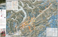
Unesco Broschüre Bellwald

Sie wollen auch ein ePaper? Erhöhen Sie die Reichweite Ihrer Titel.
YUMPU macht aus Druck-PDFs automatisch weboptimierte ePaper, die Google liebt.
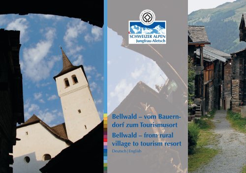
<strong>Bellwald</strong> – vom Bauerndorf<br />
zum Tourismusort<br />
<strong>Bellwald</strong> – from rural<br />
village to tourism resort<br />
Deutsch | English
1<br />
Der Saumpfad bei der St. Annakapelle, 1955<br />
The hempath to <strong>Bellwald</strong> at the Santa Anna Chapel,1955<br />
2<br />
Der letzte Postträger von <strong>Bellwald</strong>, 1955<br />
<strong>Bellwald</strong>'s last mail man,1955<br />
1 2<br />
<strong>Bellwald</strong>, bevor die Touristen kamen<br />
2<br />
Die Gemeinde <strong>Bellwald</strong> ist eine typische, aus dem Dorf <strong>Bellwald</strong> und<br />
den Weilern Ried, Egga, Bodmen und Fürgangen bestehende Hanggemeinde<br />
hoch über dem Goms und dem Fieschertal. Das Dorf <strong>Bellwald</strong>, das der<br />
Gemeinde den Namen gegeben hat, ist mit seiner Lage auf 1560 m ü. M.<br />
das höchstgelegene Dorf im Goms.<br />
Bis nach dem 2. Weltkrieg lebte die Bevölkerung von <strong>Bellwald</strong> fast ausschliesslich<br />
von der bergbäuerlichen Landwirtschaft, die aus Viehzucht und<br />
Ackerbau bestand. Diese als Mehrzweckbauerntum bezeichnete Selbstversorgungswirtschaft<br />
war weitgehend auf den eigenen Konsum ausgerichtet.<br />
Bevölkerungsmässig ist <strong>Bellwald</strong> eine Kleingemeinde. Zwischen 1850 und<br />
1970 lebten zwischen 250 und 300 Personen in <strong>Bellwald</strong>. Die Landwirtschaft<br />
mit den beschränkten Bodenressourcen vermochte nicht alle Menschen<br />
zu ernähren. Ein Teil der Bevölkerung war gezwungen, auszuwandern:<br />
Im 19. Jh. als Söldner in fremde Kriegsdienste und nach dem Verbot des<br />
Solddienstes 1859 als Kolonisten nach Südamerika oder als Melker nach<br />
Preussen und Kalifornien. Nach dem 1. Weltkrieg<br />
erfolgte dann eine Abwanderung in die<br />
Gemeinden des Haupttals oder in andere Kantone.<br />
Die grosse Wende begann in <strong>Bellwald</strong> gegen<br />
Ende der fünfziger Jahre des 20. Jh. Von 1956<br />
an verband eine Seilbahn <strong>Bellwald</strong> mit dem Tal.<br />
Zwei Jahre später wurde der Verkehrsverein gegründet<br />
und 1962 öffnete das erste Hotel seine<br />
Tore.<br />
Die 1971 fertiggestellte Fahrstrasse ins Tal beschleunigte<br />
die touristische Entwicklung. <strong>Bellwald</strong><br />
wandelte sich vom Bauerndorf zum Tourismusort.
3<br />
Die 1956 zwischen Fürgangen und <strong>Bellwald</strong><br />
erstellte Seilbahn, 1957<br />
The 1956 constructed cable railway between<br />
Fürgangen and <strong>Bellwald</strong>, 1957<br />
3 4<br />
4<br />
<strong>Bellwald</strong> mit Bergstation um 1962<br />
The cable car Station in <strong>Bellwald</strong> around 1962<br />
<strong>Bellwald</strong>, before the tourism boom<br />
High above the Goms and the Fiescher Valley, the municipality of<br />
<strong>Bellwald</strong> comprising the hamlets Ried, Egga, Bodmen and Fürgangen is a<br />
typical perched village. At an altitude of 1560 m, the village is the highest<br />
in Goms.<br />
Until the end of the Second World War <strong>Bellwald</strong>'s population lived almost<br />
exclusively from the mountain agriculture: cattle breeding and<br />
arable farming. This self-sufficiency economy was orientated to the own<br />
consumption.<br />
<strong>Bellwald</strong> is a small municipality considering its population. Between<br />
1850 and 1970, 250 to 300 people only lived in <strong>Bellwald</strong>. The agriculture<br />
on the limited land could not feed more people. Part of the population<br />
was forced into emigration: as mercenaries in foreign armies in the<br />
19 th century, as settlers in South America after the 1859 proclaimed ban<br />
on the mercenary services and as milking men in Prussia and California.<br />
After the First World War a migration to the main<br />
valley or to other cantons took place.<br />
A great change occurred during the 20th century,<br />
at the end of the 1950's. From 1956 on, a cable<br />
car linked <strong>Bellwald</strong> to the valley. The tourism office<br />
was created two years later and the first hotel<br />
opened in 1962.<br />
The in 1971 inaugurated road to the valley accelerated<br />
the tourism development. From rural village,<br />
<strong>Bellwald</strong> turned into a tourism resort.<br />
3
Geschichte und Siedlung<br />
4<br />
1<br />
2<br />
<strong>Bellwald</strong> um 1962<br />
<strong>Bellwald</strong>, around 1962<br />
Ried, 1955<br />
Ried, 1955<br />
1<br />
2<br />
<strong>Bellwald</strong> ist eine typische Weilersiedlung. Es ist dies eine Siedlungsform,<br />
die an den als «Berge» bezeichneten Talhängen des Wallis<br />
üblich ist. In Urkunden taucht manchmal die Bezeichnung «<strong>Bellwald</strong>erberg»<br />
auf.<br />
Die im 8. und 9. Jh. einwandernden Alemannen entfalteten im Goms<br />
eine immense Rodungstätigkeit und sie liessen sich vorerst in Einzelhöfen<br />
nieder, aus denen mit dem Anwachsen der Sippen allmählich<br />
kleine Weiler- und Dorfsiedlungen entstanden sind.<br />
Erste urkundliche Erwähnungen <strong>Bellwald</strong>s stammen aus dem frühen<br />
14. Jh. In dieser Zeit erfolgte die Loslösung von der Feudalherrschaft.<br />
1394 schloss sich der «<strong>Bellwald</strong>erberg» zu einer «Bauernzunft» zusammen<br />
mit dem Ziel, sich von den bestehenden Abgaben loszukaufen. Daraus<br />
entwickelte sich die Gemeinde, die Burgerschaft, die 1555 die Burgerstatuten<br />
schriftlich niederlegte. Als eigentliche Dorfverfassung enthielt<br />
diese Satzung Bestimmungen und Vorschriften über die Anerkennung<br />
und den Erwerb des Burgerrechts und sie regelten das wirtschaftliche<br />
Leben und die Landnutzung.
History and Settlement<br />
<strong>Bellwald</strong> is a typical hamlet settlement, as often found on the valley<br />
slopes in Valais. In ancient documents <strong>Bellwald</strong> is sometimes referred<br />
to as “<strong>Bellwald</strong>erberg”.<br />
The in the 8 th and 9 th centuries migrated Aleman developed a huge clearing<br />
activity in Goms and settled in isolated farms, slowly growing to<br />
small hamlets and villages to accommodate the extended clans.<br />
<strong>Bellwald</strong> is first mentioned in documents from the early14 th century; this<br />
period signed the end of feudalism. In 1394 the “<strong>Bellwald</strong>erberg” joined<br />
a “Farmers Guild” to buy themselves free of the existing taxes. A municipality<br />
was born and in 1555 the citizenship's statutes were formally<br />
written down. The statutes contained rules and regulations for the recognition<br />
and the acquisition of the civil rights and regulated the economic<br />
life and the land use.<br />
5
Der Name <strong>Bellwald</strong><br />
6<br />
Einst bereiste unser Herrgott mit etwa zwei,<br />
drei Jüngern das Wallis. Im Goms herrschte damals<br />
gerade Streit zwischen den Gemeinden Steinhaus<br />
und Niederwald. Beide sprachen das gleiche<br />
Waldstück als Eigentum an.<br />
Unser Herrgott anerbot sich als Schiedsrichter und<br />
bestimmte einer jeden Partei ihren Wald. Als Wald<br />
und Wiesen im Untergoms friedlich verteilt waren,<br />
schaute Petrus noch einmal von Lax zurück<br />
und rief dem Herrgott: «Ja schau, da oben sind<br />
ja auch noch Leute! Die haben wir jetzt ganz<br />
vergessen, die haben ja nichts vom Wald bekommen!»<br />
– «Ja nun, jetzt ist alles verteilt. Das<br />
kann ich nicht mehr rückgängig machen. Dann<br />
müssen wir denen da oben als Entschädigung<br />
den Namen ‹<strong>Bellwald</strong>› geben!» So sprach der<br />
Herr, und so blieb es.<br />
Josef Guntern: Walliser Sagen<br />
Olten und Freiburg im Breisgau,1965, S. 46 f.
The Name <strong>Bellwald</strong><br />
The Lord once travelled with two or three<br />
disciples in the canton of Valais. At that time,<br />
the Steinhaus and Niederwald municipalities<br />
fought over the same piece of forest.<br />
Lord proposed to arbitrate and attributed a part<br />
of the forest to each one of the disputing parties.<br />
Forests and pastures peacefully distributed<br />
in Untergoms, Peter took a last look from Lax<br />
and said to God: “Look, up there are people!<br />
We have forgotten them and they did not get<br />
their share of the forest!” – “Well, it is too late<br />
now, everything has been given away and I<br />
can't undo it. As compensation, we will give<br />
the people up there the name ‘<strong>Bellwald</strong>’.”<br />
So spoke the Lord and so it remained.<br />
Josef Guntern: Walliser Sagen<br />
Olten und Freiburg im Breisgau,1965, p. 46 f.<br />
7
Bäuerliche Selbstversorgungswirtschaft<br />
mit zweistufiger Landnutzung<br />
1<br />
8<br />
Bestimmendes Merkmal des inneralpinen Mehrzweckbauerntums ist<br />
die vertikale Stufung der Nutzungszonen. <strong>Bellwald</strong> kennt wegen seiner Höhenlage<br />
nur ein zweistufiges, aus Heimgütern und Alpweiden bestehendes<br />
Betriebssystem. Um die Dauersiedlungen herum befinden sich die Mähwiesen<br />
und das Ackerland. Das historische Siedlungsbild <strong>Bellwald</strong>s wird<br />
– neben den Haufensiedlungen – geprägt durch die grosse Zahl von Ausfütterungsställen,<br />
die in Gruppen vereinigt oder als Einzelbauten verstreut<br />
auf den Mähwiesen erbaut sind. Die schlechte Erschliessung des aus vielen<br />
Parzellen bestehenden Streubesitzes erschwerte Transporte zurück ins Dorf:<br />
Statt das Heu zum Vieh zu tragen, brachte man das Vieh zum Heu.<br />
2
1<br />
2<br />
Acker umgraben und Kartoffeln setzen, 1955<br />
Turning the field over and planting potatoes, 1955<br />
Mit der Sense in der Reihe mähen, um 1962<br />
Cutting the grass in a row with a scythe, around 1962<br />
The rural self-sufficiency economy<br />
and the two levels' land use<br />
The main character of the inner alpine multiple purpose farming is<br />
the vertical gradation of the land's use. Due to its altitude <strong>Bellwald</strong> experiences<br />
a two gradations use of alpine pastures and home goods. Grassy<br />
meadows and arable land are in the vicinity of the permanent housing. A<br />
great number of in groups or isolated feeding barns built on the meadows<br />
shape – next to scattered settlements – <strong>Bellwald</strong>'s historic image. The<br />
scattered localisation of the plots made the hay transport to the village<br />
quite difficult: Instead of bringing the hay to the cattle, the cattle were<br />
brought to the hay.<br />
9
10<br />
Über der Waldgrenze liegen an den Talhängen die Sommerweiden.<br />
Der Erfolg der Viehwirtschaft hing entscheidend von der Grösse und Ergiebigkeit<br />
der Alpweiden ab; denn die Nutzung der Alp als Sommerweide<br />
stand in einem komplementären Verhältnis zur Möglichkeit der Winterfütterung,<br />
d.h. die Sömmerung ermöglichte eine zwei- bis dreimonatige, von<br />
den Heimgütern unabhängige Tierhaltung.<br />
Die Sommerweiden waren (und sind) in genossenschaftlichem Besitz. Der<br />
Alpbetrieb, der aus Hüten, Melken und Käsen bestand, führte eigens dazu<br />
angestelltes Alppersonal. Die ursprüngliche Form der Alpung war in <strong>Bellwald</strong><br />
die Einzelsennerei, bei der jeder Betrieb für sich allein das Vieh besorgte<br />
und die Milch verkäste. Deshalb ist auf dem Stafel Richinen ein Alpdorf<br />
mit 34 Gebäuden entstanden, das um 1969 aus fünf Hütten, 28 Ställen<br />
und einer «Maria zum Schnee» geweihten Kapelle bestand.<br />
1<br />
2
1<br />
2<br />
«Zügeln» auf der Alp Richinen, 1956<br />
“Reining in” on the Alp Richinen, 1956<br />
Getreideernte um 1962<br />
Grain harvest, around 1962<br />
High above the forest on the valley's slopes are the summer pastures.<br />
The cattle's breeding success depended almost exclusively on the<br />
size and productivity of the alpine meadows; the use of the pastures during<br />
the summer was complementary to the winter feeding and meant 2<br />
to 3 months food independence.<br />
The summer pastures were (and still are) in cooperative ownership. The<br />
alpine farms had their own staff to tend, milk the cattle and produce<br />
cheese. In <strong>Bellwald</strong> the original form of alpine dairy farming was the<br />
individual farming, each farm tending its own cattle and producing its<br />
own cheese. On the Stafel Richinen arose therefore in 1969 an alpine<br />
village with 34 buildings, including 5 cabins, 28 barns, and a “Maria zum<br />
Schnee” consecrated Chapel.<br />
11
Funktionale Ausgestaltung des inneralpinen Streuhofs<br />
12<br />
Die vertikale Stufung der landwirtschaftlichen<br />
Nutzfläche hat in der Gestaltung der<br />
Naturlandschaft zur Kulturlandschaft ein differenziertes<br />
Landnutzungssystem hervorgebracht.<br />
Die Steilheit und die Trockenheit des Geländes<br />
bedingte Ertrag sichernde und steigernde Einrichtungen<br />
wie Terrassierungen, Bewässerungsanlagen<br />
und ein verästeltes Wegnetz.<br />
Auch der historische Hausbestand <strong>Bellwald</strong>s<br />
ist funktional auf das mehrstufige Betriebssystem<br />
mit jahrzeitlicher Wanderung ausgerichtet.<br />
Die wirtschaftliche Nutzung der verschiedenen<br />
Höhenstufen bedingte, dass jede Familie<br />
verstreut über die Kulturlandfläche die zur Bestellung<br />
und Nutzung der Güter notwendigen<br />
Gebäude errichten musste. Dieser als inneralpiner<br />
Streuhof bezeichnete Hoftypus besteht aus<br />
Einzweckbauten, aus Wohnhaus, Stallscheune,<br />
Stadel und Speicher sowie aus Alphütte.<br />
Sowohl Wohnhaus als auch Nutzbauten sind<br />
aus gestrickten Kantholzbalken gefügt. Der<br />
Walliser Blockbau ist ein typisches Wandhaus<br />
mit hochrechteckigen Wänden und einem flachen<br />
Satteldach, das in <strong>Bellwald</strong> beim originalen<br />
Hausbestand mit Schindeln gedeckt ist.<br />
Die Lage des jeweiligen Kulturlandes bestimmte<br />
den Standort der Gebäude. In der Zone<br />
der Heimgüter stehen das Wohnhaus und der<br />
Speicher, die Stallscheune und der Stadel in<br />
geschlossenen Dorf- und Weilersiedlungen<br />
(Haufendorf-Typus). Ein grosser Teil der Stallscheunen<br />
sind als Ausfütterungsställe verstreut<br />
auf den Mähwiesen erbaut.
1<br />
2<br />
Wasserfuhre «d'Undra», 1996<br />
Water canal “d'Undra”, 1996<br />
Ein von Ökonomiebauten gesäumter Gassenzug in <strong>Bellwald</strong>, 2010<br />
A line of economy constructions fringes an alley in <strong>Bellwald</strong>, 2010<br />
The inner alpine widely-spread farms and their functional form<br />
1<br />
2<br />
In shaping the natural landscape into<br />
an agricultural landscape, the productive land<br />
with its vertical gradation produced a complex<br />
land use. The ground's steepness and the aridity<br />
were the main reasons for the need of watering<br />
installations and a ramified road net.<br />
The historic buildings in <strong>Bellwald</strong> tend to accommodate<br />
the seasonal migrations. Each family<br />
had to build, spread over the agricultural<br />
area on different levels, the constructions needed<br />
for the land tilling and the storage of the<br />
goods. This so-called inner alpine widespread<br />
farm consists of house, stable, barn and storehouse<br />
as well as Alp huts.<br />
Both house and functional buildings consist of pieces<br />
of squared timber. The Valais log-cabin is a typical<br />
construction with high rectangular walls and<br />
a flat, shingle-covered saddle roof in <strong>Bellwald</strong>'s<br />
ancient buildings.<br />
The location of each agrarian area determined the<br />
building's position. In the home goods' area are<br />
the house and the storehouse, in build-up villages<br />
and hamlets the stable and the barn. A great number<br />
of stables used as feeding stables are scattered<br />
over the pastures.<br />
13
Haus, Stallscheunen und Stadel<br />
House, Stables and Barn<br />
Wohnhaus aus dem Jahre 1756 im Weiler Egga<br />
Der zweigeschossige Blockbau steht, leicht in den Hang<br />
eingetieft, auf einem gemauerten Kellergeschoss. Das Vorderhaus<br />
wird durch eine Blockwand unterteilt in Stuben<br />
und schmale Kammern. An der linken Traufwand des Vorderhauses<br />
ist unter der Abschleppung des Satteldachs eine<br />
mit Brettern eingewandete Laubenkonstruktion angebaut.<br />
Eine Besonderheit der <strong>Bellwald</strong>er Häuser ist ein an der hinteren<br />
Giebelwand angebautes Treppenhaus (Wit-hüs).<br />
14<br />
House dated 1756 in the hamlet Egga<br />
The two-storey log cabin with a brick cellar is built on a<br />
slope. A log wall divides the front part in rooms and narrow<br />
chambers. Under the saddle's roof, on the left wall, a<br />
pergola is built with the help of boards. A peculiarity of the<br />
<strong>Bellwald</strong>'s houses is the staircase built on the rear gable<br />
wall (Wit-hüs).
Stallscheune im Weiler Egga<br />
Die Stallscheune ist zahlenmässig der wichtigste Ökonomiebau.<br />
Im Grundschema setzt sie sich aus einem Stallgeschoss<br />
und einem aufgesetzten Heuspeicher zusammen. Das Stallgeschoss<br />
ist an der vorderen Giebelwand durch einen in der<br />
Gebäudeachse ausgesparten Eingang zugänglich. (Diese<br />
Anordnung entspricht der innern Raumaufteilung mit seitlichen<br />
Lagerstellen für die Kühe.) Beidseits des Stalleingangs<br />
ansteigende Treppen erschliessen den Heuspeicher.<br />
Stadel von 1679 an der Dorfgasse in <strong>Bellwald</strong><br />
Der Stadel ist das Gebäude des Ackerbaus. Ihm kommt<br />
eine Doppelfunktion als Garbenspeicher und Dreschplatz<br />
zu. Unter dem in der Mitte des Gebäudes ausgesparten Eingang<br />
stehen die Bohlen des Tenns als Auflage für die Leiter<br />
podestartig vor. Das in Firstrichtung laufende Tenn dient als<br />
Dreschplatz. Hier wurde mit einem Flegel das Korn aus den<br />
Ähren geschlagen. (Bis in die sechziger Jahre war das Handdreschen<br />
in <strong>Bellwald</strong> eine gängige Winterarbeit.)<br />
Stable in the hamlet Egga<br />
In number the stable is the most important economy building.<br />
The basic architecture elements are a low stable and<br />
an elevated storehouse built on top of it. The entrance is<br />
located in the building's axle on the front gable wall. (This<br />
arrangement corresponds to the inner floor plan with sideways<br />
places for the cows.) On both sides of the stable's<br />
entrance, exterior stairs lead to the hay storehouse.<br />
Barn dated 1679 in an alley of <strong>Bellwald</strong><br />
The barn is the building for the agrarian works. It has a double<br />
function as sheaves storehouse and threshing place. In<br />
the middle of the building the threshing floor's boards are<br />
used as platform for the ladder. On the threshing floor the<br />
corn was separated from the ears, with the help of the flail.<br />
(Until the 1960's hand threshing was a common winter occupation<br />
in <strong>Bellwald</strong>.)<br />
15
Speicher und Backhaus<br />
Storehouse and Baking House<br />
Einräumiger Speicher in der Unner Bodma<br />
Die Speicher dienten als Vorratskammer und als Aufbewahrungsort<br />
für Kleider und Wertsachen, weil hier eine geringere<br />
Feuergefahr als im Wohnhaus bestand. Wie der Stadel steht<br />
auch der Speicher auf Holzstützen, die mit gerundeten Steinplatten<br />
abgedeckt sind (Mäuseschutz?).<br />
Der Speicher ist der am wenigsten durch die vorgegebene<br />
Funktion an ein Bauschema gebundene Ökonomiebau. In seiner<br />
«Urform» besteht der Speicher aus einem kleinen, einräumigen<br />
und eingeschossigen Kantholzblock.<br />
16<br />
One-room storehouse in the Unner Bodma<br />
The storehouses were used as pantry and storage for clothing<br />
and valuables as the risk of fire was lower here than in the<br />
house. The storehouse, so the barn, stands on wood pillars covered<br />
with rounded stone plates (Protection against mice?).<br />
The storehouse through its function is the least concerned by<br />
a construction scheme for economy buildings. In its original<br />
form, the storehouse consists in a small one-room, singlestorey<br />
log cabin.
Doppelspeicher auf dem Dorfplatz von <strong>Bellwald</strong><br />
(2. Hälfte 17. Jh.)<br />
Die Technik des Blockbaus erlaubt eine horizontale und<br />
vertikale Wiederholung des einräumigen Raumschemas<br />
zu zweiraumbreiten und zweigeschossigen Mehrfachspeichern.<br />
Zu einem weit verbreiteten Speichertypus gehört<br />
der zweigeschossige Doppelspeicher. Das obere Geschoss<br />
wird dabei – ähnlich wie bei der Stallscheune – durch seitlich<br />
ansteigende Treppen erschlossen. Im Sockelgeschoss<br />
des repräsentativen Speichers befand sich noch in den fünfziger<br />
Jahren des 20. Jh. der Dorfladen.<br />
Backhaus im Ried aus dem Jahre 1780<br />
Der eingeschossige Blockbau steht traufständig zum Hang.<br />
Er besteht aus zwei quer zum First geteilten Räumen: aus der<br />
Mehlstube mit Teigtrog und Bäckertisch sowie der Backstube.<br />
Der Backofen aus Bruchsteinen ist an der talseitigen Wand apsisartig<br />
vorgebaut. Bis ins 20. Jahrhundert verfügten das Dorf<br />
und jeder Weiler von <strong>Bellwald</strong> über ein eigenes Backhaus. Hier<br />
wurde im Turnus von jeder Familie das eigene Brot gebacken.<br />
Das Backhaus von Ried ist das einzige, das sich bis heute erhalten<br />
hat.<br />
Double Storehouse on <strong>Bellwald</strong>'s village square<br />
(second half of the 17 th century)<br />
The log cabin construction technique permits a horizontal<br />
and vertical repetition of the one-room floor plan to obtain<br />
a two-room, two-storey storehouse. The two-storey double<br />
storehouse belongs to the widely spread storehouse type.<br />
The upper floor is reached over a sideways staircase as by<br />
the stables. The village shop was located on the ground<br />
floor of this representative storehouse in the 1950's.<br />
Baking house in Ried dated 1780<br />
The long, single-storey log cabin stands at right angles to the<br />
slope. It consists of two rooms built diagonally to the roof ridge:<br />
the flour room with kneading trough and baker's table and the<br />
baking room. The rough stones oven is built on the valley's side<br />
wall, as an apse. Into the 20 th century, the village and every<br />
hamlet of <strong>Bellwald</strong> had its own baking house. In rotation each<br />
family used it to bake its own bread. The Ried's baking house is<br />
the last one preserved today.<br />
17
1<br />
2<br />
3<br />
4<br />
Balkentreppe am Doppelspeicher auf dem Dorfplatz.<br />
Wooden beams staircase on a double storehouse in <strong>Bellwald</strong>'s village square.<br />
Wohnhaus in <strong>Bellwald</strong> (erbaut um 1600): Rillenfries.<br />
House in <strong>Bellwald</strong>'s ancient village (built around 1600): Groove frieze.<br />
Am gleichen Wohnhaus «Vorschutz», der auf Konsolen abgestützt ist.<br />
On the same house: “Vorschutz“ on consoles, decorated with single and double rods.<br />
Mit Kerbschnitzerei verzierte Türpfosten an einem 1670 datierten Stall in der Unere Bodma.<br />
Doorposts decorated with carvings on a stable in the Unere Bodma (dated 1670).<br />
1<br />
Hausbau und Dorfhandwerker<br />
18<br />
Der historische Gebäudebestand <strong>Bellwald</strong>s<br />
genügte als Spontanarchitektur den Bedürfnissen<br />
des bergbäuerlichen Alltags. In der bergbäuerlichen<br />
Selbstversorgungswirtschaft war Lohnarbeit<br />
systemfremd. Handwerkliche Verrichtungen wurden<br />
– soweit sie in der bäuerlichen Tradition eingebunden<br />
waren – von einzelnen Bauern selber ausgeführt.<br />
Unter ihnen gab es handwerklich Begabte,<br />
deren Können sich oft über Generationen vererbte.<br />
Dennoch zeugen viele Wohnhäuser in der Konstruktion<br />
und in der Ausgestaltung der Schmuckelemente<br />
von handwerklicher Professionalität. An den<br />
wandartig geschlossenen Frontseiten des Hauses bilden die ober- und unterhalb<br />
der Fensterreihen durchgezogenen, geschnitzten Friesborten aus<br />
Rinnen, Würfeln und Rauten einen zurückhaltenden Schmuck. Auch die<br />
wandartig vorstehenden Balkenvorstösse der Pfettenkonsolen wurden mit<br />
Rundstäben, Tropfen oder einem rosskopfähnlichen Abschluss verziert.<br />
Ein besonderes Gepräge erhalten einige Häuser <strong>Bellwald</strong>s durch das an<br />
der Stirnseite über den Sockel vorkragende Blockwerk (Vorschutz).<br />
Die Speicher- und Stadelbauten bilden in den Haufensiedlungen <strong>Bellwald</strong>s<br />
wichtige Akzente. Mit ihren – je nach Geschosszahl – unterschiedlichen<br />
Proportionen und durch ihre Stelzung wirken sie dynamischer als<br />
die Wohnhäuser. Sie gehören zu wichtigen Leistungen dörflicher Zimmermannskunst.
2 3 4<br />
House building and village's workmen<br />
The historic buildings' stand was tailored<br />
to the needs of the alpine everyday life. Labour<br />
was unknown in the mountain self-sufficiency<br />
economy. The farmers had all the manual skills<br />
required to carry out the works needed in the<br />
rustic tradition. Some of them were true tradesmen<br />
and passed their knowledge on to the next<br />
generation; the butchers and carpenters for example.<br />
Many buildings show a real professionalism<br />
in their conception and in their ornaments'<br />
decoration. Carved friezes with grooves, cubes and lozenges humbly decorate<br />
the windows' frame of the houses' front sides, the advancing joists of<br />
the corbels are embellished with round rods, drops or horse head endings.<br />
A few <strong>Bellwald</strong>'s buildings display on their front side a protruding wood<br />
block over the base (Vorschutz).<br />
The storehouses and barns accentuate <strong>Bellwald</strong>'s scattered settlements character.<br />
Thanks to their different sizes and proportions – according to the<br />
number of storey – and their stilts they appear more dynamic than the houses.<br />
They are very representative of the carpenters' skills.<br />
19
<strong>Bellwald</strong> als Tourismusort<br />
Der Bau der Strasse 1971 löste in <strong>Bellwald</strong><br />
eine hektische touristische Entwicklung<br />
aus. Zwischen 1970 und 1974 stieg die Zahl der<br />
Fremdenbetten von 450 auf 1450 und die der<br />
Logiernächte von 30'000 auf 95'000. Derzeit<br />
generiert der Tourismus zwischen 170'000 bis<br />
180'000 Übernachtungen und <strong>Bellwald</strong> besitzt<br />
an die 4500 Fremdenbetten. In den grosszügig<br />
bemessenen Bauzonen entstand eine grosse<br />
Zahl von Chaletbauten. Die älteste homologierte<br />
Zonenplanung <strong>Bellwald</strong>s datiert vom 14. Januar<br />
1976. Heute gibt es in <strong>Bellwald</strong> über 600 Chalets.<br />
Dieses neue Bauvolumen ist um ein Vielfaches<br />
grösser als der historische Hausbestand.<br />
Ein Inventar aus den frühen neunziger Jahren<br />
des 20. Jh. erfasste im Dorf und in den Weilern<br />
insgesamt 40 vor 1900 erbaute Wohnhäuser.<br />
Der «Chaletboom» hat die Siedlungsentwicklung<br />
<strong>Bellwald</strong>s eingreifend geprägt. Die Siedlungslücke<br />
zwischen dem historischen Baubestand<br />
des Dorfes und des nördlich davon auf<br />
einer Hangkrete errichteten Weilers Ried hat<br />
sich geschlossen. Auch der im Talgrund auf<br />
1200 m ü. M. gelegene Weiler Fürgangen (mit<br />
Stationen der Matterhorn Gotthard Bahn und<br />
der Seilbahn) erhielt in jüngerer Zeit wieder<br />
Bedeutung als Dauerwohnsitz, während die auf<br />
1370 und 1475 m ü. M. erbauten Weiler Bodma<br />
und Egga als Primärwohnsitz an Bedeutung<br />
verloren.<br />
20
<strong>Bellwald</strong>, tourism resort<br />
The road construction in 1971 set off a<br />
rapid development of tourism. The number of<br />
beds rose from 450 to 1450 between 1970 and<br />
1974 and the overnight stays from 30'000 to<br />
95'000. Tourism nowadays generates 170'000<br />
to 180'000 overnight stays and <strong>Bellwald</strong> has<br />
approximately a capacity of 4500 beds. A great<br />
number of chalets were built in large construction<br />
areas. The oldest building plan dates back<br />
14. January 1976. Over 600 chalets stand now<br />
in <strong>Bellwald</strong>. The historic construction volume<br />
has been multiplied several times. In the early<br />
1990's an inventory recorded only 40 houses built<br />
before 1900 in the village and hamlets.<br />
The Chalet boom had a great influence on<br />
<strong>Bellwald</strong>’s development. The gap between the<br />
historic village centre and the hamlet Ried, build<br />
on a ridge in the north, is now closed. The hamlet<br />
Fürgangen at an altitude of 1200 m (with the<br />
Matterhorn Gotthard Bahn and the cable railway<br />
stations) gained significance as a permanent domicile<br />
while the 1370 m and 1475 m high hamlets<br />
Bodma and Egga lost their importance as primary<br />
domicile.<br />
21
22<br />
«Ohne Tourismus hätte <strong>Bellwald</strong> wohl das gleiche Schicksal der Abwanderung und Entvölkerung<br />
wie so viele andere Bergdörfer im Alpenraum erlitten. Leider hat die touristische Entwicklung<br />
von <strong>Bellwald</strong> noch zu wenig Niederschlag im tertiären Wirtschaftsbereich gefunden. Sehr<br />
positiv zu vermerken ist aber, dass viele junge ‹Einheimische› ihre Zukunft in <strong>Bellwald</strong> sehen,<br />
sich hier ein Haus bauen und eine Familie gründen. Die grosse Herausforderung in den nächsten<br />
Jahren besteht einerseits darin, eine möglichst grosse Anzahl der vorhandenen Gästebetten einer<br />
aktiven Bewirtschaftung zuzuführen und andererseits den natürlichen Charme und die Identität<br />
eines Walliser Bergdorfes zu erhalten.»<br />
Andreas Wyden, ehemaliger Gemeindepräsident
“Without tourism <strong>Bellwald</strong> would have suffered the same fate of migration and depopulation<br />
as so many other mountain villages in the Alps. Nevertheless the tourism development still reflects<br />
too little on the tertiary sector of the economy. The positive point however is the young ‘locals’<br />
commitment to <strong>Bellwald</strong> and their will to build a house and raise their children in the village. The<br />
main challenge for the coming years will be on the one hand to develop an active management in<br />
the greatest possible number of existing hospitality businesses and to preserve the natural charm<br />
and the identity of a true Valais mountain village on the other hand.”<br />
Andreas Wyden, former Mayor<br />
23
Der historische Baubestand heute<br />
24<br />
1<br />
2<br />
Gruppe von Ökonomiebauten in <strong>Bellwald</strong><br />
Group of economy buildings in <strong>Bellwald</strong><br />
Gasse im Weiler Egga<br />
Alley in the hamlet Egga<br />
Heute arbeitet in vier Betrieben noch ungefähr 1 % der <strong>Bellwald</strong>er<br />
Bevölkerung in der Landwirtschaft. Die grosse Zahl der traditionellen<br />
Wirtschaftsbauten in den geschlossenen Haufensiedlungen und in der<br />
Landwirtschaftszone hat grösstenteils ihre ursprüngliche Funktion verloren.<br />
Ackerbau gibt es nicht mehr. Die imposanten Stadelbauten drohen zu<br />
verfallen und die traditionellen Heuställe entsprechen nicht mehr den heutigen<br />
Tierschutzbestimmungen. Einige Gebäude – vor allem Stallscheunen<br />
– wurden umgebaut zu Ferienwohnungen. Derartige Umnutzungen<br />
werden dann problematisch, wenn sie den ursprünglichen Charakter der<br />
Gebäude stark verändern und wenn das Umfeld «möbliert» wird mit Sonnenterrasse,<br />
Grillplatz und Fahnenstangen.<br />
Um dem unsachgemässen Umgang mit der alten Bausubstanz vorzubeugen<br />
und den Verfall von Ökonomiebauten in den geschlossenen Haufensiedlungen<br />
zu verhindern, wurde 1983 die Stiftung «Altes <strong>Bellwald</strong>»<br />
gegründet. Die Stiftung hat in den letzten Jahren fünf in ihrem Besitz stehende<br />
Nutzbauten restauriert. Auch leistet sie Beiträge an die Renovation<br />
von historischen Gebäuden (seit der Gründung über 150'000 Franken an<br />
33 Objekten).
1<br />
The historic constructions nowadays<br />
1 % only of <strong>Bellwald</strong>'s population works today in the sector of the<br />
agriculture, in four farms. Many traditional buildings in the closed scattered<br />
settlements have lost their original function. The fields are no longer cultivated.<br />
The imposing barns threaten to collapse and the traditional stables do<br />
not comply with the new animals' protection regulations. A few buildings,<br />
stables before all, are converted into holiday flats. These changes represent<br />
a problem when the original character of the construction is altered by the<br />
adjunction of sun terraces, barbecue spots and flagpoles.<br />
To prevent an improper use of the old structure and to stop the decay of the<br />
economy constructions in the village, the Foundation “Altes <strong>Bellwald</strong>” was<br />
created in 1983. Five buildings owned by the foundation were renovated in<br />
the last years. Funds are also given for the restoration of historic buildings<br />
(over 150'000 Swiss Francs for 33 objects since the creation).<br />
25<br />
2
«Ziel der Stiftung ‹Altes <strong>Bellwald</strong>› ist es, die in Jahrhunderten gewachsene<br />
Kulturlandschaft bestmöglich zu erhalten. Dass Dorfbild, alte<br />
Wege und Gassen, offen geführte Wasserleiten und anderes mehr sind,<br />
als ein kulturelles Erbgut unserer Vorfahren, sollte jedem <strong>Bellwald</strong>er<br />
klar sein und somit tragen alle gemeinsam eine Verantwortung gegenüber<br />
Vergangenheit und Zukunft. Prägend für <strong>Bellwald</strong> wird auch in Zukunft<br />
die Architektur der Vergangenheit sein und nicht die uniformierte<br />
Chaletarchitektur unserer Tage.»<br />
Urban Paris, Präsident Stiftung «Altes <strong>Bellwald</strong>»<br />
26<br />
“Aim of the ‘Altes <strong>Bellwald</strong>’ Foundation is to preserve the centuries-old<br />
cultural landscape. The village, the old ways and alleys, the<br />
water canals running in the open are, among others, a cultural heritage<br />
left by the ancestors. All <strong>Bellwald</strong> citizens share a common responsibility<br />
for past and future. The ancient architecture, not the uniform Chalet<br />
architecture, will be striking for <strong>Bellwald</strong> in the future.”<br />
Urban Paris, Präsident Stiftung “Altes <strong>Bellwald</strong>”
1<br />
1<br />
Weiler Egga<br />
Hamlet Egga<br />
27
Umgang mit der historischen Bausubstanz<br />
Dealing with the historic structure<br />
28<br />
ISOS – Bundesinventar der schützenswerten Ortsbilder<br />
der Schweiz<br />
Das ISOS hat das Dorf <strong>Bellwald</strong> vor allem wegen seines<br />
gut erhaltenen Innerortsbildes als Siedlung von regionaler<br />
Bedeutung eingestuft.<br />
Eine nationale Klassifikation erhielt der zeilenartig auf einer<br />
Hangkante erbaute Weiler Bodma wegen seiner Lagequalität<br />
und architekturhistorischen Qualität. Die heutige<br />
Zweiteilung hat ihre Ursache in einem Brand von 1896, bei<br />
dem in der Ortsmitte drei Wohnhäuser und fünf Ökonomiebauten<br />
niederbrannten.<br />
ISOS – Federal Inventory of the Swiss to be preserved<br />
townscapes<br />
Thanks to <strong>Bellwald</strong>'s well preserved structure ISOS classified<br />
the village as settlement with a historical significance.<br />
The hamlet Bodma received a national classification for its<br />
situation, its ribbon development on a ridge and its historic<br />
architectural quality. The actual division of Bodma in two<br />
parts is due to a fire, which in 1896 destroyed three houses<br />
and five economy buildings in the village centre.
«Huberhaus» – Ferien im Baudenkmal<br />
Das Huberhaus befindet sich im Weiler Egga. Seit 1930 war<br />
das aus dem 16. Jh. stammende Haus (Umbau 1713) unbewohnt<br />
und wurde als Abstellraum und Schreinerwerkstatt<br />
genutzt. 2006 konnte die «Stiftung Ferien im Baudenkmal»<br />
(Schweizer Heimatschutz) das Haus übernehmen und renovieren.<br />
Seit 2008 wird es von der Stiftung wochenweise als<br />
Ferienhaus vermietet.<br />
“Huberhaus” – Holiday in a historic monument<br />
The “Huberhaus” is located in the hamlet Egga. The house<br />
built in the 16 th century (renovated in 1713) stood empty<br />
since 1930 and was used as storage and carpenter's workshop.<br />
In 2006 the Foundation “Stiftung Ferien im Baudenkmal”<br />
(Swiss Heritage Preservation) was able to acquire and<br />
renovate the house. Since 2008 the Foundation rents the<br />
house on a weekly basis.<br />
29
1<br />
30<br />
1<br />
Vor der Renovation<br />
Before renovation<br />
2<br />
Nach der Renovation<br />
After renovation<br />
2
Der Kirchenstadel<br />
Um 1990 war der Kirchenstadel baulich in einem ruinösen<br />
Zustand, der eine Renovation unmöglich erscheinen liess.<br />
Der damalige schweizerische Botschafter in Rom, Dr. Bruno<br />
Spinner, hatte durch seine Beziehungen zu <strong>Bellwald</strong> aber<br />
ein Projekt. Er wollte in <strong>Bellwald</strong> einen Kunstverein gründen<br />
und einen Atelierraum einrichten. Er kaufte den Stadel<br />
und liess ihn aufwendig restaurieren und zum Atelier umbauen.<br />
Der Verein «artbellwald» wurde am 7. August 2009<br />
gegründet. Bruno Spinner hat diese Gründung nicht mehr<br />
erlebt. Er starb wenige Tage zuvor an einer heimtückischen<br />
Krankheit.<br />
Der Verein lädt Kunstschaffende aus dem In- und Ausland<br />
für 2 bis 6 Monate ein und stellt ihnen im umfunktionierten<br />
Kirchenstadel das Atelier zur Verfügung.<br />
The Church barn<br />
Around 1990 the Church Barn was in a critical state and a<br />
renovation seemed impossible. The, then Swiss Ambassador<br />
in Rome, Dr. Bruno Spinner, had through his connection<br />
to <strong>Bellwald</strong> a project. He wanted to create an Art Institute<br />
and an Atelier in the village. He bought the barn, had it<br />
expensively renovated and converted into an Atelier. The<br />
Association “artbellwald“ was created on August 7, 2009.<br />
Bruno Spinner did not live to it. He died a few days earlier<br />
after a long illness.<br />
The association invites national and foreign artists for a 2 – 6<br />
months long period and put the Atelier at their disposal.<br />
31
1<br />
32<br />
1<br />
Alpstafel Richinen um 1980<br />
Alp Richinen around 1980<br />
2<br />
Die Alpgebäude von Richinen im Freilichtmuseum<br />
Ballenberg<br />
The alpine constructions of Richinen in the Freilichtmuseum<br />
Ballenberg<br />
2
Der Fall «Richinen»<br />
Auf dem Alpstafel Richinen standen ursprünglich zusammen mit der Kapelle 34 Gebäude.<br />
Mit der Modernisierung und Rationalisierung des Alpbetriebs hatten die Hütten und Ställe<br />
ihre ursprüngliche Funktion für den Alpbetrieb verloren. Es gab Projekte, einen Teil der<br />
Hütten und Ställe z.B. in ein Jugendlager umzubauen. Gegen dieses Umbauvorhaben regte<br />
sich bei der Bevölkerung Widerstand. Und so kam es zu dem einmaligen Fall, dass die Urversammlung<br />
(Gemeindeversammlung) 1986 beschloss, die Gebäude abzubrechen. Nach<br />
1987 begann dieser Abbruch. Heute steht nur noch eine Hütte bei der Kapelle. Eine Hütte<br />
wurde am Dorfplatz neu aufgebaut und beherbergt ein Alpmuseum. Zwei Hütten und drei<br />
Ställe dokumentieren im schweizerischen Freilichtmuseum Ballenberg das ehemalige Älplerleben<br />
in <strong>Bellwald</strong>.<br />
The case “Richinen”<br />
On the Alp Richinen 34 constructions and a chapel stood originally. The huts and stables<br />
lost their original function through modernization and rationalization. There were projects<br />
to convert them into a youth camp. The population opposed this project and for the first<br />
time in history the “Urversammlung” (Municipal Council) 1986 decided to tear the buildings<br />
down. Shortly after 1987 the destruction started. Nowadays a lonely hut still stands<br />
next to the chapel. A new hut was built on the village square and hosts an alpine Museum.<br />
Two huts and three stables in the Swiss “Freilichtmuseum Ballenberg” document the former<br />
alpine life in <strong>Bellwald</strong>.<br />
33
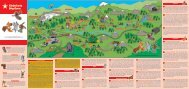
Besonderheiten | Peculiarities<br />
Basel<br />
Spilsee, oberhalb Richinen<br />
Spilsee, above Richinen<br />
Zürich<br />
D'Undra, oberhalb Richinen<br />
D'Undra, above Richinen<br />
Lausanne<br />
Bern<br />
Kandersteg<br />
Luzern<br />
Interlaken<br />
Spiez<br />
Gotthard<br />
Chur<br />
Kapelle «Maria zum Schnee», Alp Richinen<br />
Chapel “Maria zum Schnee”, Alp Richinen<br />
Pfarrkirche mit Beinhaus, <strong>Bellwald</strong><br />
Parish Church with ossuary, <strong>Bellwald</strong><br />
Genève<br />
Sion<br />
Brig<br />
Lugano<br />
Gemeindespeicher, <strong>Bellwald</strong><br />
Municipal Storehouse, <strong>Bellwald</strong><br />
Milano<br />
Museum Alphütte «Spittel», <strong>Bellwald</strong><br />
Alpine Museum “Spittel”, <strong>Bellwald</strong><br />
Gasse mit Ökonomiebauten, <strong>Bellwald</strong><br />
Alley with economy buildings, <strong>Bellwald</strong><br />
Backhaus, Ried<br />
Baking House, Ried<br />
«Huberhaus», Egga<br />
“Huberhaus”, Egga<br />
Zeile von Stallscheunen, Obere Bodma<br />
Row of stables, Obere Bodma<br />
34<br />
Stadel mit der Korporationsstube, Unere Bodma<br />
Barn with corporation room, Unere Bodma<br />
Siedlungsgruppe «uf em Biel», Unere Bodma<br />
Settlement “uf em Biel”, Unere Bodma<br />
Kapelle «Unsere Liebe Frau», Fürgangen<br />
Chapel “Unsere Liebe Frau”, Fürgangen
35
Unser gemeinsames Erbe …<br />
36<br />
Der Grosse Aletschgletscher und das weltberühmte<br />
Dreigestirn Eiger, Mönch und Jungfrau<br />
repräsentieren das Herz des UNESCO Welterbes<br />
Schweizer Alpen. Spektakuläre Hochgebirgslandschaften<br />
stehen in dynamischer Symbiose<br />
mit der umgebenden Kulturlandschaft. Von mediterran<br />
anmutenden Steppenlandschaften bis<br />
zu Gletschern erstreckt sich das Gebiet über<br />
alle Vegetationsstufen. Es ist ein hervorragendes<br />
Beispiel für die Entstehung der Gebirge und<br />
Gletscher und den aktuellen Klimawandel.<br />
Die vorliegende <strong>Broschüre</strong> ist Teil einer Serie,<br />
welche zentrale Welterbe-Themen sowohl in<br />
ihrer lokalen und regionalen als auch ihrer globalen<br />
Bedeutung beleuchtet. Die Verbindung<br />
von Wissen und Erlebnissen eröffnet einen neuen<br />
Zugang zu den reichen Schätzen und Geheimnissen<br />
des Welterbes und schafft Bewusstsein<br />
für unser gemeinsames Erbe. Es stellt sich<br />
die zentrale Frage: Was trage ich persönlich zur<br />
Förderung dieses Erbes bei und wie geben wir<br />
dieses Erbe der nächsten Generation weiter?<br />
Mehr Geheimnisse entdecken Sie unter www.<br />
myswissalps.ch
Our common Heritage …<br />
The Great Aletsch glacier and the three<br />
world-famous peaks Eiger, Mönch and Jungfrau<br />
are the core of the UNESCO World Heritage<br />
Swiss Alps. Impressive high mountains and the<br />
surrounding cultural landscape have a dynamic<br />
symbiotic relationship.The area stretches from<br />
the rocky steppes with a mediterranean character<br />
to the glaciers. It is a perfect example of the<br />
mountain and glacier's formation and of the actual<br />
climatic changes.<br />
This brochure is part of a series, shedding light<br />
on central World Heritage themes and their<br />
local, regional and global significance. In connecting<br />
knowledge and experience a new access<br />
is given to the treasures and secrets of the<br />
World Heritage and awareness of our common<br />
heritage is created. An important question arises:<br />
How can I personally contribute to promote<br />
this heritage and transmit it to the next<br />
generation? Discover more secrets under www.<br />
myswissalps.ch.<br />
37
Legenden | Legends<br />
38<br />
Icons | Icons<br />
Statement / Meinungen | Statement / Opinions<br />
Wissenswertes | Valuable information<br />
Interview | Interview<br />
Wissenschaft | Science<br />
Sagen / Mythen | Legend / Myth<br />
Über das Welterbe hinaus | Beyond the World Heritage<br />
Spiel und Spass | Games and Fun<br />
Infopunkt | Information Point<br />
Schwelle | Threshold<br />
www.myswissalps.ch<br />
Themen | Themes<br />
Gebirge | Mountains<br />
Klima | Climate<br />
Gletscher | Glacier<br />
Wasser | Water<br />
Tiere und Pflanzen | Fauna and Flora<br />
Landwirtschaft | Agriculture<br />
Siedlung | Settlement<br />
Kultur | Culture<br />
Tourismus | Tourism<br />
Verkehr | Traffic
Impressum | Imprint<br />
Herausgeber | Publisher<br />
Stiftung UNESCO Welterbe Schweizer Alpen Jungfrau-<br />
Aletsch, Managementzentrum<br />
Texte und Bilder sind urheberrechtlich geschützt. Verwendung<br />
und Neudruck nur mit schriftlichem Einverständnis<br />
des Herausgebers.<br />
All rights reserved. No part of this publication may be<br />
used or reproduced without the prior permission in<br />
writing of the Publisher.<br />
1. Ausgabe | 1 st edition<br />
2011<br />
Texte | Script<br />
Klaus Anderegg, Dr. phil. / Ethnologe<br />
Fotos | Photo credits<br />
Oliver Ritz, Klaus Anderegg, Edmund Wyden, Walther Ryser,<br />
Bettmeralp Bahnen, Jungfraubahnen, Laudo Albrecht, Maurus<br />
Gsponer, Stefan Eggel, Stefan Zurschmitten<br />
Gestaltung | Layout<br />
sens’or Gestaltungs-GmbH, Naters<br />
Druck | Print<br />
Mengis Druck und Verlag, Visp<br />
Schutzgebühr | Nominal fee<br />
CHF 2.–<br />
39
Co-Partner<br />
Nationaler Medienpartner<br />
Regionaler Medienpartner<br />
Regionalpartner<br />
UNESCO Welterbe Schweizer Alpen Jungfrau-Aletsch<br />
Managementzentrum<br />
CH - 3904 Naters | T: +41 27 924 52 76<br />
www.jungfraualetsch.ch