Prof. Günther Vogt - ETH Zürich
Prof. Günther Vogt - ETH Zürich Prof. Günther Vogt - ETH Zürich
Professur für Landschaftsarchitektur Chair of Landscape Architecture Professor Günther Vogt Assistenz Franziska Bark Tobias Baldauf Alice Foxley Medea Hoch Florian Otto Forschung Jürgen Krusche
- Seite 2 und 3: Entwurf ws 2006/07 Projektentwicklu
- Seite 4: Forschungsprojekt eth Zürich, nsl,
<strong>Prof</strong>essur für<br />
Landschaftsarchitektur<br />
Chair of Landscape<br />
Architecture<br />
<strong>Prof</strong>essor<br />
<strong>Günther</strong> <strong>Vogt</strong><br />
Assistenz<br />
Franziska Bark<br />
Tobias Baldauf<br />
Alice Foxley<br />
Medea Hoch<br />
Florian Otto<br />
Forschung<br />
Jürgen Krusche
Entwurf ws 2006/07<br />
Projektentwicklung<br />
Hanael Sfez<br />
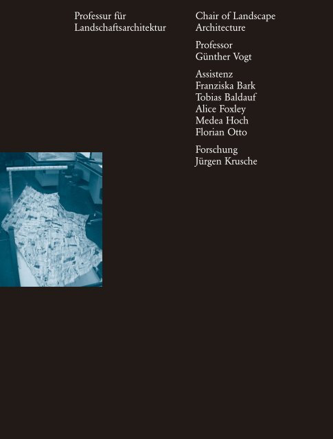
links:<br />
Tischmodell image from<br />
Rachel Metzger<br />
Process Cartography I<br />
Als spatial practitioners haben wir viel mit Kartographie zu<br />
tun. Wo es traditionellen Kartographen um Weisen<br />
der Darstellung realer geo- und topographischer Gegebenheiten<br />
geht, beschäftigen wir uns oft mit imaginierten<br />
Räumen. Unseren Entwurfsprozess könnte man als die Art<br />
und Weise des Umgangs mit realem und imaginiertem<br />
Terrain verstehen. Den Begriff der Karte erweiternd, handelt<br />
es sich bei «Process Cartography» also nicht nur<br />
um Karten, Pläne, Schnitte, Ansicht und Modelle, sondern<br />
u. a. auch um Zeichnungen, Filme, Tonaufnahmen und<br />
Texte.<br />
Die Kartographie basiert auf der Unterscheidung zwischen<br />
Symbol und Objekt; eine Karte ist kein Terrain.<br />
Viele Übersetzungskriterien trennen Karte und Terrain,<br />
wenn es darum geht, das Reale und das Imaginierte<br />
in eine standardisierte und zugleich spezifische Sprache<br />
zu überführen, sie unterliegen aber auch jedem Entwurfsprozess.<br />
In unserem einführenden Semester haben<br />
wir uns auf fünf konventionelle Weisen der Darstellung<br />
von Raumgestaltungen konzentriert – Konzeptmodell,<br />
Bild, Arbeitsmodell, Plan und die Präsentation – samt den<br />
individuellen Übersetzungsschritten von einem zum<br />
anderen.<br />
Das Kasernenareal wurde als Gelände ausgewählt, da<br />
es weder «Park» noch «Garten» oder «Platz» ist und<br />
weil es die Studentinnen und Studenten mit einem Ort<br />
mit sehr diversem sozio-kulturellen Kontext konfrontierte.<br />
Die Studentinnen und Studenten wurden aufgefordert,<br />
Endpräsentation<br />
Martin Staubli<br />
211<br />
Process Cartography I<br />
The idea of cartography is something which as spatial<br />
practitioners we have much to do with. Whereas the<br />
traditional cartographer is concerned with ways of representing<br />
real geographical and topographical situations,<br />
we are often engaged with imagined spatial situations. We<br />
might think of our design processes as the art and<br />
science of representing both real and imagined terrain. By<br />
extended definition, ‘Process Cartography’ provides<br />
us not only with maps, plans, sections, elevations and<br />
models but also with drawings, films, sound recordings<br />
and texts.<br />
Cartography is dependent on the differentiation of<br />
symbol and object; the map is not the territory. Several<br />
criteria of translating the real and imagined into a<br />
standardized and yet specific symbolic language separate<br />
map and territory, but also underlay every design process.<br />
In our introductory semester, we focus on five conventions<br />
of spatial design representation – the concept<br />
model, the image, the working model, the plan and the<br />
presentation – and the individual steps of translation<br />
from the one to the next one.<br />
The area of the former barracks was chosen as the site<br />
for a new terrain in the city of Zurich, because it is neither<br />
park, nor garden nor square, and because it presented<br />
NSL/Institut ILA Departement Architektur<br />
<strong>Günther</strong> <strong>Vogt</strong>
<strong>Günther</strong> <strong>Vogt</strong><br />
NSL/Institut ILA Departement Architektur<br />
Wahlfach<br />
Konzeptentwicklung<br />
Mathis Keller und<br />
Marc Haller<br />
irgendwo zu beginnen und eine Intervention in ihrem umgedrehten<br />
Tisch als imaginärem Terrain zu machen,<br />
wozu ihnen alle möglichen Materialen zur Verfügung<br />
standen. Der Tisch repräsentierte im Anschluss daran<br />
das Gelände des Kasernenareals.<br />
Bei der Bewertung standen das Entwurfskonzept und<br />
die kritische Auseinandersetzung der Studierenden mit<br />
dem individuellen Entwurfsprozess Seite an Seite. Sie<br />
sollten klare Kriterien für die Entwicklung ihres Entwurfs<br />
finden und sich der Entscheidungen bewusst werden,<br />
die sie fällen, wenn sie ihre sich entwickelnden Entwürfe<br />
von einem Darstellungsmodus in den nächsten übersetzen.<br />
Wie zum Beispiel lässt sich eine vorgestellte Atmosphäre<br />
in einem Plan oder Modell manifestieren? Oder<br />
inwiefern entwickelt sich der Umgang mit dem Arbeitsmodell<br />
auf der Basis von Ideen, die in einem Bild eingefangen<br />
sind?<br />
Präsentationen zum Modellbau und der Herstellung<br />
von Plänen im Büro <strong>Vogt</strong> Landschaftsarchitekten<br />
wurden durch Workshops bzw. Endkritiken der Gäste<br />
Tanja Mergler (ucca, Canterbury), Peter Erni (Peter Erni<br />
Architekturbüro, Meggen, ch) und Lars Müller (Lars<br />
Müller Publishers, Baden) ergänzt.<br />
«Pairi-daeza: Wasser»<br />
Pairi-daeza ist persisch für «eine Mauer, die einen Garten<br />
umschliesst». Der Begriff stellt den Ausgangspunkt<br />
dar für eine Wahlfachserie, die landschaftsarchitektonische<br />
Grundelemente erkundet. Anschliessend an «Umgrenzung»<br />
und «Schwelle» befasste sich dieses Wahlfach mit dem<br />
Thema «Wasser». Das Element mit seinen aussergewöhnlichen<br />
Eigenschaften findet sich in <strong>Zürich</strong> mit seinem<br />
See, seinen Flüssen und 1200 Brunnen überall. Und dennoch<br />
ist die formbildende Dynamik von Wasser in<br />
der Stadt rar. Das Wahlfach suchte das Element daher an<br />
einem der wenigen offenen Bachläufe auf. Wie seine<br />
Namen Wehrenbach, Wildbach, Hornbach changiert dieser<br />
Bach zwischen domestiziert und wild. Die Studierenden<br />
entwarfen eine Intervention, die den Bewegungscharakter<br />
von Wasser erfahrbar machte. Sie wählten einen Ort<br />
zwischen Burgwies und Horn, den sie vermassen, kartierten<br />
und in ein Modell übersetzten oder in eine Versuchsanordnung,<br />
in der Wasser am Gestaltungsprozess mitwirkte.<br />
212<br />
students with a space strongly connoted by the sociocultural<br />
diversity of its context. The students were asked to<br />
‘begin anywhere’ with the physical modeling of an imaginary<br />
terrain defined by their own table upturned, using<br />
whatever materials came to hand. The table would come<br />
to represent the designated site in the Barracks.<br />
The concept for the design of the terrain was assessed<br />
alongside with students’ critical handling of their individual<br />
design processes. The students were asked to find<br />
clear criteria for advancing their designs and to be conscious<br />
about their decision-making, as they translated their<br />
developing designs from one representational mode<br />
to another. For example, how would they approach the<br />
manifestation of an imagined atmosphere in the making<br />
of a plan or a model? Or how did their handling of<br />
the working model develop from the ideas suggested by<br />
their defining image?<br />
Alongside sessions about model making and representation<br />
on plan at <strong>Vogt</strong> Landschaftsarchitekten, guests<br />
Tanja Mergler (ucca, Canterbury), Peter Erni (Peter<br />
Erni Architekturbüro, Meggen, ch) and Lars Müller (Lars<br />
Müller Publishers, Baden) gave related workshops and<br />
took part in the final criticism.<br />
‘Pairi-daeza: Water’<br />
The elective is part of a six-semester investigation concerned<br />
with the development of Pairi-daeza (Persian<br />
for ‘a wall enclosing a garden’) to the garden typology<br />
‘Paradise’. The series explores the basic elements of<br />
landscape design. Following ‘peri’ and ‘threshold’, this<br />
elective dealt with the topic ‘water’. With its lake,<br />
its rivers and 1200 wells, one finds this element with its<br />
extraordinary qualities all around the city of Zurich.<br />
However, the sculpting dynamics of water are rarely to<br />
be found here. The elective therefore explored the<br />
element at one of the rare open brooks. Like its names<br />
Wehrenbach, Wildbach, Hornbach, the brook moves<br />
between being domesticated and wild. The students chose<br />
a site between Burgwies and Horn of which they were<br />
asked to take measurements, from which they made a map<br />
and translated into a model. Their design interventions<br />
allowed the water’s play to become experiencable.
Forschungsprojekt eth<br />
<strong>Zürich</strong>, nsl, Institut<br />
für Landschaftsarchitektur<br />
(ila), <strong>Prof</strong>. <strong>Günther</strong> <strong>Vogt</strong><br />
Berlin (Streetart)<br />
and<br />
Tokyo (Walking)<br />
Taking to the Streets<br />
Das Forschungsprojekt Taking to the Streets (seit April 2007)<br />
nimmt sich mit Leidenschaft eines Themas an, das allgemein<br />
nicht als sehr attraktiv betrachtet wird: der Strasse.<br />
Doch betrachten wir die Strasse nicht nur als Ort<br />
des Verkehrs, sondern vielmehr als Raum, und zwar als<br />
Lebensraum. Aus der Perspektive des Raums ist die<br />
Strasse immer auch öffentlicher Raum, Handlungs- und<br />
Bewegungsraum, performativer Raum, Raum der Kommunikation<br />
genauso wie subversiver Raum der politischen<br />
Äusserungen und künstlerischen Interventionen.<br />
Im Zentrum der Untersuchung steht nicht die grossmassstäbliche<br />
Planung, sondern das Kleine und Alltägliche,<br />
das tägliche Leben mit all seinen Handlungen und<br />
Mikro-Gestaltungen, welche als Ausdruck eines ständig ablaufenden,<br />
dynamischen und lebendigen Prozesses verstanden<br />
werden; eines Prozesses, der den Raum als Lebensraum<br />
– als lived space, wie es Henri Lefèbvre nennt – erst<br />
konstituiert. Die deutsche Raumsoziologin Martina Löw<br />
spricht diesbezüglich auch von Spacing-Prozessen.<br />
Der Raum der Strasse, als Beispiel eines stets aktuellen<br />
und verdichteten urbanen Raums, geht aus den vielschichtigen<br />
Relationen zwischen den Handlungen und<br />
Wahrnehmungen der Menschen und der gebauten<br />
Umwelt hervor. Um dieser Komplexität gerecht zu werden,<br />
siedelt sich die Untersuchung zwischen Landschaftsarchitektur,<br />
Architektur und Städtebau, Kunst und Soziologie<br />
an und vereint sowohl architektur-, stadt- und<br />
raumsoziologische wie künstlerische, kulturwissenschaftliche<br />
und phänomenologische Sichtweisen und Methoden.<br />
Am treffendsten wird dieses interdisziplinäre – in diesem<br />
Fall auch interkulturelle – Forschungsgebiet vielleicht<br />
unter dem Begriff Raumwissenschaft zusammengefasst.<br />
Vergleichende Studien in Ostasien (vor allem<br />
China und Japan) und Europa werden möglichst vielfältige<br />
Erscheinungsweisen, Gestaltungen und Funktionen der<br />
Strasse in den Blick nehmen. Durch die enge Zusammenarbeit<br />
mit Kooperationspartnern in Japan und China<br />
sollen nicht-eurozentrische Verfahrensweisen und Perspektiven<br />
erarbeitet werden, die neue Möglichkeiten und<br />
Strategien für die Analyse und Planung künftiger Gestaltungen<br />
des öffentlichen Raums eröffnen können.<br />
Schwerpunkt der Untersuchung werden Feldforschungen<br />
in ausgewählten Städten Europas, Chinas und<br />
Japans sein. Diese basieren auf der Methode des Imagebased<br />
Research, einer Methode, die künstlerische Ansätze<br />
mit neuen Bildstrategien, wie sie auch im Bereiche<br />
der visuellen Anthropologie eingesetzt werden, verbindet.<br />
Die Bildproduktion wird dadurch mit zum Forschungsinhalt.<br />
Bilder werden einen wesentlichen Teil<br />
der Ergebnisse darstellen, wodurch bewusst die Rolle der<br />
Bilder innerhalb des wissenschaftlichen Diskurses thematisiert<br />
wird.<br />
Wir schliessen uns ganz dem Motto des Studios von<br />
Yoshihiko Iida an der Yokohama-Graduate School<br />
for Architecture (y-gsa), einem Kooperationspartner des<br />
Projekts, an: «Taking to the streets and thinking about architecture».<br />
213<br />
Taking to the Streets<br />
The research project Taking to the Streets (ongoing since<br />
April 2007) passionately deals with a topic otherwise<br />
not considered very attractive: the street. We deal with<br />
the street not only as the realm of traffic but rather as<br />
a space, the space of everyday life. Seen from the perspective<br />
of ‘space’, the street is simultaneously public<br />
space, space of action and movement, performative space,<br />
a space of communication, as well as a subversive space<br />
of political expressions and artistic interventions.<br />
The center of our investigation is not the large scale<br />
planning, but the small and the common, everyday<br />
life with all its actions and micro-designs, which is understood<br />
as a continuous, dynamic and lively process, a<br />
process which, according to Henri Lefebvre, constitutes<br />
the space as ‘lived’ in the first place. In regards to<br />
this definition, the German sociologist Martina Löw<br />
speaks of spacing-processes.<br />
As an example of a condensed and ever-current space,<br />
the realm of the street is created by the manifold relations<br />
between the built environment and the actions<br />
and perceptions of people. In order to do justice to<br />
this complexity, the examination of this research is positioned<br />
between the fields of landscape architecture,<br />
architecture and urban planning, art and sociology, and<br />
combines the respective different methods and ways<br />
of seeing accordingly. The interdisciplinary – and in this<br />
case also inter-cultural – field of research can be summarized<br />
under the term ‘science of space’.<br />
Comparable studies in Eastern Asia (mainly China and<br />
Japan) and Europe will ideally examine manifold<br />
phenotypes, designs and functions of the street. Via the<br />
close cooperation with partners in Japan and China,<br />
non-Eurocentric modes of procedure and perspectives will<br />
be developed. They can open up new possibilities and<br />
strategies for the analysis and planning of future designs<br />
of public space.<br />
The main focus of the research is field-studies in<br />
selected cities in Europe, China and Japan. They will be<br />
based on the method of image-based research, a method<br />
combining artistic approaches with new strategies in<br />
the employment of images, also used in the field of<br />
visual anthropology. The production of images is hence<br />
going to be part of the research. Images are going to<br />
form a main part of the research results, and the role of<br />
images within the academic discourse will be discussed.<br />
We conclude with a motto from the studio of<br />
Yoshihiko Iida at the Yokohama-Graduate School for<br />
Architecture (y-gsa), one of our cooperation partners<br />
for the project: ‘Taking to the streets and thinking about<br />
architecture’.<br />
NSL/Institut ILA Departement Architektur<br />
<strong>Günther</strong> <strong>Vogt</strong>


