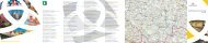
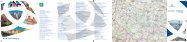
Leták In-line skating v jižnÃch Äechách a na Å umavÄ - Jižnà Äechy
Leták In-line skating v jižnÃch Äechách a na Å umavÄ - Jižnà Äechy
Leták In-line skating v jižnÃch Äechách a na Å umavÄ - Jižnà Äechy

Sie wollen auch ein ePaper? Erhöhen Sie die Reichweite Ihrer Titel.
YUMPU macht aus Druck-PDFs automatisch weboptimierte ePaper, die Google liebt.
jižní Čechy®<br />
EUREGIO Bayerischer Wald<br />
- Böhmerwald - Unterer <strong>In</strong>n e.V.<br />
<strong>In</strong>-<strong>line</strong> <strong>skating</strong><br />
<strong>In</strong>-<strong>line</strong> skatin<br />
V JIŽNÍCH ČECHÁCH A NA ŠUMAVĚ<br />
IN SÜDBÖHMEN UND IM BÖHMERWALD<br />
<strong>skating</strong><br />
IN SOUTH BOHEMIA<br />
AND IN THE BOHEMIAN FOREST<br />
<strong>In</strong>-<strong>line</strong><br />
Partner JCCR<br />
Tento projekt je spolufi<strong>na</strong>ncován Evropskou unií z Programu <strong>In</strong>iciativy společenství INTERREG IIIA.<br />
Dieses Projekt wird von der Europäischen Union aus dem Programm <strong>In</strong>itiative der Gemeinschaft INTERREG IIIA mitfi<strong>na</strong>nziert.<br />
This project is co-funded by the European Union from the Programme of Community <strong>In</strong>itiative INTERREG IIIA.
Tento materiál je neprodejný_Kostenlose Broschüre_Not for sale.<br />
© JIHOČESKÁ CENTRÁLA CESTOVNÍHO RUCHU 2007<br />
2
OBSAH_INHALT_CONTENT<br />
TRASA_STRECKE_ROUTE 01 ....................................................... 6<br />
Č. Budějovice - Hluboká <strong>na</strong>d Vltavou<br />
TRASA_STRECKE_ROUTE 02 ....................................................... 8<br />
Třeboň (U Sv. Petra a Pavla) - Vitmanov<br />
TRASA_STRECKE_ROUTE 03 ..................................................... 10<br />
Chlum u Třeboně (Kosky) - Nová Huť<br />
TRASA_STRECKE_ROUTE 04 ..................................................... 12<br />
Klášter - Filipov<br />
TRASA_STRECKE_ROUTE 05 ..................................................... 14<br />
Tábor (Švehlův most) - Harrachovka<br />
TRASA_STRECKE_ROUTE 06 ..................................................... 16<br />
Strakonice - Nový Dražejov<br />
TRASA_STRECKE_ROUTE 07 ..................................................... 18<br />
Lipno <strong>na</strong>d Vltavou<br />
TRASA_STRECKE_ROUTE 08 ..................................................... 20<br />
Hůrka - Horní Planá<br />
TRASA_STRECKE_ROUTE 09 ..................................................... 22<br />
Nová Pec - Stožec<br />
TRASA_STRECKE_ROUTE 10 ..................................................... 24<br />
Kvilda - Buči<strong>na</strong><br />
TRASA_STRECKE_ROUTE 11 ..................................................... 26<br />
Modrava - Rybár<strong>na</strong><br />
TRASA_STRECKE_ROUTE 12 ..................................................... 28<br />
Modrava - Březník<br />
TRASA_STRECKE_ROUTE 13 ..................................................... 30<br />
Klatovy - Vrhaveč<br />
TRASA_STRECKE_ROUTE 14 ..................................................... 32<br />
Domažlice - Havlovice<br />
Další možnosti_Weitere Möglichkeiten_Further possibilities..........34<br />
Tipy z Bavorska_Tipps aus Bayern _Tips from Bavaria .....................34<br />
Legenda - povrch_Legende - Oberfläche_Legend - surface:<br />
1<br />
2<br />
hladký povrch_glatte Oberfläche_smooth surface<br />
hrubší povrch, možné menší nerovnosti_rauhe Oberfläche, kleinere Unebenheiten<br />
möglich_less abrasive surface, small asperity possible<br />
3<br />
nekvalitní hrubý povrch, možné nerovnosti a výmoly_sehr wellige und rauhe<br />
Oberfläche, grössere Unebenheiten und Löcher möglich_poor quality abrasive<br />
surface, asperity and holes possible<br />
3
14<br />
13<br />
06<br />
11<br />
12<br />
10<br />
01<br />
09<br />
08<br />
07<br />
4
05<br />
02<br />
04<br />
03<br />
5
TRASA_STRECKE_ROUTE 01<br />
Č. Budějovice - Hluboká <strong>na</strong>d Vltavou<br />
Jed<strong>na</strong> z nejfrekventovanějších, ale také nejkvalitnějších in-<strong>line</strong> tras<br />
v jižních Čechách. Z Českých Budějovic lze vyjet z několika míst,<br />
ideálním východiskem je začátek cyklostezky u Dlouhého mostu.<br />
Po přejezdu řeky Vltavy po lávce pro pěší a cyklisty (samozřejmě<br />
i pro bruslaře) projedete úsek po méně kvalitním povrchu, potom<br />
vás ovšem čeká velmi příjemný bruslařský zážitek. Po velmi kvalitním<br />
povrchu dobruslíte kolem Vltavy až do Bavorovic. Zde přežijete<br />
nejhorší část cesty - přejezd obce s automobilovým provozem<br />
a špatným povrchem - a pokračujete velmi příjemným prostředím<br />
mezi stromořadím a hlubockými rybníky. Na konci trasy si můžete<br />
odpočinout při sledování golfu či baseballu nebo při vyhlídce <strong>na</strong><br />
zámek Hluboká.<br />
Eine der meist befahrenen, aber auch der hochwertigsten <strong>In</strong><strong>line</strong>-<br />
Strecken in Südböhmen. České Budějovice (Budweis) kann man<br />
von einigen Stellen aus verlassen, ein idealer Ausgangspunkt ist<br />
jedoch der Anfang des Radweges an der Dlouhý most (Langen<br />
Brücke). Nachdem Sie die Moldau auf einer Brücke für Fußgänger<br />
und Radler (selbstverständlich auch für Skater) überquert haben,<br />
fahren Sie ein Stück auf einer weniger guten Oberfläche, doch<br />
dann erwartet Sie ein sehr angenehmes Skater-Erlebnis. Auf einem<br />
hochwertigen Radweg gelangen Sie entlang der Vltava (Moldau)<br />
bis <strong>na</strong>ch Bavorovice. Hier müssen Sie mit dem schlimmsten<br />
Abschnitt rechnen – die Durchfahrt des Ortes mit viel Autoverkehr<br />
und einer schlechten Straßenoberfläche – und weiter geht es durch<br />
eine schöne Gegend mit Alleen und Teichen um den Ort Hluboká.<br />
Am Ende der Strecke können Sie sich erholen, indem Sie den Golfoder<br />
Baseballspielern zuschauen oder die schöne Aussicht auf das<br />
Schloss Hluboká genießen.<br />
This is one of the most frequented in-<strong>line</strong> routes and is also one<br />
of the highest quality ones in South Bohemia. You can start from<br />
České Budějovice from several places; the ideal starting point is the<br />
beginning of the bicycle route by the Dlouhý most (Long Bridge).<br />
After crossing the River Vltava on a pedestrian and bicycle bridge<br />
(in-<strong>line</strong> skaters too) you will pass a lower quality surface section,<br />
then, however, you can expect a very pleasant <strong>skating</strong> experience.<br />
You will skate on a very high quality surface along the Vltava River<br />
as far as Bavorovice. Here you will encounter the worst part of the<br />
route – crossing a village with car traffic and a very bad surface -<br />
and you will continue through a very pleasant area along an alley<br />
and the fishponds of Hluboká. At the end of the route, you can<br />
have a rest watching a game of golf or baseball or enjoying the<br />
view of Hluboká chateau.<br />
6
Převýšení_Höhenprofil_Degrese of inc<strong>line</strong>:<br />
Délka trasy_Streckenlänge_Route lenght:<br />
Povrch_Oberfläche_Surface:<br />
1<br />
10 km<br />
2 3<br />
7
TRASA_STRECKE_ROUTE 02<br />
Třeboň (U Sv. Petra a Pavla) - Vitmanov<br />
Začátek trasy <strong>na</strong>jdete za Třeboní u silnice směrem <strong>na</strong> Halámky a Vídeň<br />
v místě zvaném U Sv. Petra a Pavla. Rovi<strong>na</strong>tá trasa vedoucí krásnou,<br />
převážně zalesněnou přírodou Chráněné krajinné oblasti Třeboňsko<br />
může být ideálním místem pro váš in-<strong>line</strong> výlet. Od povrchu<br />
trasy nečekejte zázraky, v místě zvaném U Holičky je nutné přejet<br />
i lávku přes Lužnici, ale vůně lesa a přírody vám jistě umocní zážitek<br />
z této trasy. Na konci vaší cesty se vám <strong>na</strong>skytne krásný pohled <strong>na</strong><br />
Vyšehrad - jeden z rybníků Třeboňské rybniční soustavy.<br />
Den Anfang der Strecke finden Sie bei Třeboň an der Landstraße<br />
in Richtung Halámky und Wien an der Stelle, die U Sv. Petra<br />
a Pavla (Zum Hl. Peter and Paul) ge<strong>na</strong>nnt wird. Die flache<br />
Strecke, die durch eine schöne, vorwiegend bewaldete Natur des<br />
Landschaftsschutzgebietes Třeboňsko führt, könnte der ideale Ort<br />
für Ihren <strong>In</strong><strong>line</strong>-Ausflug sein. Von der Oberfläche erwarten Sie bitte<br />
keine Wunder, an der Stelle ge<strong>na</strong>nnt U Holičky ist sogar ein schmaler<br />
Steg über die Lužnice (Lainsitz) zu überqueren, aber der Duft<br />
des Waldes und die Natur entschädigen Sie bestimmt mit einem<br />
schönen Erlebnis von dieser Strecke. Am Ende Ihrer Wanderung<br />
können Sie einen wunderschönen Blick auf Vyšehrad – einen der<br />
Teiche der Teichlandschaft um Třeboň genießen.<br />
The beginning of the route is situated outside Třeboň by the road<br />
leading to Halámky and Vien<strong>na</strong> in a place called U Sv. Petra a Pavla<br />
(At St. Peter and Paul’s). The flatland route crossing a beautiful,<br />
mostly forested countryside of the Protected Landscape Area<br />
Třeboňsko may be an ideal place for your in-<strong>line</strong> trip. Do not expect<br />
wonders from the surface; you will have to cross a footbridge across<br />
the River Lužnice in the place called U Holičky, too, but the smell of<br />
the forest will no doubt enhance the experience from this route. At<br />
the end of the route, you can enjoy a beautiful view of Vyšehrad –<br />
one of the fishponds of the Fishpond System of Třeboň.<br />
8
Převýšení_Höhenprofil_Degrese of inc<strong>line</strong>:<br />
Délka trasy_Streckenlänge_Route lenght:<br />
Povrch_Oberfläche_Surface:<br />
7 km<br />
2<br />
Upozornění_ Hinweis_ Note:<br />
Tato komunikace je využívá<strong>na</strong> lesní správou, proto se <strong>na</strong> ní mohou vyskytovat<br />
nečistoty a stroje těžké lesní techniky.<br />
Dieser Weg wird auch forstlich genutzt, und deshalb können sich dort<br />
stellenweise Verunreinigungen und schwere forstwirtschaftliche Maschinen<br />
befinden.<br />
The Forest Administration uses this road; for this reason, it may be polluted,<br />
and you can come across heavy forest machines on it.<br />
9
TRASA_STRECKE_ROUTE 03<br />
Chlum u Třeboně (Kosky) - Nová Huť<br />
Při cestě z Majdalény směrem <strong>na</strong> Chlum u Třeboně v místě zvaném<br />
Kosky se <strong>na</strong>chází začátek lesní cesty, která je využívá<strong>na</strong> též jako cyklostezka.<br />
Tímto směrem budete bruslit téměř celou cestu mírně do<br />
kopce, zato cestu zpět můžete svištět jako o závod. Sami poznáte,<br />
proč se této cestě říká „Dálnice“. Povrch ovšem není úplně hladký,<br />
proto dávejte při zpáteční cestě raději pozor a nejezděte příliš rychle.<br />
Přibližně v polovině trasy musíte přejet silnici s běžným automobilovým<br />
provozem, proto dbejte zvýšené opatrnosti. Výlet přírodou<br />
Chráněné krajinné oblasti Třeboňsko zakončíte v Nové Huti.<br />
Am Weg von Majdalé<strong>na</strong> in Richtung Chlum bei Třeboň an der<br />
Stelle, die Kosky ge<strong>na</strong>nnt wird, befindet sich der Anfang eines<br />
Waldwegs, der auch als Radweg genutzt wird. Wenn Sie in der<br />
erwähnten Richtung skaten, führt er bergauf, auf dem Rückweg<br />
können Sie schnell wie der Wind rasen. So werden Sie selber sehen,<br />
warum dieser Radweg „Autobahn“ ge<strong>na</strong>nnt wird. Die Oberfläche<br />
ist aber nicht völlig glatt, deshalb passen Sie auf dem Rückweg<br />
lieber auf und fahren Sie nicht allzu schnell. Ungefähr auf halber<br />
Strecke müssen Sie eine Verkehrsstraße überqueren, deshalb ist hier<br />
ebenso Vorsicht angesagt. Der Ausflug ins Landschaftsschutzgebiet<br />
Třeboňsko geht in Nová Huť zu Ende.<br />
The place called Kosky, situated on the road from Majdalé<strong>na</strong><br />
leading to Chlum u Třeboně, is the starting point of a forest road<br />
that is also used as a cycle path. You will skate slightly uphill all the<br />
way in this direction, but you can whiz downhill on the way back.<br />
You will find out yourselves why this road is called “Highway”.<br />
However, its surface is not completely smooth, so be careful on<br />
your way back and do not skate very fast. You will have to cross<br />
a road with regular car traffic approximately in the middle of the<br />
route, so increased caution is recommended. Your <strong>skating</strong> trip in<br />
the countryside of the Protected Landscape Area Třeboňsko will<br />
end in Nová Huť.<br />
10
Převýšení_Höhenprofil_Degrese of inc<strong>line</strong>:<br />
Délka trasy_Streckenlänge_Route lenght:<br />
Povrch_Oberfläche_Surface:<br />
6,5 km<br />
2<br />
Upozornění_ Hinweis_ Note:<br />
Tato komunikace je využívá<strong>na</strong> lesní správou, proto se <strong>na</strong> ní mohou vyskytovat<br />
nečistoty a stroje těžké lesní techniky.<br />
Dieser Weg wird auch forstlich genutzt, und deshalb können sich dort<br />
stellenweise Verunreinigungen und schwere forstwirtschaftliche Maschinen<br />
befinden.<br />
The Forest Administration uses this road; for this reason, it may be polluted,<br />
and you can come across heavy forest machines on it.<br />
11
TRASA_STRECKE_ROUTE 04<br />
Klášter - Filipov<br />
V příhraničním pásmu s Rakouskem si můžete u Nové Bystřice zabruslit<br />
<strong>na</strong> trase vedoucí z obce Klášter do obce Filipov. Horší povrch<br />
vám vykompenzuje klidné prostředí uprostřed lesů v oblasti České<br />
Ka<strong>na</strong>dy. Budete si zde připadat jako <strong>na</strong> konci světa. Na trase vás<br />
čeká několik výšlapů do kopce (<strong>na</strong> cestě opačným směrem cca v polovině<br />
trasy - nebezpečný sjezd s kopce s nekvalitním povrchem ve<br />
spodní části).<br />
<strong>In</strong> Grenznähe zu Österreich können Sie bei Nová Bystřice auf der<br />
Strecke von der Ortschaft Klášter in die Ortschaft Filipov skaten.<br />
Den Ausgleich für die schlechtere Oberfläche bietet eine ruhige<br />
Umgebung mitten in den Wäldern im Gebiet von dem sog. Česká<br />
Ka<strong>na</strong>da (Böhmischen Ka<strong>na</strong>da). Sie werden sich hier wie am Ende<br />
der Welt vorkommen. Unterwegs erwarten Sie einige Steigungen<br />
(in Gegenrichtung ca. in der Mitte der Strecke – gefährliche Abfahrt<br />
auf einer schlechten Oberfläche im unteren Abschnitt).<br />
<strong>In</strong> the frontier area with Austria, you can enjoy <strong>skating</strong> near Nová<br />
Bystřice on the route leading from the village of Klášter to Filipov.<br />
The low-quality surface is compensated by the quiet countryside<br />
amidst forests in the Czech Ca<strong>na</strong>da. You will feel like at the end of<br />
the world. You will have to climb several hills on your way (there is<br />
a very dangerous descent in the opposite direction approximately<br />
in the middle of the route, with a low-quality surface in its lower<br />
part).<br />
12
Převýšení_Höhenprofil_Degrese of inc<strong>line</strong>:<br />
Délka trasy_Streckenlänge_Route lenght:<br />
Povrch_Oberfläche_Surface:<br />
6 km<br />
2 3<br />
Upozornění_ Hinweis_ Note:<br />
Tato komunikace je využívá<strong>na</strong> lesní správou, proto se <strong>na</strong> ní mohou vyskytovat<br />
nečistoty a stroje těžké lesní techniky.<br />
Dieser Weg wird auch forstlich genutzt, und deshalb können sich dort<br />
stellenweise Verunreinigungen und schwere forstwirtschaftliche Maschinen<br />
befinden.<br />
The Forest Administration uses this road; for this reason, it may be polluted,<br />
and you can come across heavy forest machines on it.<br />
13
TRASA_STRECKE_ROUTE 05<br />
Tábor (Švehlův most) - Harrachovka<br />
Po pravobřežní komunikaci podél řeky Lužnice od Švehlova mostu<br />
v Táboře si dobře zabruslíte po mírně zvlněné trase až k oblíbené<br />
výletní restauraci Harrachovka. Trasa s kvalitním povrchem vedoucí<br />
příjemným prostředím údolí řeky Lužnice s opravdu minimálním<br />
provozem automobilů je převážně využívaná pěšími, cyklisty a in<strong>line</strong><br />
bruslaři. Při mírném sjezdu před koncem trasy dávejte pozor ve<br />
spodní části, kde se <strong>na</strong>chází krátký úsek s horším povrchem.<br />
Auf der Straße am rechten Ufer des Flusses Lužnice (Lainsitz) ab<br />
der Švehlův most (Švehla-Brücke) in Tábor können Sie auf einer<br />
leicht gewellten Strecke bis zu dem beliebten Ausflugsrestaurant<br />
Harrachovka gut skaten. Die Strecke mit einer sehr guten Oberfläche<br />
im angenehmen Tal der Lužnice (Lainsitz) mit wirklich minimalem<br />
Verkehr nutzen hauptsächlich Wanderer, Radler und <strong>In</strong><strong>line</strong>skater.<br />
Am Ende der Strecke bei einer leicht abschüssigen Abfahrt passen<br />
Sie bitte gut auf, und zwar im unteren Abschnitt, wo sich eine<br />
Teilstrecke mit schlechterer Oberfläche befindet.<br />
You will have a nice time <strong>skating</strong> on the right-bank road along<br />
the River Lužnice from Švehlův most (Švehla’s Bridge) in Tábor, on<br />
a slightly undulating route leading as far as the popular Harrachovka<br />
Restaurant. This high-quality surface route leads through the<br />
pleasant countryside of the Lužnice River with minimum car traffic<br />
and is mostly used by pedestrians, cyclists and in-<strong>line</strong> skaters. There<br />
is a slight descent before the end of the route in the lower part,<br />
which has a short section with worse surface.<br />
14
Převýšení_Höhenprofil_Degrese of inc<strong>line</strong>:<br />
Délka trasy_Streckenlänge_Route lenght:<br />
Povrch_Oberfläche_Surface:<br />
2,5 km<br />
1 3<br />
15
TRASA_STRECKE_ROUTE 06<br />
Strakonice - Nový Dražejov<br />
Trasa začíná u Měšťanského pivovaru Strakonice (Nektar) z místa<br />
zvaného Podskalí. Stezka je rozděle<strong>na</strong> <strong>na</strong> dva pruhy - zvlášť pro pěší<br />
a zvlášť pro cyklisty a bruslaře, je tedy užší než klasická cyklostezka.<br />
Zato povrch je opravdu kvalitní, což ocení nejeden náročný vyz<strong>na</strong>vač<br />
in-<strong>line</strong> bruslení. Cestu částí <strong>na</strong>učné stezky Podskalí vám zpříjemňuje<br />
řeka Otava, podél které jedete až do Nového Dražejova. V posledním<br />
úseku pojedete již oblastí se zástavbou, a tedy i s možným<br />
automobilovým provozem.<br />
Die Strecke beginnt bei der Bürgerbrauerei von Strakonice (Nektar)<br />
ab der Stelle, die Podskalí ge<strong>na</strong>nnt wird. Die Strecke ist in zwei<br />
Fahrstreifen geteilt – einen für Fußgänger und einen für Radler und<br />
Skater, sie ist also schmaler als ein klassischer Radweg. Dafür ist<br />
die Oberfläche wirklich ausgezeichnet, was jeder anspruchsvolle<br />
<strong>In</strong><strong>line</strong>skater zu schätzen weiß. Das Skaten durch einen Teil des<br />
Lehrpfades Podskalí wird durch die Nähe des Flusses Otava noch<br />
angenehmer. Sie gelangen daran entlang bis <strong>na</strong>ch Nový Dražejov.<br />
Der letzte Teil der Strecke führt durch ein bewohntes Gebiet, also<br />
durch ein Gebiet mit Straßenverkehr.<br />
The route starts by the Municipal Brewery Strakonice (Nektar), at<br />
a place called Podskalí. The path is divided into two separate lanes:<br />
one for pedestrians and the other one for cyclists and skaters.<br />
Therefore, it is <strong>na</strong>rrower than a common bicycle path. It has<br />
a really good-quality surface, which will be appreciated by many<br />
demanding in-<strong>line</strong> skaters. The River Otava will make <strong>skating</strong> on<br />
a part of the <strong>na</strong>ture trail Podskalí more pleasant, along which you<br />
will continue as far as Nový Dražejov. The last part will lead through<br />
a built-up area, i.e. with possible car traffic.<br />
16
Převýšení_Höhenprofil_Degrese of inc<strong>line</strong>:<br />
Délka trasy_Streckenlänge_Route lenght:<br />
Povrch_Oberfläche_Surface:<br />
3 km<br />
1<br />
17
TRASA_STRECKE_ROUTE 07<br />
Lipno <strong>na</strong>d Vltavou<br />
V obci Lipno <strong>na</strong>d Vltavou od Mariny se můžete projet <strong>na</strong> in-<strong>line</strong><br />
bruslích směrem <strong>na</strong> Frymburk. Po kvalitním hladkém povrchu projedete<br />
kolem Autokempu Modřín a dále po stezce kolem hlavní<br />
silnice. Stezka se stáčí k Lipenskému jezeru, budete tak mít možnost<br />
bruslit krásným prostředím kolem břehu největší vodní nádrže<br />
v České republice. V některých úsecích chrání stezku dřevěné<br />
zábradlí, u kterého si můžete odpočinout a pokochat se výhledem<br />
<strong>na</strong> vodní plochu a krajinu Lipenska. Přibližně v polovině trasa končí,<br />
připravuje se ovšem její prodloužení až do Frymburku.<br />
<strong>In</strong> der Ortschaft Lipno <strong>na</strong>d Vltavou ab der Mari<strong>na</strong> können Sie in<br />
Richtung Frymburk skaten. Auf einer hochwertigen Oberfläche<br />
skaten Sie am Autocamping Modřín vorbei und weiter die<br />
Hauptstraße entlang. Der Weg führt zum Lipenské jezero<br />
(Moldau-Stausee) hin, sodass Sie die Möglichkeit haben, durch<br />
die wunderschöne Landschaft an Tschechiens größtem Stausee zu<br />
skaten. An einigen Stellen schützt den Weg ein Holzgeländer, an<br />
dem Sie sich ausruhen und den Ausblick auf die Wasserfläche und<br />
die Landschaft am See genießen können. Die Strecke ist ungefähr<br />
nur zur Hälfte fertig, geplant ist allerdings ihre Fortsetzung bis <strong>na</strong>ch<br />
Frymburk.<br />
You can go on in-<strong>line</strong> skates from the Mari<strong>na</strong> in the village of Lipno<br />
<strong>na</strong>d Vltavou to Frymburk. The route with a good-quality surface<br />
will lead you past the Modřín caravan site and farther on the path<br />
along the main road. The path turns to Lipno Lake, so you will<br />
be able to skate in the beautiful countryside of the largest water<br />
reservoir in the Czech Republic. The path is protected with wooden<br />
railing in some sections, by which you can have a rest and enjoy the<br />
view of the water area and countryside of Lipno. The route ends<br />
approximately in the middle but a prolongation as far as Frymburk<br />
is being prepared.<br />
18
Převýšení_Höhenprofil_Degrese of inc<strong>line</strong>:<br />
Délka trasy_Streckenlänge_Route lenght:<br />
Povrch_Oberfläche_Surface:<br />
5 km<br />
1<br />
Upozornění_ Hinweis_ Note:<br />
V lesních úsecích trasy se mohou vyskytovat nečistoty.<br />
<strong>In</strong> den Waldabschnitten kann die Strecke verunreinigt sein.<br />
You may come across polluted sections when the route leads through the<br />
forest.<br />
19
TRASA_STRECKE_ROUTE 08<br />
Hůrka - Horní Planá<br />
Od nádraží Černá v Pošumaví v obci Hůrka vede cyklostezka s kvalitním<br />
povrchem kolem hlavní silnice vedoucí do Horní Plané. V osadě<br />
Karlovy Dvory si vybruslíte příkrý kopec (při cestě opačným směrem<br />
- velmi nebezpečný sjezd s vyústěním těsně u hlavní silnice).<br />
Odtud vás čeká příjemná cesta lesem. Po přejezdu hlavní silnice<br />
pojedete až do Jenišova po silnici s automobilovým provozem, <strong>na</strong><br />
cestě musíte zdolat i jeden železniční přejezd. Z Jenišova až do Horní<br />
Plané pak dobruslíte po stezce bez aut kolem železniční tratě.<br />
Odměnou vám bude klidné prostředí, kde mezi stromy zahlédnete<br />
i Lipenské jezero.<br />
Vom Bahnhof Černá v Pošumaví in der Gemeinde Hůrka führt ein<br />
Radweg mit hochwertiger Oberfläche entlang der Hauptstraße in<br />
Richtung Horní Planá (Oberplan). <strong>In</strong> der Gemeinde Karlovy Dvory<br />
skaten Sie einen steilen Hang hoch (in der Gegenrichtung ist es eine<br />
sehr gefährliche Teilstrecke, die unmittelbar an der Hauptstraße<br />
führt). Von dort aus erwartet Sie ein angenehmes Skaten durch<br />
den Wald. Nach dem Überqueren der Hauptstraße fahren Sie bis<br />
<strong>na</strong>ch Jenišov auf der Verkehrsstraße, unterwegs erwartet Sie auch<br />
ein Bahnübergang. Von Jenišov <strong>na</strong>ch Horní Planá skaten Sie auf<br />
einem Weg ohne Autos entlang der Bahngleise. Belohnung für die<br />
Mühe ist eine ruhige Umgebung, wo Sie zwischen den Bäumen<br />
den Moldau-Stausee erblicken können.<br />
From the Černá v Pošumaví railway station in the village of Hůrka,<br />
the bicycle route with a quality surface leads along the main road<br />
to Horní Planá. You will skate up a steep hill in the village of<br />
Karlovy Dvory (<strong>skating</strong> in the opposite direction – a very dangerous<br />
descent ending right by the main road). From there you can expect<br />
a pleasant road through the forest. After crossing the main road,<br />
you will continue as far as Jenišov on a road with car traffic and<br />
you will have to go over a railway crossing on your way. Then, from<br />
Jenišov as far as Horní Planá, you will skate on a path without car<br />
traffic leading along the railway track. You will be rewarded with<br />
quiet countryside, where you will see Lipno Lake through the trees,<br />
too.<br />
20
Převýšení_Höhenprofil_Degrese of inc<strong>line</strong>:<br />
Délka trasy_Streckenlänge_Route lenght:<br />
Povrch_Oberfläche_Surface:<br />
8 km<br />
1 2<br />
Upozornění_ Hinweis_ Note:<br />
V jarních měsících se může <strong>na</strong> úsecích stezky vedoucích kolem hlavní silnice<br />
vyskytovat štěrk (zimní posyp silnice).<br />
<strong>In</strong> den Frühlingsmo<strong>na</strong>ten kann sich auf den entlang der Hauptstraße<br />
führenden Abschnitten Streugut befinden (Winterstreumittel).<br />
<strong>In</strong> the spring months, some sections of the path leading along the main<br />
road may be covered with gravel (winter gritting).<br />
21
TRASA_STRECKE_ROUTE 09<br />
Nová Pec - Stožec<br />
Z Nové Pece, kde začíná Lipenská přehradní nádrž, vede jed<strong>na</strong><br />
z nejzajímavějších a nejdelších souvislých tras vhodných pro in-<strong>line</strong><br />
v jižních Čechách. Mírně zvlněným terénem kolem řeky Vltavy<br />
a Mrtvého luhu v I. zóně Národního parku Šumava dojedete po<br />
velmi kvalitním povrchu přes Černý Kříž až do Stožce. Trasa vede<br />
krásnou zalesněnou šumavskou přírodou. Stezku lemuje železniční<br />
trať, kterou musíte za cestu překo<strong>na</strong>t <strong>na</strong> několika přejezdech. U některých<br />
doporučujeme dbát nejvyšší opatrnosti. Pokud si netroufáte<br />
<strong>na</strong> celou trasu oběma směry, můžete v Nové Peci, Černém Kříži<br />
nebo Stožci <strong>na</strong>sednout <strong>na</strong> vlak a zkrátit si tak svoji cestu.<br />
Aus Nová Pec, wo der Moldau-Stausee beginnt, führt eine der<br />
interessantesten und längsten zusammenhängenden Strecken<br />
in Südböhmen, die für <strong>In</strong><strong>line</strong><strong>skating</strong> geeignet sind. Über leicht<br />
gewelltes Terrain entlang der Vltava (Moldau) und Mrtvý luh (Tote<br />
Aue) in der 1. Zone des Natio<strong>na</strong>lparks Böhmerwald gelangen Sie<br />
auf hochwertigen Radwegen über Černý Kříž bis <strong>na</strong>ch Stožec. Die<br />
Strecke führt durch die waldreiche Böhmerwaldlandschaft. Die<br />
Strecke führt in der Nähe von Bahngleisen, die unterwegs mehrmals<br />
überquert werden müssen. An einigen Bahnübergängen raten wir<br />
zu höchster Aufmerksamkeit. Falls Sie sich nicht zutrauen, die<br />
gesamte Strecke in beiden Richtungen zurückzulegen, dann können<br />
Sie in Nová Pec, Černý Kříž oder Stožec in den Zug einsteigen und<br />
sich so den Weg abkürzen.<br />
Nová Pec, where Lipno Lake starts, is the starting point of one of<br />
the most interesting and longest uninterrupted routes suitable for<br />
in-<strong>line</strong> <strong>skating</strong> in South Bohemia. Skating through a moderately<br />
undulating countryside along the River Vltava and Mrtvý luh in the<br />
1st zone of the Bohemian Forest Natio<strong>na</strong>l Park, you will reach a high<br />
quality surface, through Černý Kříž as far as Stožec. The route leads<br />
through the beautiful forested countryside of the Bohemian Forest.<br />
The path leads along the railway track that you have to get over<br />
on a number of railway crossings. We recommend you to be highly<br />
cautious on some of them. If you do not trust yourself to master<br />
the route in both directions, you can get on the train in Nová Pec,<br />
Černý Kříž or Stožec and shorten your way.<br />
22
Převýšení_Höhenprofil_Degrese of inc<strong>line</strong>:<br />
Délka trasy_Streckenlänge_Route lenght:<br />
Povrch_Oberfläche_Surface:<br />
16 km<br />
1<br />
Upozornění_ Hinweis_ Note:<br />
Tato komunikace je využívá<strong>na</strong> lesní správou, proto se <strong>na</strong> ní mohou vyskytovat<br />
nečistoty a stroje těžké lesní techniky.<br />
Dieser Weg wird auch forstlich genutzt, und deshalb können sich dort<br />
stellenweise Verunreinigungen und schwere forstwirtschaftliche Maschinen<br />
befinden.<br />
The Forest Administration uses this road; for this reason, it may be polluted,<br />
and you can come across heavy forest machines on it.<br />
23
TRASA_STRECKE_ROUTE 10<br />
Kvilda – Buči<strong>na</strong><br />
Fyzicky náročnější trasa s velmi kvalitním povrchem začíná <strong>na</strong> jižním<br />
okraji Kvildy. Pojedete jihovýchodním směrem <strong>na</strong> Bučinu po<br />
zelené turistické z<strong>na</strong>čce. Téměř celá trasa vede lesem, překrásnou<br />
šumavskou přírodou, do táhlého kopce. Pro <strong>na</strong>čerpání sil můžete<br />
při cestě využít několika odpočívadel. Na konci vám bude odměnou<br />
vyhlídka, ze které jsou při zvláště příznivém počasí vidět Alpy. Tuto<br />
trasu doporučujeme pro in-<strong>line</strong> pouze směrem <strong>na</strong> Bučinu, opačným<br />
směrem by vás převážně čekal nebezpečný prudký sjezd s dlouhého<br />
táhlého kopce s nutností brzdit. Zpět můžete jet Ekobusem (pouze<br />
v hlavní turistické sezóně) nebo jít pěšky. Na celé trase platí zákaz<br />
vjezdu motorových vozidel s výjimkou Ekobusu. Doporučujeme<br />
boty a svačinu do batohu.<br />
Eine physisch anspruchsvollere Strecke mit einer sehr hohen<br />
Oberflächenqualität beginnt am Südrand von Kvilda. Sie skaten in<br />
südöstlicher Richtung <strong>na</strong>ch Buči<strong>na</strong> der grüne Touristen-Markierung<br />
entlang. Bei<strong>na</strong>he die ganze Strecke führt durch den Wald und<br />
die wunderschöne Böhmerwaldlandschaft einen lang gezogenen<br />
Berg hi<strong>na</strong>uf. Zum Erholen können Sie unterwegs einige Rastplätze<br />
nutzen. Der Lohn für Ihre Mühe wird zum Schluss ein Aussichtspunkt<br />
sein, von dem aus man bei schönem Wetter die Alpen sehen<br />
kann. Diese Strecke empfehlen wir nur in Richtung Buči<strong>na</strong>, in der<br />
Gegenrichtung würde Sie eine gefährliche Abfahrt einen langen<br />
Hang hinunter erwarten, bei der Sie gezwungen wären, stark zu<br />
bremsen. Zurückfahren können Sie mit einem Ökobus (nur in der<br />
touristischen Hauptsaison) oder Sie können auch zu Fuß gehen.<br />
Für die gesamte Strecke gilt Kraftfahrzeugverbot mit Aus<strong>na</strong>hme<br />
des Ökobusses. Wir empfehlen Ihnen, Schuhe und Proviant im<br />
Rucksack mitzunehmen.<br />
A route with a high quality surface, yet physically more demanding,<br />
starts on the southern verge of Kvilda. You will go in the southeast<br />
direction towards Buči<strong>na</strong> along the green tourist mark. Almost the<br />
whole route leads through the forest, the beautiful countryside of<br />
the Bohemian Forest, on a protracted hill. To regain energy, you can<br />
have a rest at several rest stops. At the end, you will be rewarded<br />
with a beautiful viewpoint, from which you can see the Alps if<br />
there is favourable weather. This route is recommended for in-<strong>line</strong><br />
<strong>skating</strong> to Buči<strong>na</strong> only, as there is a very dangerous descent in the<br />
opposite direction, down the long protracted hill, when braking is<br />
necessary. You can take the Ekobus back (only in the peak tourist<br />
season) or walk. Motor traffic is banned on the whole length of the<br />
route, with the exception of the Ekobus. Taking shoes and a s<strong>na</strong>ck<br />
in the backpack along with you is recommended.<br />
24
Převýšení_Höhenprofil_Degrese of inc<strong>line</strong>:<br />
Délka trasy_Streckenlänge_Route lenght:<br />
Povrch_Oberfläche_Surface:<br />
6,5 km<br />
1<br />
25
TRASA_STRECKE_ROUTE 11<br />
Modrava – Rybár<strong>na</strong><br />
Z Modravy <strong>na</strong> západ po červené turistické z<strong>na</strong>čce směrem <strong>na</strong> Javoří<br />
pilu vede údolím Roklanského potoka velice nenáročná, jen mírně<br />
zvlněná trasa. Pojedete malebným údolím, lemovaným temnými<br />
lesy a šumavskými rašeliništi <strong>na</strong> křižovatku Rybár<strong>na</strong> – Tříjezerní<br />
slať, zde trasa pokračuje dál až <strong>na</strong> Poledník, ale bohužel její povrch<br />
a převýšení neumožňuje využití pro in-<strong>line</strong>. Na celé trase platí zákaz<br />
vjezdu motorových vozidel. Tuto trasu doporučujeme jako vhodnou<br />
pro děti a začátečníky.<br />
Von Modrava <strong>na</strong>ch Westen, der roten Markierung folgend, in<br />
Richtung Javoří pila, führt durch das Tal des Roklanský potok<br />
(Roklanský-Baches) eine anspruchslose, nur leicht gewellte<br />
Strecke. Sie skaten durch das malerische, mitten in dunklen<br />
Wäldern und Böhmerwald-Mooren liegende Tal zur Kreuzung<br />
Rybár<strong>na</strong> – Tříjezerní slať (Drei-Seen-Moor), von hier führt der Weg<br />
weiter bis <strong>na</strong>ch Poledník; leider machen seine Oberfläche und die<br />
Höhenunterschiede das <strong>In</strong><strong>line</strong>skaten unmöglich. Für die gesamte<br />
Strecke gilt Kraftfahrzeugverbot. Diese Strecke empfehlen wir für<br />
Kinder und Anfänger.<br />
There is a very undemanding, only lightly undulating route leading<br />
along the red tourist mark in the valley of Roklanský potok<br />
(Roklanský Brook), from Modrava westwards to Javoří pila. You<br />
will go through a picturesque valley, with a dark forest and moors<br />
of the Bohemian Forest on both sides of the route as far as the<br />
intersection of Rybár<strong>na</strong> – Tříjezerní slať. The route goes further as<br />
far as Poledník, but this part cannot be used for in-<strong>line</strong> <strong>skating</strong>,<br />
due to its surface and elevation. Motor traffic is banned on the<br />
whole length of the route. This route is recommended as suitable<br />
for children and beginners.<br />
26
Převýšení_Höhenprofil_Degrese of inc<strong>line</strong>:<br />
Délka trasy_Streckenlänge_Route lenght:<br />
Povrch_Oberfläche_Surface:<br />
2,5 km<br />
2<br />
27
TRASA_STRECKE_ROUTE 12<br />
Modrava – Březník<br />
Z Modravy jižním směrem po Nové březnické cestě (červená turistická z<strong>na</strong>čka)<br />
vede údolím Modravského potoka trasa s proměnlivou kvalitou povrchu. Převažující<br />
velice kvalitní asfaltový povrch se střídá s nekvalitním hůře sjízdným, proto je<br />
tato trasa vhodná zejmé<strong>na</strong> pro zdatnější bruslaře. Po dvou kilometrech jízdy, těsně<br />
před první křižovatkou „Modravský potok - most“ (2 km), je téměř nesjízdný<br />
cca 100 metrový úsek. Skoro celou cestu pojedete do mírného kopce, <strong>na</strong> pátém<br />
kilometru vybruslíte asi 300 metrový prudší úsek ke druhé křižovatce „Na Ztraceném“<br />
(5,5 km). V tomto úseku dbejte zvýšené opatrnosti během cesty zpátky.<br />
Trasa s několika odpočívadly vede převážně les<strong>na</strong>tou krajinou až do Luzenského<br />
údolí <strong>na</strong> jedno z nejkrásnějších míst Šumavy zvané Březník. Nad údolím stojí Březnická<br />
hájenka, v letní turistické sezóně je zde v provozu informační bod a můžete<br />
se zde občerstvit před nenáročnou cestou zpátky. Na celé trase platí zákaz vjezdu<br />
motorových vozidel. I přes místy horší kvalitu povrchu a fyzickou náročnost je<br />
zdolání této trasy velikým zážitkem. Doporučujeme pro in-<strong>line</strong> zejmé<strong>na</strong> mimo<br />
období hlavní turistické sezóny.<br />
Von Modrava <strong>na</strong>ch Süden auf dem Weg „Nová březnická cesta“ (rote Touristen-<br />
Markierung) führt durch das Tal des Modravský potok (Modravský-Baches)<br />
eine Strecke mit schwankender Oberflächenqualität. Die überwiegend sehr<br />
gute Asphaltoberfläche wechselt mit einer schlechter befahrbaren, deshalb ist<br />
diese Strecke vor allem den erfahreneren Skatern zu empfehlen. Nach zwei<br />
Kilometern, unmittelbar vor der ersten Kreuzung „Modravský potok - most“<br />
(2 km), gibt es einen fast unbefahrbaren, etwa 100 m langen Abschnitt. Fast<br />
die gesamte Strecke skaten Sie leicht bergauf, auf Kilometer 5 kommt dann ein<br />
300 m langer, steilerer Abschnitt zur zweiten Kreuzung „Na Ztraceném“ (5,5 km).<br />
An dieser Stelle ist auf dem Rückweg erhöhte Aufmerksamkeit zu empfehlen.<br />
Die Strecke mit einigen Rastplätzen führt durch ein vorwiegend bewaldetes<br />
Gebiet bis ins Luzenské údolí (Luzenské-Tal), zu einem der schönsten Orte des<br />
Böhmerwaldes, ge<strong>na</strong>nnt Březník. Oberhalb des Tals steht das Březník-Forsthaus,<br />
in der touristischen Sommersaison ist hier ein <strong>In</strong>formationspunkt geöffnet und<br />
Sie können sich vor dem anspruchslosem Rückweg hier erfrischen. Für die<br />
gesamte Strecke gilt Kraftfahrzeugverbot. Trotz der stellenweise schlechteren<br />
Oberflächenqualität und der physischen Beanspruchung ist das Skaten auf dieser<br />
Strecke ein großes Erlebnis. Wir empfehlen diese Strecke für das <strong>In</strong><strong>line</strong><strong>skating</strong> vor<br />
allem außerhalb der touristischen Hauptsaison.<br />
There is a route of changeable surface quality, leading from Modrava southwards<br />
on the “Nová březnická cesta” (red tourist marking) through the valley of the<br />
Modravský potok (Modravský Brook). The prevailingly high-quality asphalted<br />
surface takes turns with low-quality parts of worse practicability; that is why this<br />
route is suitable especially for more experienced skaters. After two kilometres,<br />
just before the first intersection of the “Modravský potok - most” (2 km), there<br />
is an almost impassable 100-metre section. You will go slightly uphill most of the<br />
way, and in the fifth kilometre you will be <strong>skating</strong> up a steep section for about<br />
300 metres as far as the second intersection “Na Ztraceném” (5.5 km). <strong>In</strong>creased<br />
caution is recommended on the way back. The route, which has a few rest stops,<br />
leads through a predomi<strong>na</strong>ntly forested countryside as far as Luzenské údolí<br />
(Luzenské Valley) to one of the most beautiful places in the Bohemian Forest<br />
called Březník. The valley is overlooked by the Březnická hájenka (Březnická<br />
Gamekeeper’s House), which houses an information centre in the summer tourist<br />
season, and where you can get refreshments before the undemanding trip back.<br />
Motor traffic is banned on the whole length of the route. Despite a few parts<br />
of lower-quality surface and higher demands on stami<strong>na</strong>, <strong>skating</strong> on this route<br />
is a great experience. <strong>In</strong>-<strong>line</strong> <strong>skating</strong> is recommended especially in the off-peak<br />
tourist season.<br />
28
Převýšení_Höhenprofil_Degrese of inc<strong>line</strong>:<br />
Délka trasy_Streckenlänge_Route lenght:<br />
Povrch_Oberfläche_Surface:<br />
7,5 km<br />
1 2 3<br />
29
TRASA_STRECKE_ROUTE 13<br />
Klatovy - Vrhaveč<br />
Z Městských sadů v Klatovech směrem <strong>na</strong> Klatovy - Luby si skvěle<br />
zabruslíte po nově zrekonstruovaném úseku cyklostezky č. 38 <strong>na</strong><br />
velice nenáročné trati lemované topolovou alejí, která Vám v horkých<br />
dnech poskytne příjemný stín. Podél celé trasy jsou umístě<strong>na</strong><br />
odpočívadla a platí zde zákaz vjezdu motorových vozidel.<br />
Von den städtischen Parks in Klatovy in Richtung Klatovy - Luby<br />
können Sie auf dem rekonstruierten Abschnitt des Radweges<br />
Nr. 38 wunderbar skaten; es ist eine einfache Strecke durch eine<br />
Pappelallee, die an heißen Tagen einen angenehmen Schatten<br />
spendet. Entlang der gesamten Strecke gibt es Rastplätze und es<br />
gilt hier Kraftfahrzeugverbot.<br />
You will have a wonderful time <strong>skating</strong> on the newly reconstructed<br />
section of bicycle path No. 38, starting in the Municipal Park in<br />
Klatovy in the direction to Klatovy - Luby, which leads along a poplar<br />
alley that will provide you with pleasant shade on hot summer days.<br />
There are rest stops placed on the whole route and motor traffic is<br />
banned here.<br />
30
Převýšení_Höhenprofil_Degrese of inc<strong>line</strong>:<br />
Délka trasy_Streckenlänge_Route lenght:<br />
Povrch_Oberfläche_Surface:<br />
6,5 km<br />
1<br />
31
TRASA_STRECKE_ROUTE 14<br />
Domažlice - Havlovice<br />
V okolí Domažlic je pro in-<strong>line</strong> bruslení vhodná nová cyklostezka<br />
v noci osvětlená pouličním osvětlením. Vyjedete z Domažlic <strong>na</strong> západ<br />
z místa zvaného „Pod cvičákem“. Směrem <strong>na</strong> Havlovice podél<br />
potoka Zubři<strong>na</strong> pojedete po velice komfortní a nenáročné trase,<br />
lemované lesem téměř po celé její délce až <strong>na</strong> křižovatku Havlovice<br />
– Pasečnice. Tam zatím trasa končí, i když je již <strong>na</strong>plánováno její pokračování<br />
<strong>na</strong> Babylon. Skoro po celé délce trasy platí zákaz vjezdu<br />
motorových vozidel.<br />
<strong>In</strong> der Umgebung von Domažlice gibt es einen neuen, für das<br />
<strong>In</strong><strong>line</strong><strong>skating</strong> geeigneten Radweg mit Straßenbeleuchtung. Sie<br />
fahren in Domažlice in westlicher Richtung an der „Pod cvičákem“<br />
ge<strong>na</strong>nnten Stelle los. <strong>In</strong> Richtung Havlovice fahren Sie entlang des<br />
Zubři<strong>na</strong>-Baches auf einer komfortablen, anspruchslosen Strecke, die<br />
die ganze Zeit durch einen Wald führt, bis zur Kreuzung Havlovice –<br />
Pasečnice. Dort endet die Strecke vorläufig, ihre Fortsetzung bis in<br />
die Ortschaft Babylon ist bereits geplant. Kraftfahrzeugverbot gilt<br />
bei<strong>na</strong>he für die gesamte Strecke.<br />
There is a new bicycle path in the surroundings of Domažlice,<br />
suitable for in-<strong>line</strong> <strong>skating</strong> and lit by street lamps. You will go from<br />
Domažlice westwards from a place called “Pod cvičákem”. Following<br />
the direction to Havlovice along the Zubři<strong>na</strong> Brook you will go<br />
along a very comfortable and undemanding route, flanked by the<br />
forest for almost all its length as far as the intersection Havlovice –<br />
Pasečnice. The route ends there, although a continuation towards<br />
Babylon is being planned. Motor traffic is banned on almost the<br />
whole length of the route.<br />
32
Převýšení_Höhenprofil_Degrese of inc<strong>line</strong>:<br />
Délka trasy_Streckenlänge_Route lenght:<br />
Povrch_Oberfläche_Surface:<br />
4 km<br />
1<br />
33
Další možnosti<br />
Weitere Möglichkeiten<br />
Further possibilities<br />
Prachatice<br />
Městský stadion - venkovní in-<strong>line</strong> dráha (492 m)<br />
Städtisches Stadion - äußere <strong>In</strong><strong>line</strong>-Strecke (492 m)<br />
Municipal stadium - outdoor in-<strong>line</strong> track (492 m)<br />
tel: +420 388 313 475, e-mail: szmpt@nettel.cz, www.prachatice.cz/sport<br />
DDM (Dům dětí a mládeže) - venkovní hřiště - možnost půjčení in-<strong>line</strong> bruslí<br />
DDM (Haus der Kinder und Jugendlichen) - äußerer Spielplatz - <strong>In</strong><strong>line</strong>skate-Verleih möglich<br />
DDM (House of Children and Youth) - outdoor - possibility of lending in-<strong>line</strong> skates<br />
tel.: +420 388 312 721<br />
Horažďovice<br />
Skate park - DDM (Dům dětí a mládeže) Horažďovice<br />
sportovní areál Na Lipkách<br />
vhodné pro skateboarding, in-<strong>line</strong>, freestyle BMX<br />
překážky umístěné ve skateparku: Pyramida, Spin, Wallride, Radius, Funbox, ¼ bazénu,<br />
Transfery, Zábradlí<br />
Skate-Park - DDM (Haus der Kinder und Jugendlichen) Horažďovice<br />
Sportareal Na Lipkách<br />
geeignet für Skateboarden, <strong>In</strong><strong>line</strong><strong>skating</strong>, Freestyle BMX<br />
Hürde im Skate-Park: Pyramide, Spin, Wallride, Radius, Funbox, ¼ Schwimmbecken,<br />
Transfers, Geländer<br />
Skate Park - DDM (Children and Youth House) Horažďovice<br />
Na Lipkách sports complex<br />
suitable for skateboarding, in-<strong>line</strong>, freestyle BMX<br />
obstacles placed in the skate-park: Pyramid, Spin, Wallride, Radius, Funbox, ¼ swimming<br />
pool, Transfers, Railings<br />
Zámek 11, CZ - 341 01 Horažďovice<br />
Kontaktní osoby_Kontaktpersonen_Contact persons: Zdeněk Bláha, Martin Hlaváč<br />
tel.: +420 723 915 295, e-mail: ddm@ddm-hd.cz<br />
Tipy z Bavorska<br />
Tipps aus Bayern<br />
Tips from Bavaria<br />
Cyklostezka údolím řeky Rot<br />
Rottalradweg<br />
Rottal Bicycle Path<br />
www.passauer-land.de<br />
Du<strong>na</strong>jská cyklostezka<br />
Do<strong>na</strong>uradweg<br />
Danube Bicycle Path<br />
Passau - Jochenstein<br />
www.do<strong>na</strong>u-radweg.info<br />
Cyklostezka kolem Du<strong>na</strong>je a Ilzu<br />
Do<strong>na</strong>u-Ilz-Radweg<br />
Danube-Ilz Bicycle Path<br />
Tittling - Hengersberg<br />
www.do<strong>na</strong>u-ilz-radweg.de<br />
34
České Budějovice<br />
náměstí Přemysla Otakara II. 1, 2<br />
CZ - 370 92 České Budějovice<br />
tel.: +420 386 801 413<br />
e-mail: infocb@c-budejovice.cz<br />
web: www.c-budejovice.cz<br />
České Budějovice<br />
náměstí Přemysla Otakara II. 21<br />
CZ - 370 01 České Budějovice<br />
tel.: +420 386 359 470<br />
e-mail: mapcentrum@vol.cz<br />
web: www.mapove-centrum.cz<br />
Domažlice<br />
náměstí Míru 51<br />
CZ - 344 01 Domažlice<br />
tel./fax: +420 379 725 852<br />
e-mail: infocentrum@mesto-domazlice.cz<br />
web: www.domazlice.info<br />
Hluboká <strong>na</strong>d Vltavou<br />
Zborovská 80<br />
CZ - 373 41 Hluboká <strong>na</strong>d Vltavou<br />
tel.: +420 387 966 164<br />
e-mail: infocentrum.hluboka@unios.cz<br />
web: www.hluboka.cz<br />
Horní Planá<br />
Náměstí 8<br />
CZ - 382 26 Horní Planá<br />
tel./fax: + 420 380 738 008<br />
e-mail: info@hornipla<strong>na</strong>.cz<br />
web: www.lipensko.cz/hpla<strong>na</strong><br />
Klatovy<br />
Náměstí Míru 63<br />
CZ - 339 01 Klatovy<br />
tel.: +420 376 347 240<br />
fax: +420 376 347 390<br />
e-mail: icklatovy@mukt.cz<br />
web: www.klatovy.cz<br />
Kvilda<br />
CZ - 384 93 Kvilda 14<br />
tel.: +420 388 435 544<br />
e-mail: iskvilda@npsumava.cz<br />
Lipno <strong>na</strong>d Vltavou<br />
CZ - 382 78 Lipno <strong>na</strong>d Vltavou 87<br />
tel.: + 420 380 736 053<br />
fax: + 420 380 736 054<br />
e-mail: info@lipno.info<br />
web: www.lipno.info<br />
Lomnice <strong>na</strong>d Lužnicí<br />
Náměstí 5. květ<strong>na</strong> 133<br />
CZ - 378 16 Lomnice <strong>na</strong>d Lužnicí<br />
tel.: +420 384 792 433<br />
e-mail: info@iks.lomnice-nl.cz<br />
web: www.lomnice-nl.cz<br />
Nová Bystřice<br />
Mírové náměstí 53<br />
CZ - 378 33 Nová Bystřice<br />
tel.: +420 384 38 69 09<br />
e-mail: info@novabystrice.cz<br />
web: www.novabystrice.cz<br />
Prachatice<br />
Velké náměstí 1<br />
CZ - 383 01 Prachatice<br />
tel./fax: +420 388 312 563<br />
e-mail: icentrum@prachatice-info.cz<br />
web: www.prachatice.cz<br />
Slavonice<br />
nám. Míru 480<br />
CZ - 378 81 Slavonice<br />
tel.: +420 384 493 320<br />
e-mail: i@slavonice-mesto.cz<br />
web: www.slavonice-mesto.cz<br />
Stachy<br />
Stachy 422<br />
CZ - 384 73 Stachy<br />
tel.: +420 380 120 271<br />
e-mail: info@rras.cz<br />
web: www.rras.cz<br />
Stožec<br />
CZ - 384 44 Stožec 68<br />
tel.: +420 388 335 014<br />
e-mail: isstozec@npsumava.cz<br />
Strakonice<br />
Velké náměstí 2<br />
CZ - 386 21 Strakonice<br />
tel.: +420 383 700 700<br />
e-mail: infocentrum@strakonice.net<br />
web: www.strakonice.net<br />
Tábor<br />
Žižkovo náměstí 2<br />
CZ - 390 01 Tábor<br />
tel.: +420 381 486 230<br />
e-mail: infocentrum@mu.tabor.cz<br />
web: www.tabor.cz<br />
Třeboň<br />
Masarykovo náměstí 103<br />
CZ - 379 01 Třeboň<br />
tel.: +420 384 721 169<br />
e-mail: info@iks.tbnet.cz<br />
web: www.trebon-mesto.cz<br />
35
www.jiznicechy.cz<br />
www.isumava.cz